
Dr. Lesley L. Smith, Associate Scientist
Plots
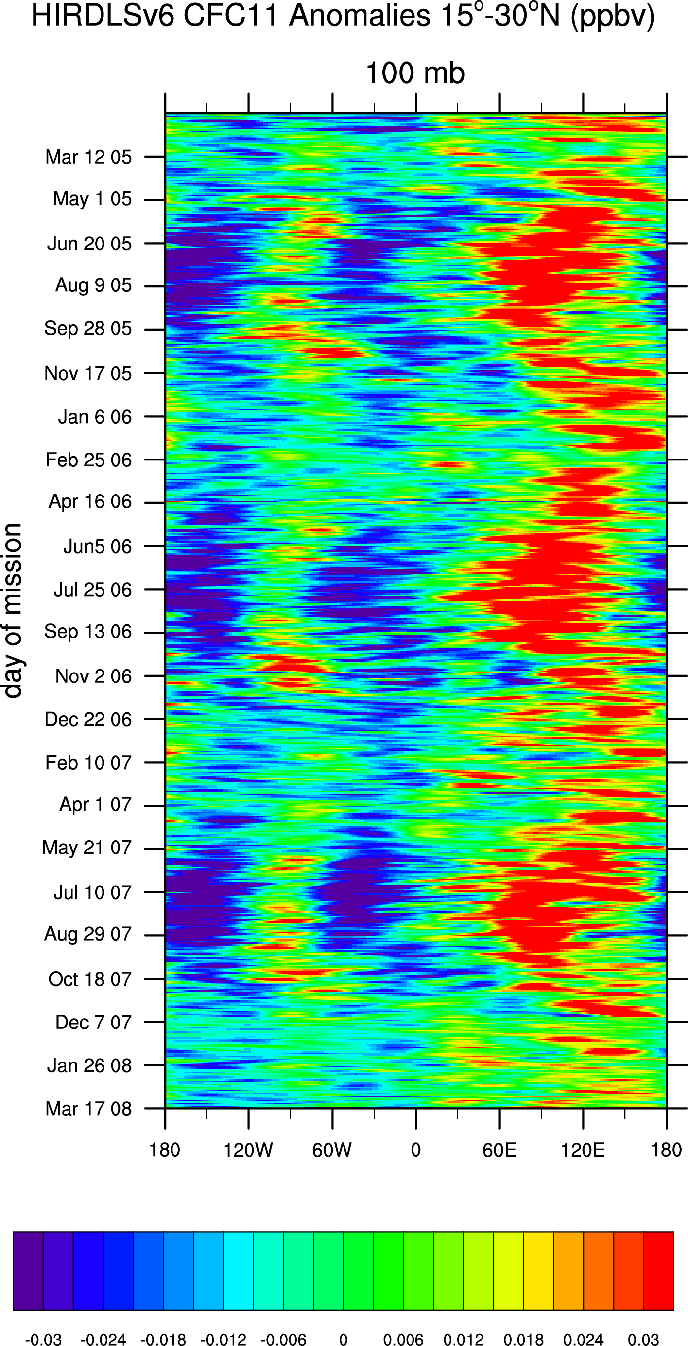
Evidence for Asian Monsoon via HIRDLS V.6 data?
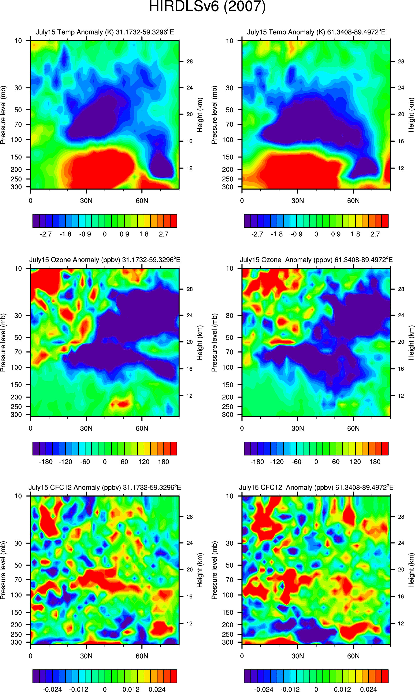
Daily Cross-sections of HIRDLS V.6 Temperature, Ozone, CFC12 Anomalies for (30-60E) and (60-90E):
- 2005: July1: 1 day,
10 day running average
- 2005: July15: 1 day,
10 day running average
- 2005: Aug1: 1 day,
10 day running average
- 2005: Aug15: 1 day,
10 day running average
- 2005: Aug31: 1 day,
10 day running average
- 2006: July1: 1 day,
10 day running average
- 2006: July15: 1 day,
10 day running average
- 2006: Aug1: 1 day,
10 day running average
- 2006: Aug15: 1 day,
10 day running average
- 2006: Aug31: 1 day,
10 day running average
- 2007: July1: 1 day,
10 day running average
- 2007: July15: 1 day,
10 day running average
- 2007: Aug1: 1 day,
10 day running average
- 2007: Aug15: 1 day,
10 day running average
- 2007: Aug31: 1 day,
10 day running average
- HIRDLS V.6 daily species on isentropic surfaces:
- 420K -- 350K:
- 500K -- 430K:
- Other species, days, levels also available.
2-month mean NH Cross-sections of HIRDLS V.6 for 30-degree longitude bands:
here
Hovmoller diagrams of HIRDLS V.6 anomalies for different latitude bands.
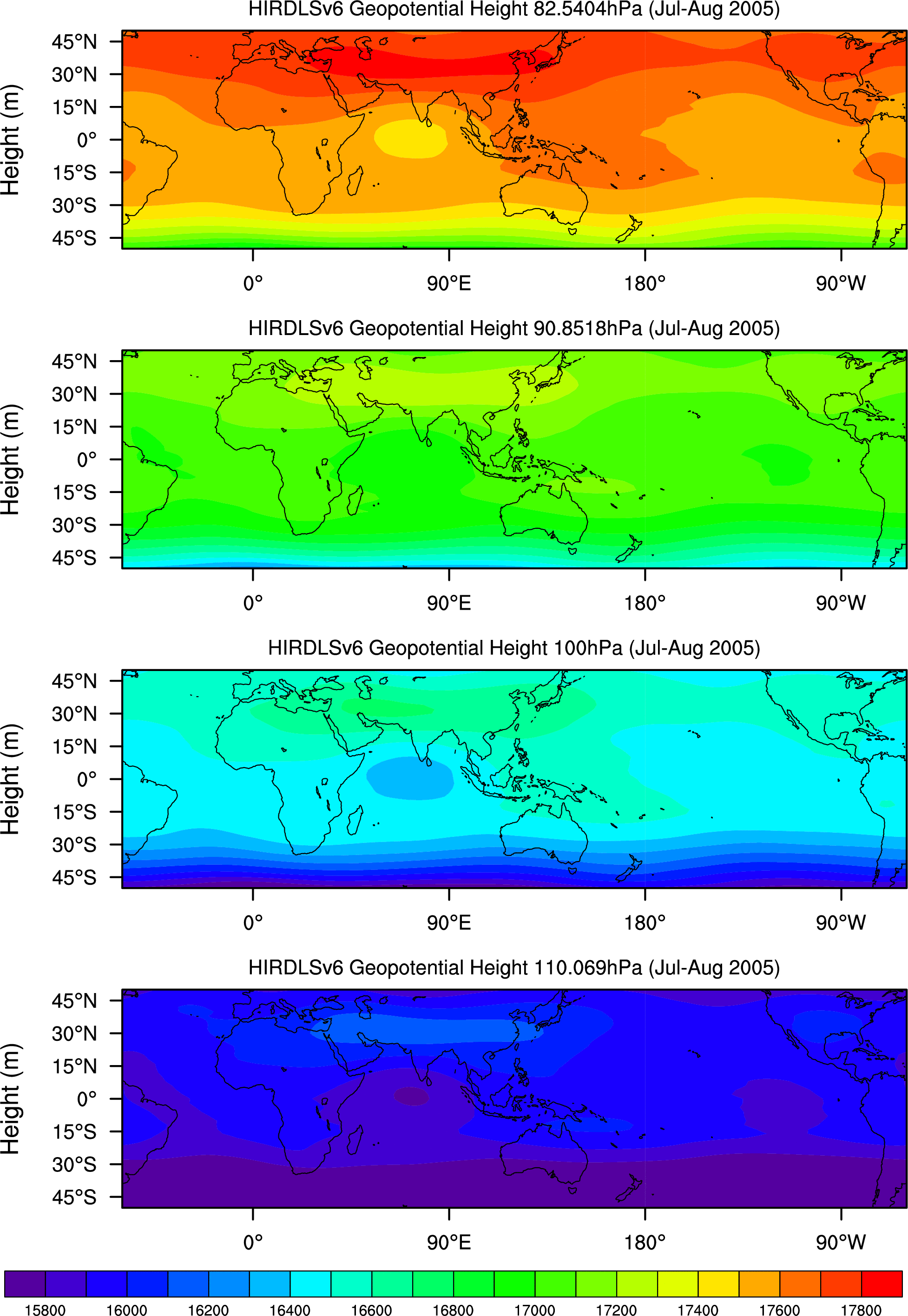
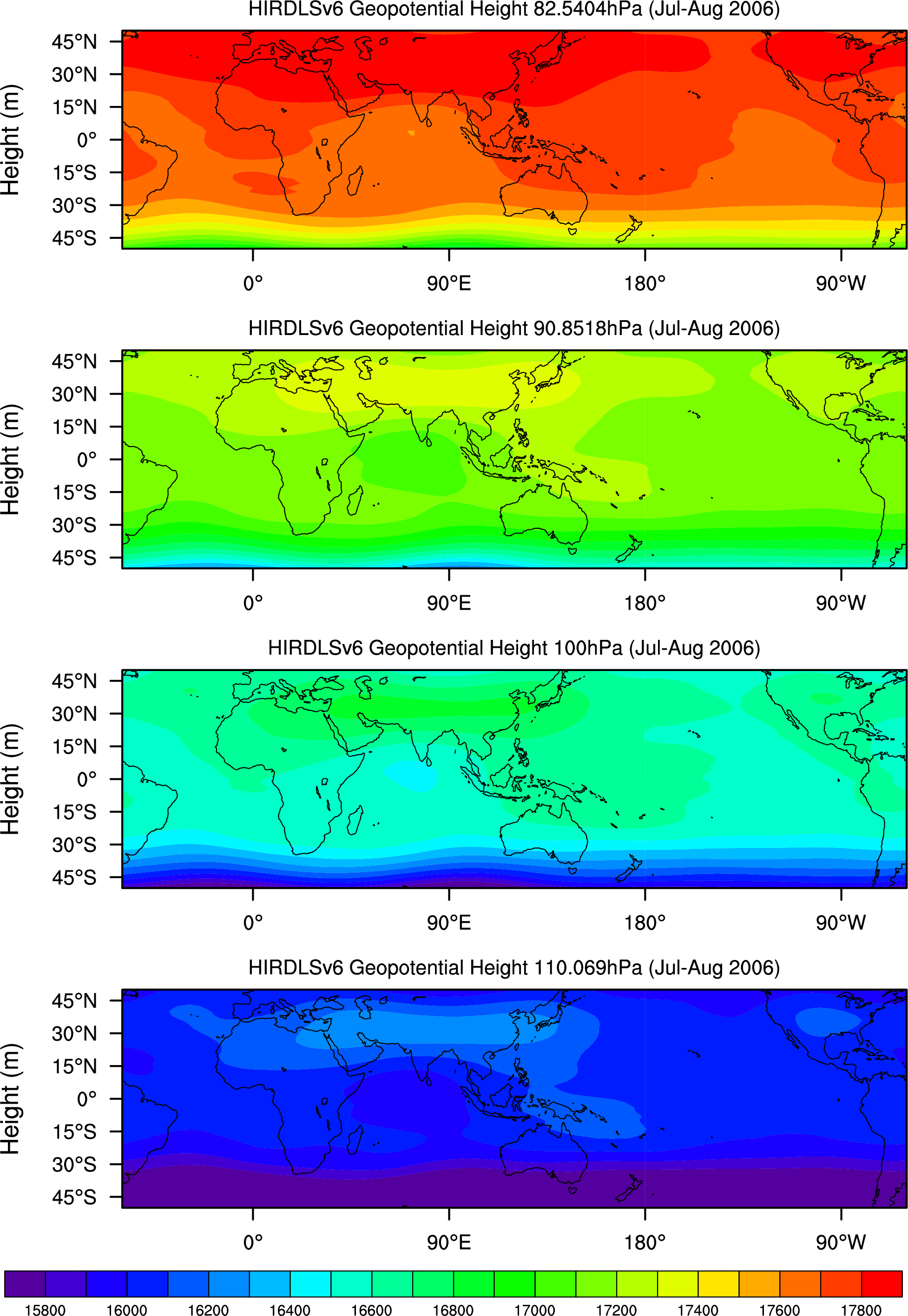
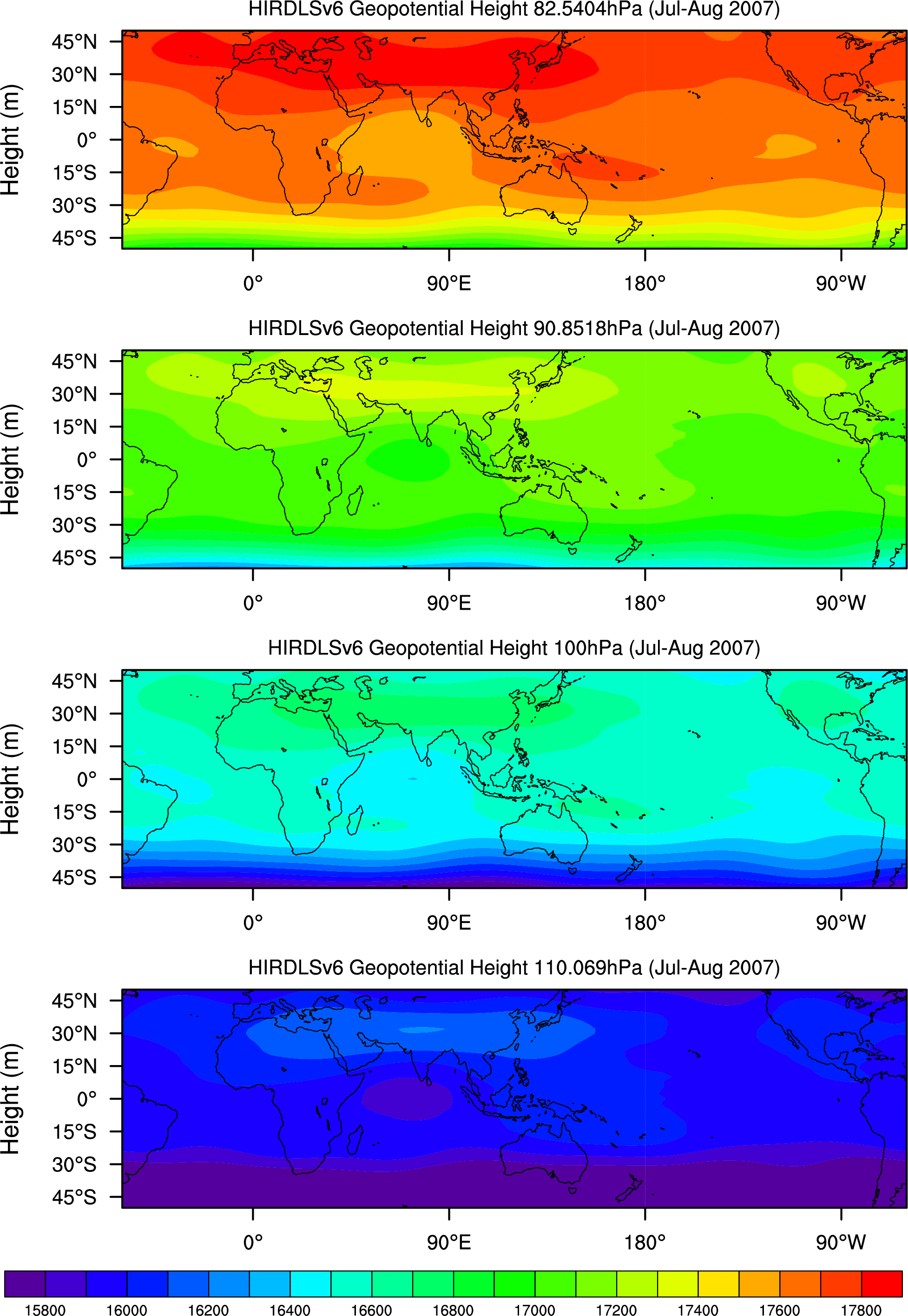
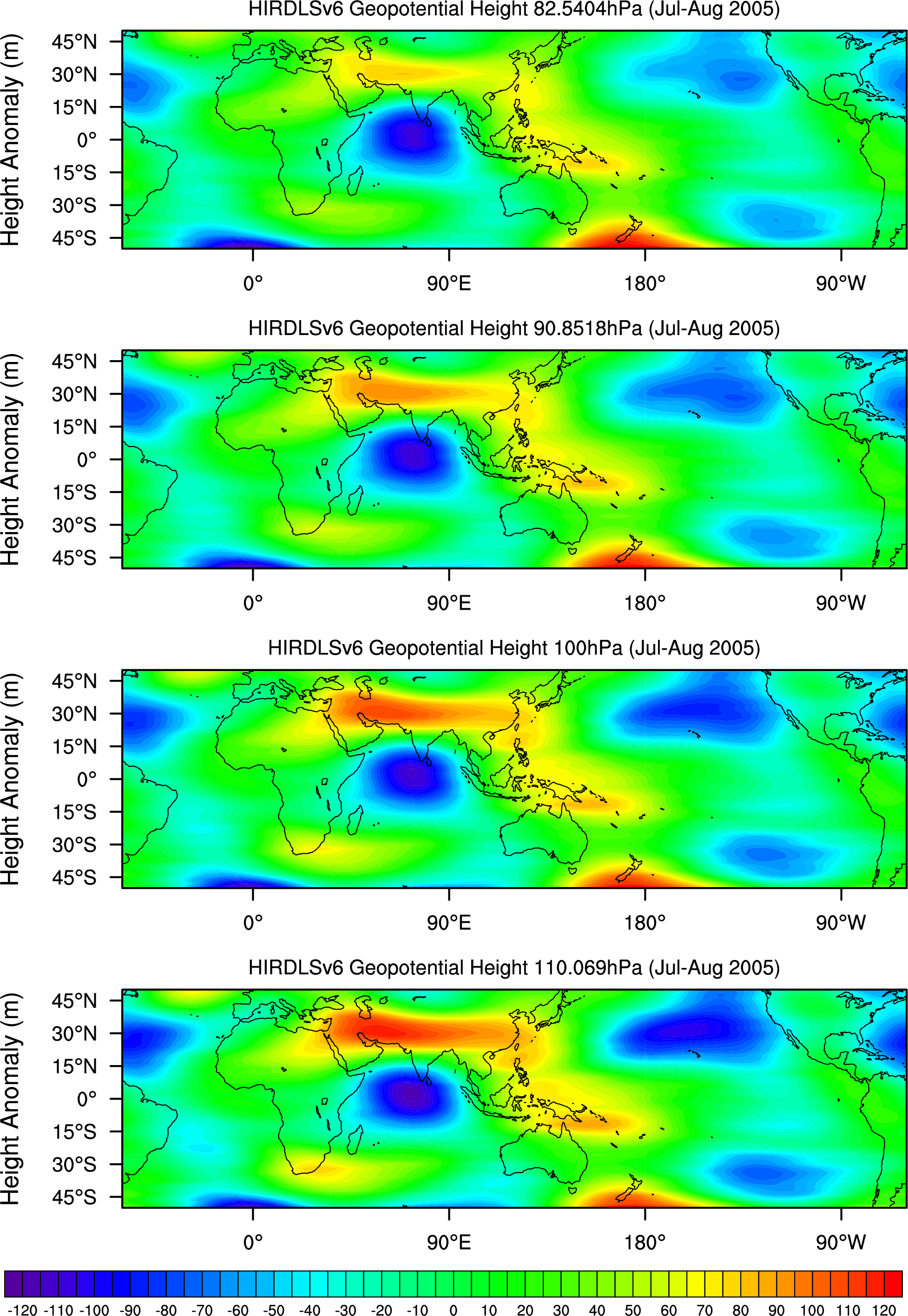
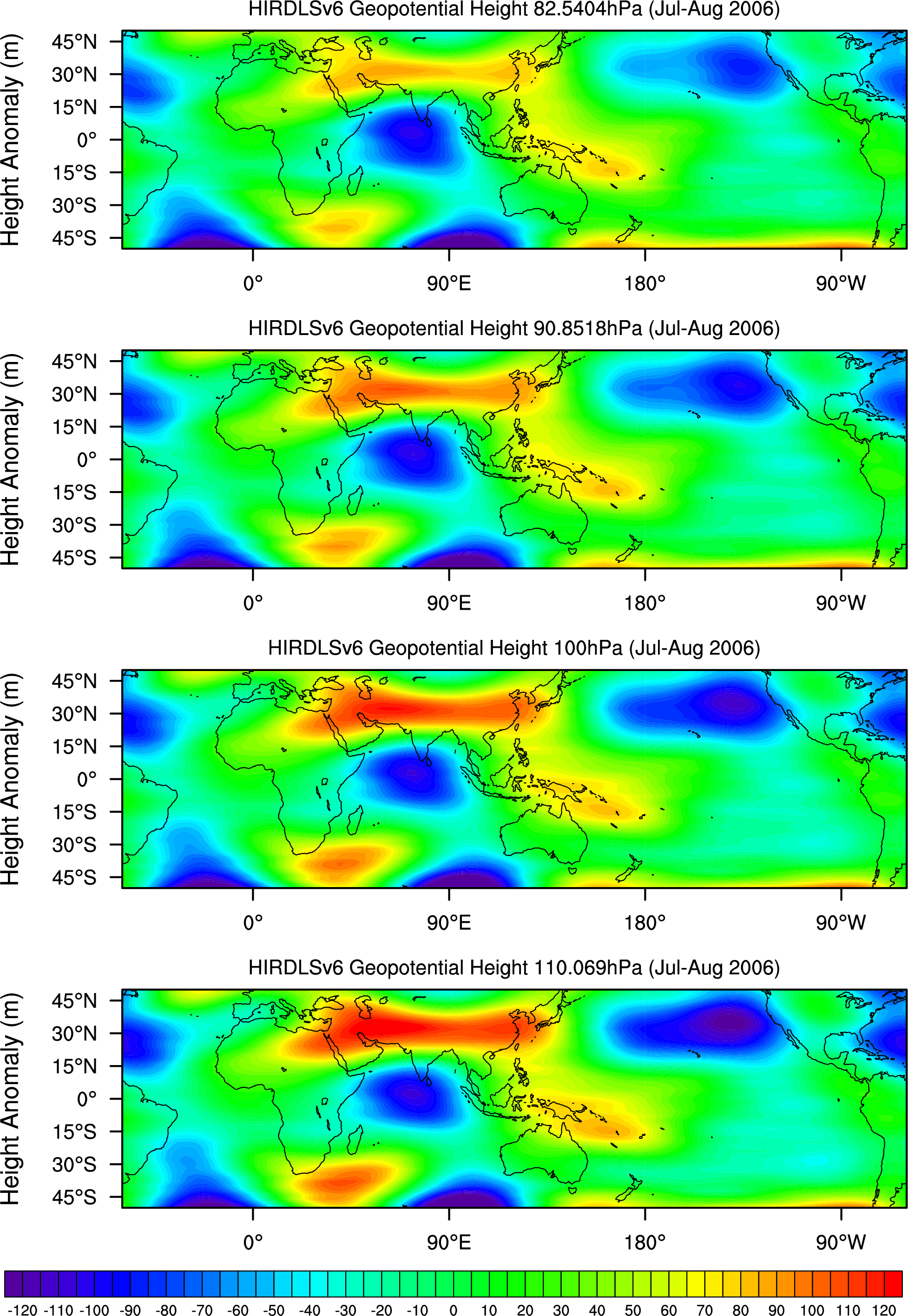
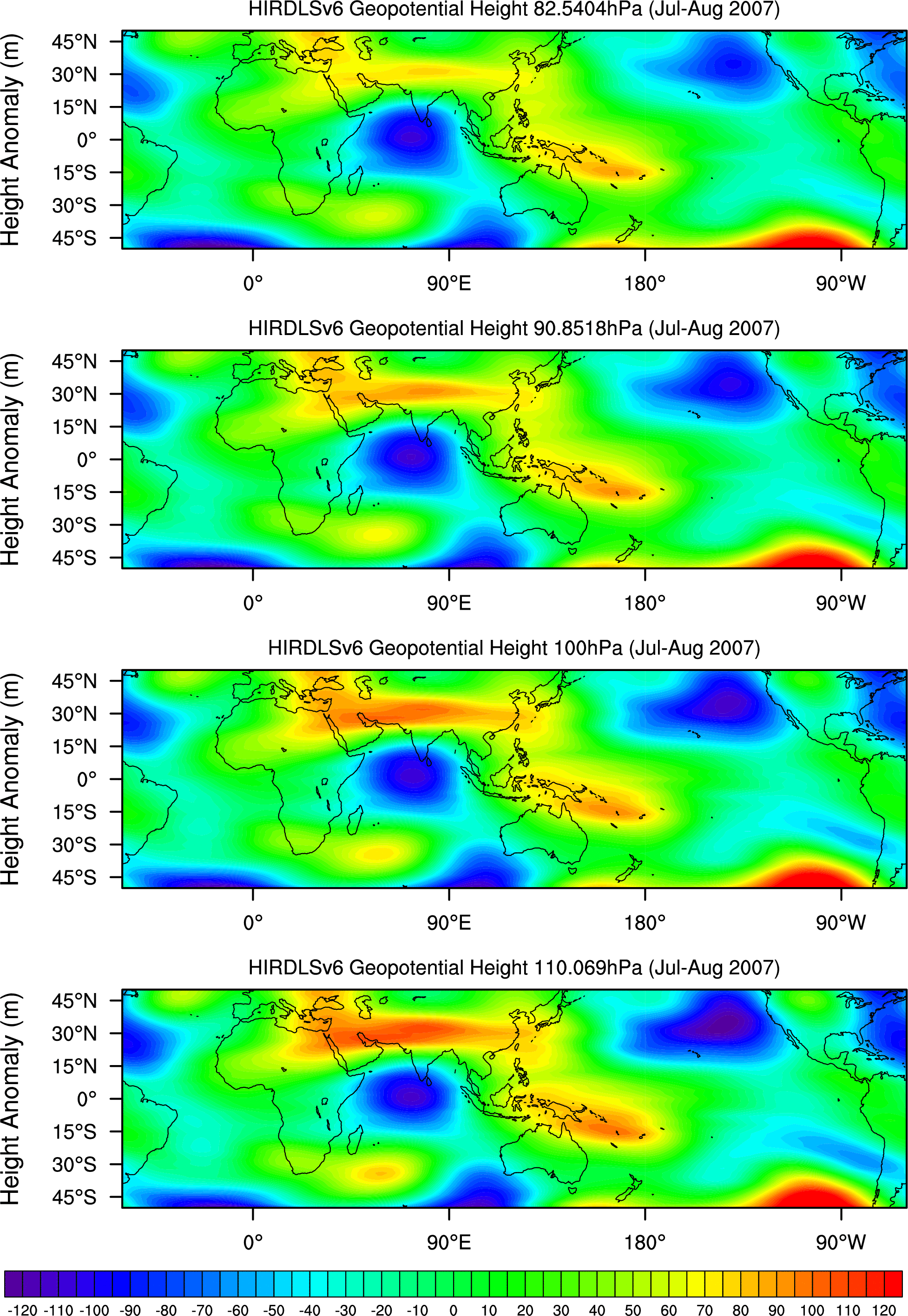
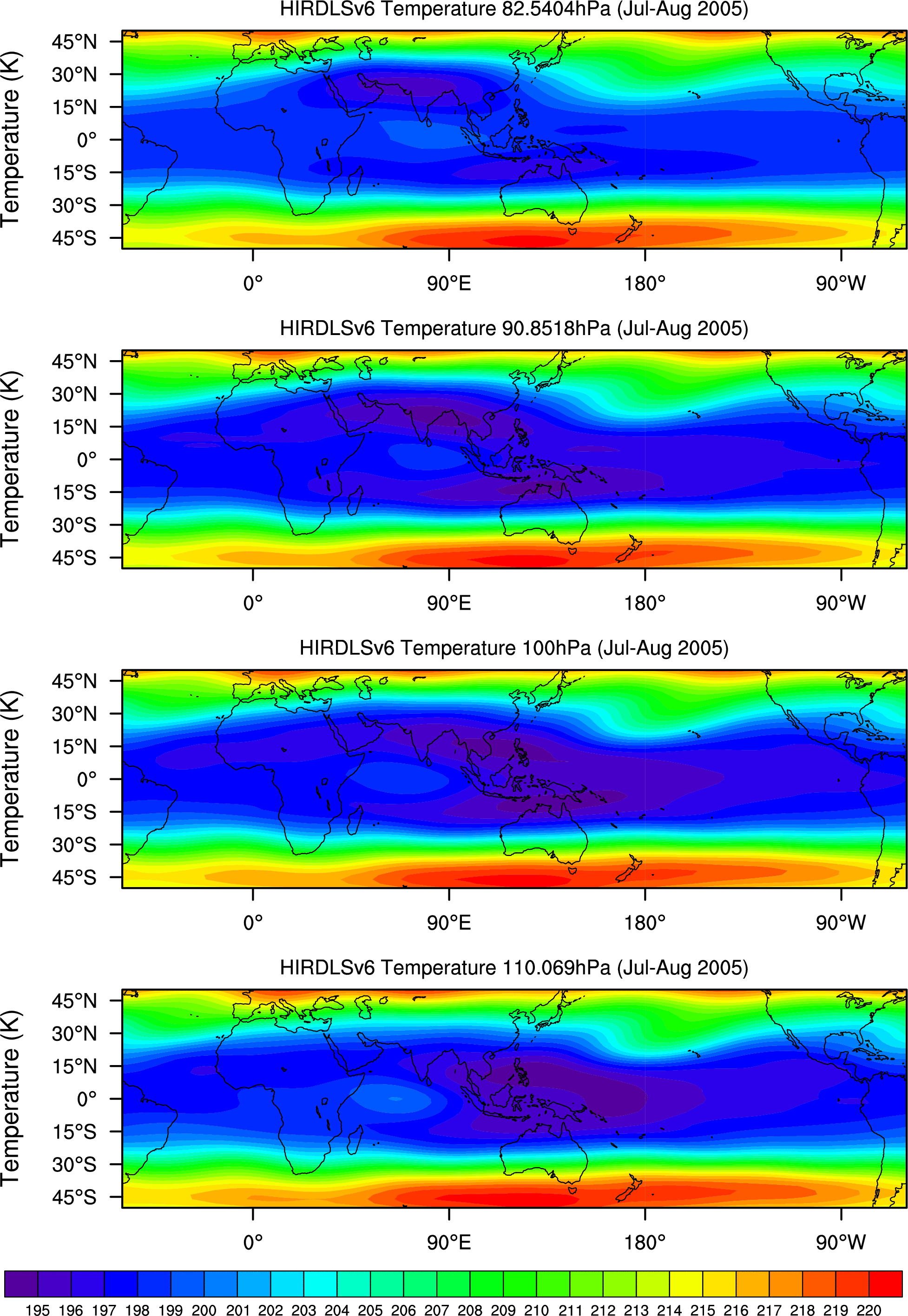
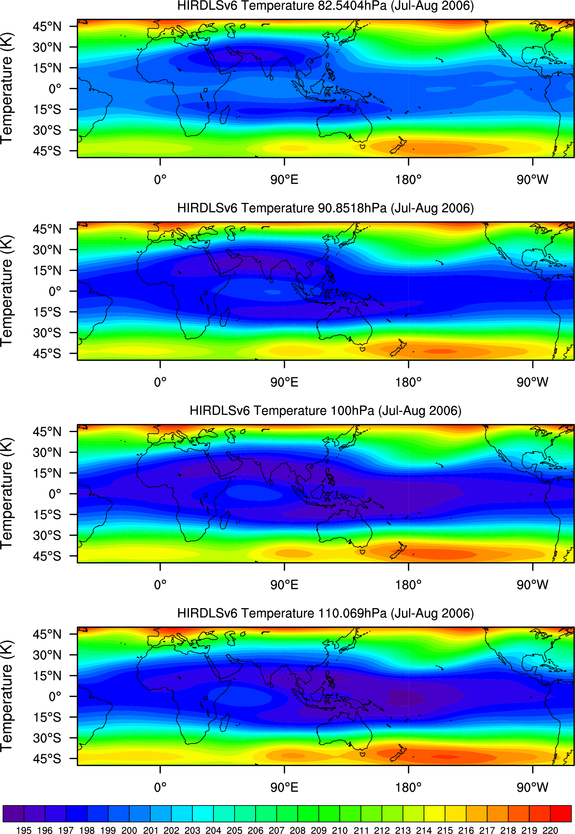
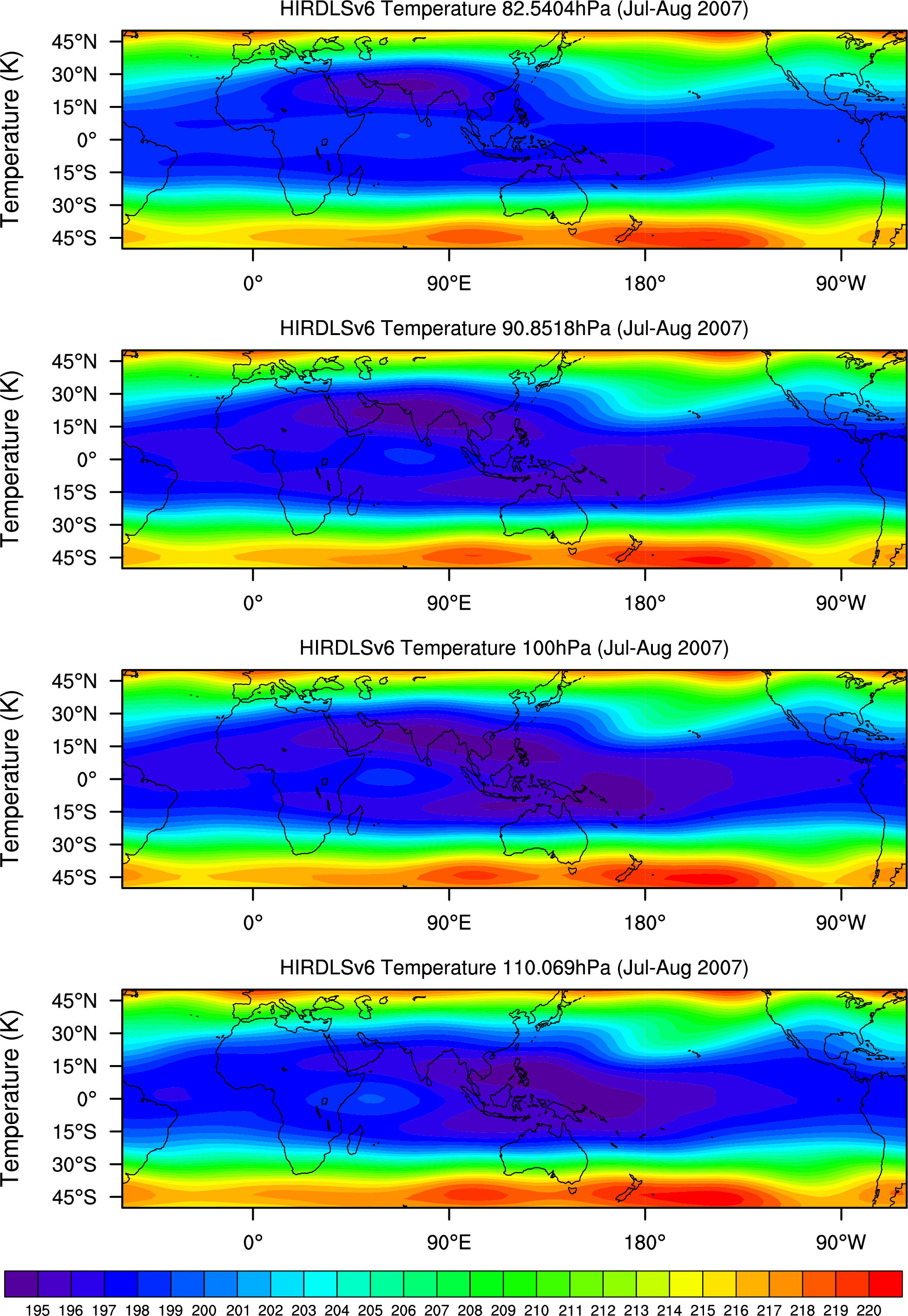
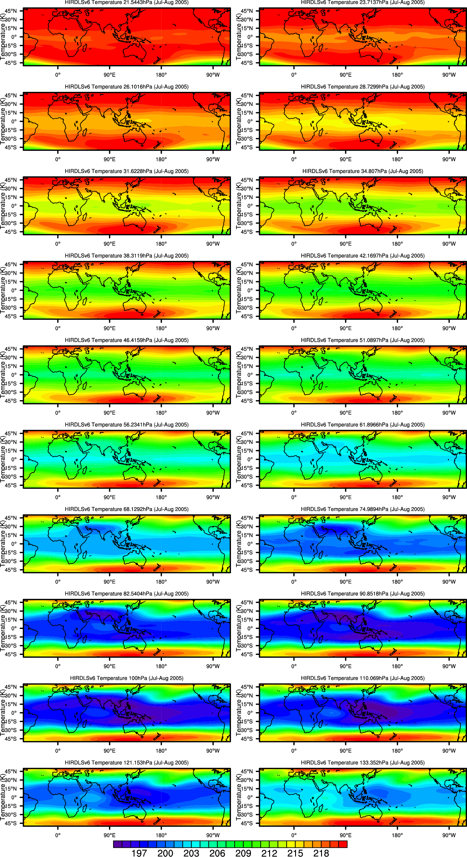
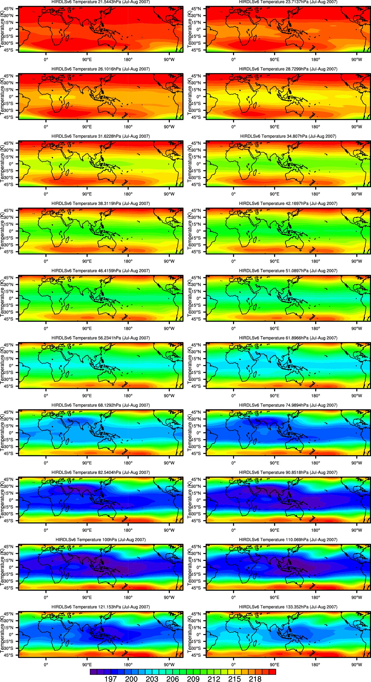
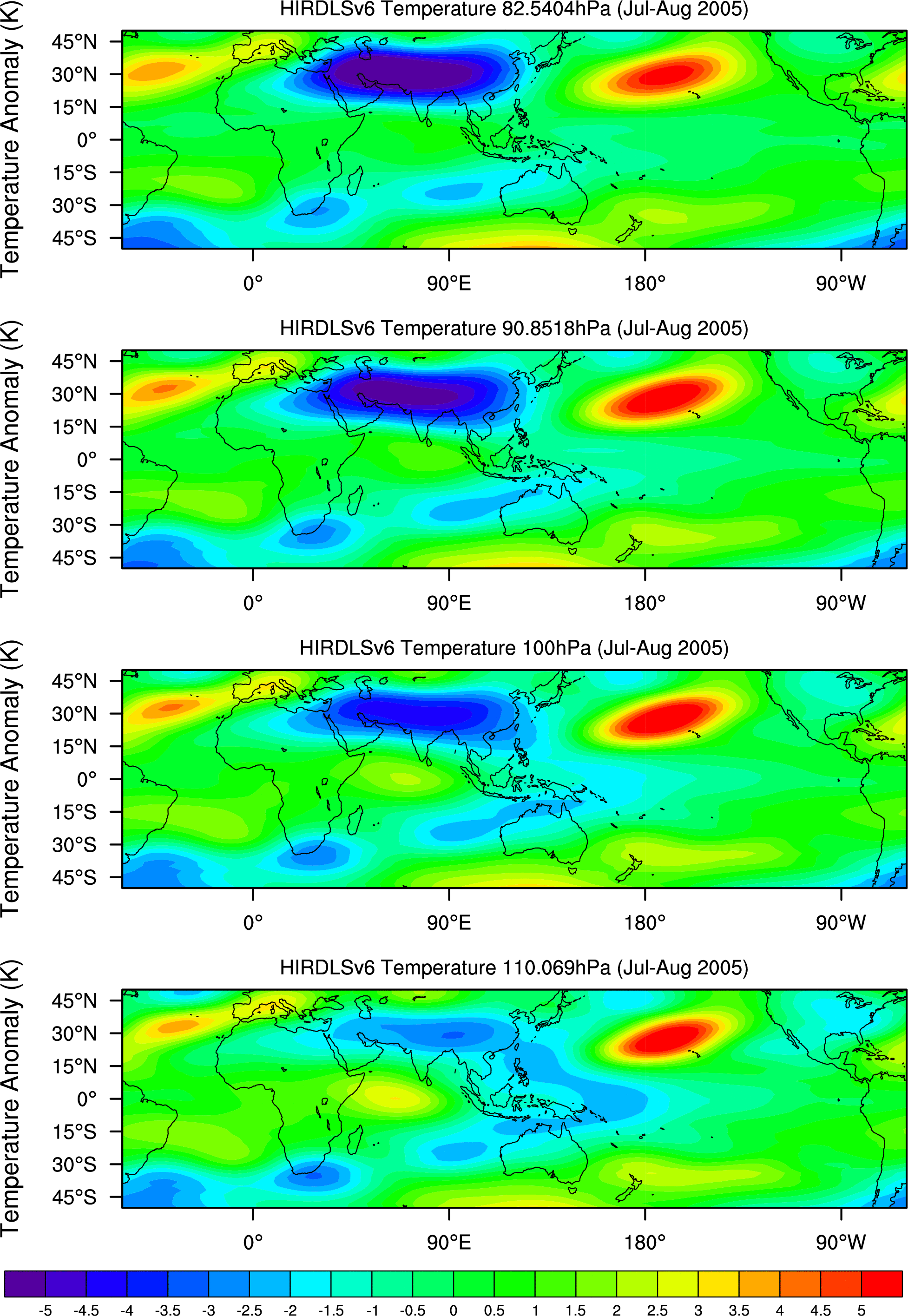
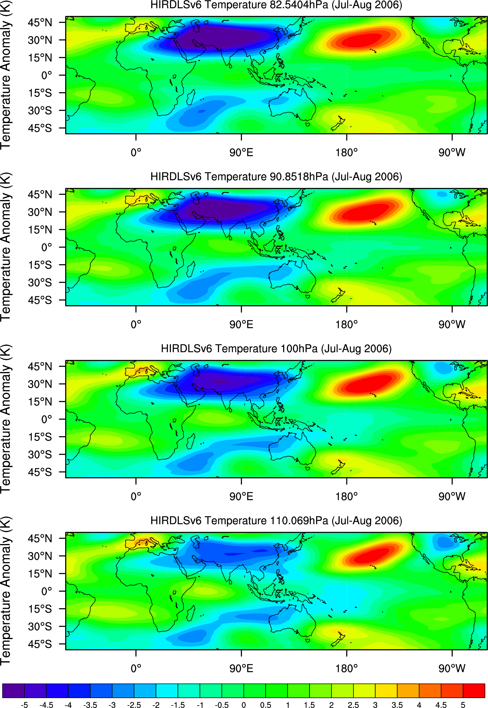
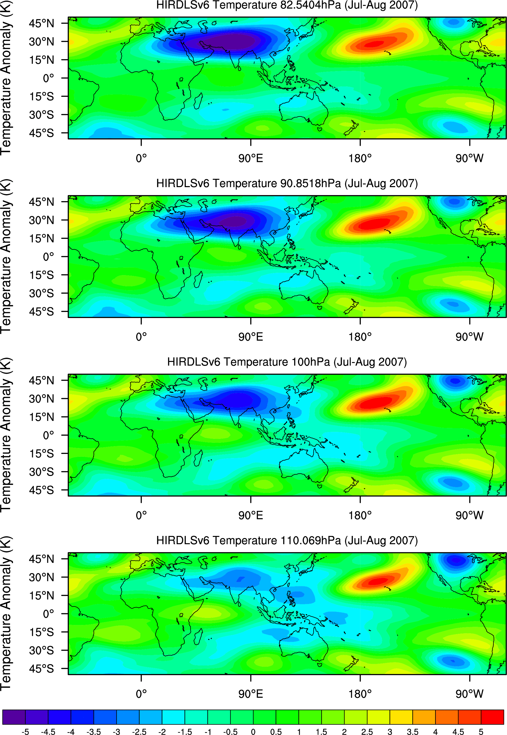
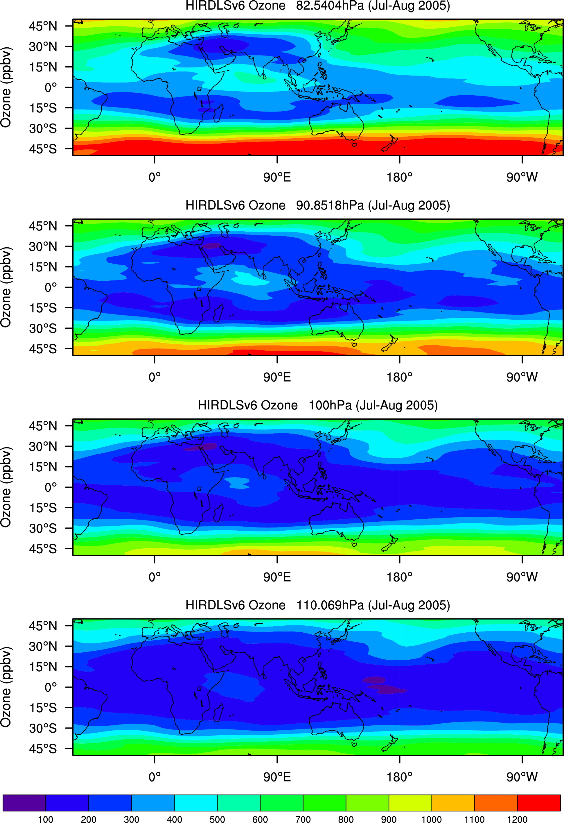
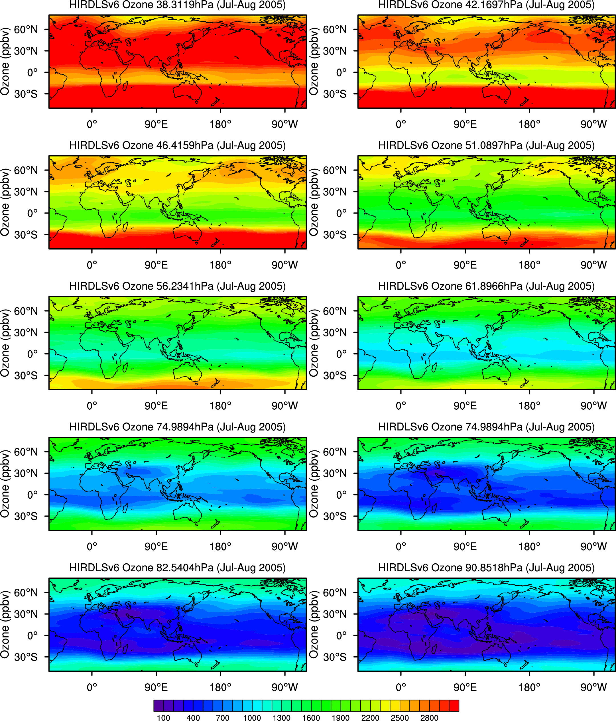
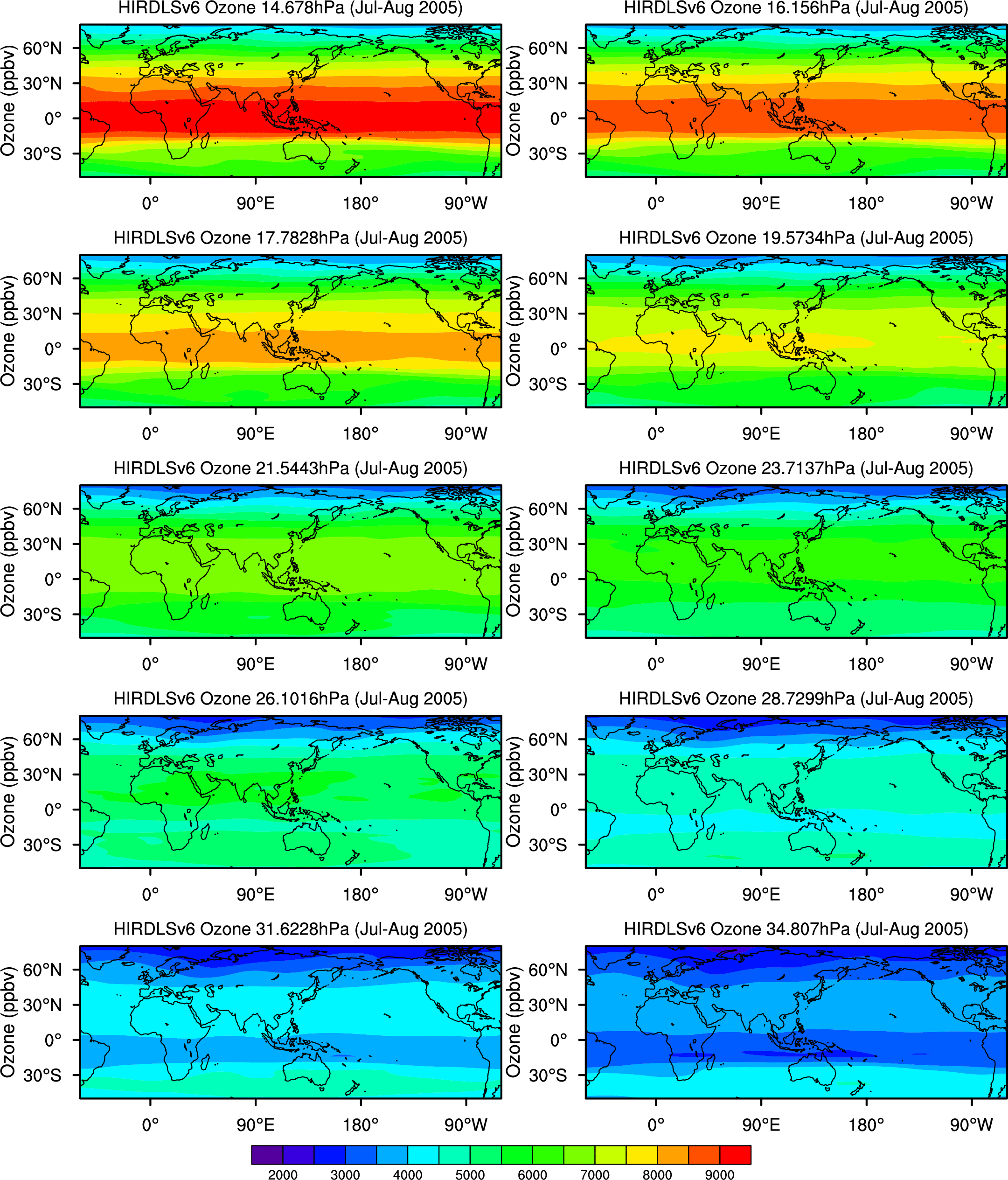
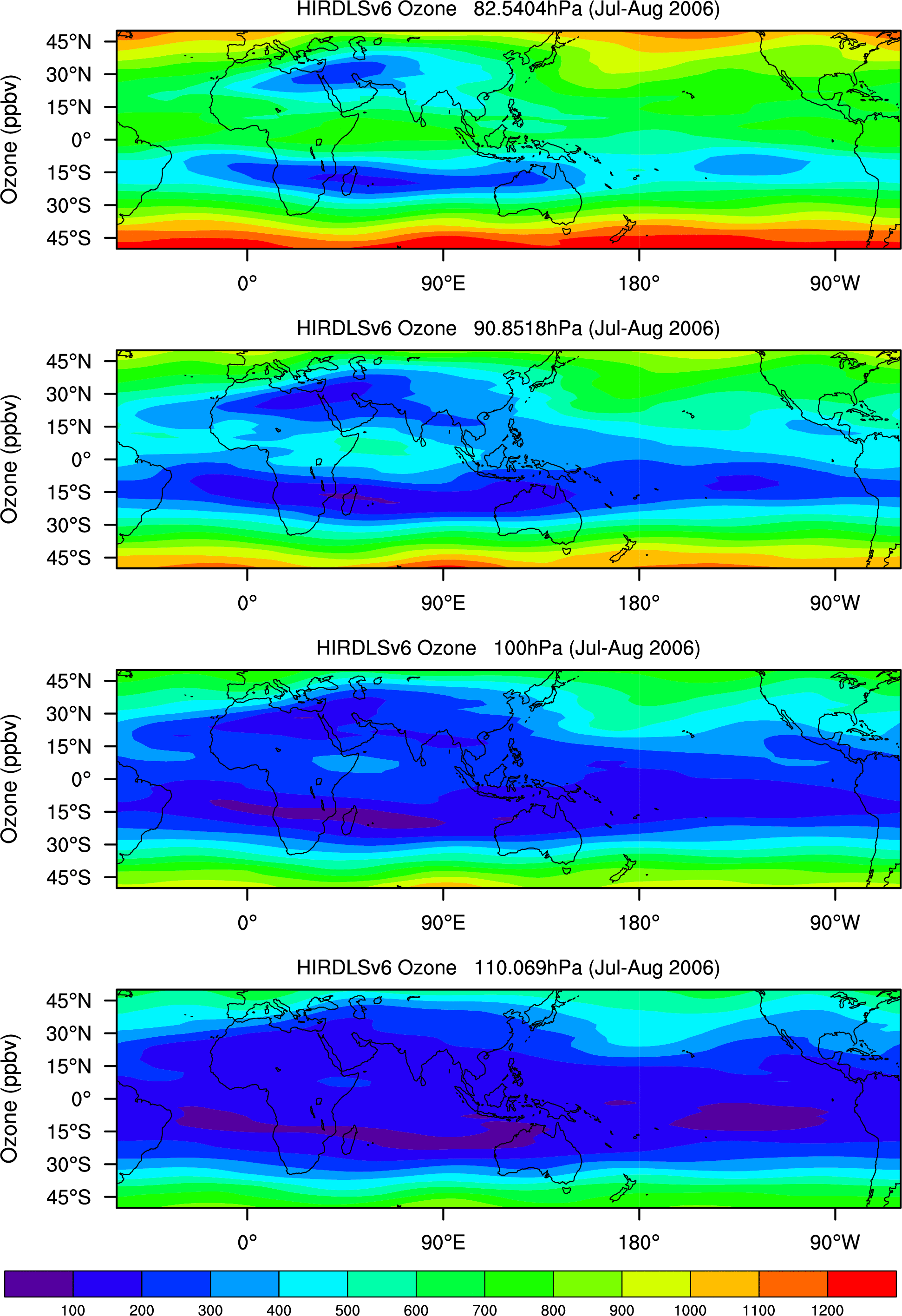
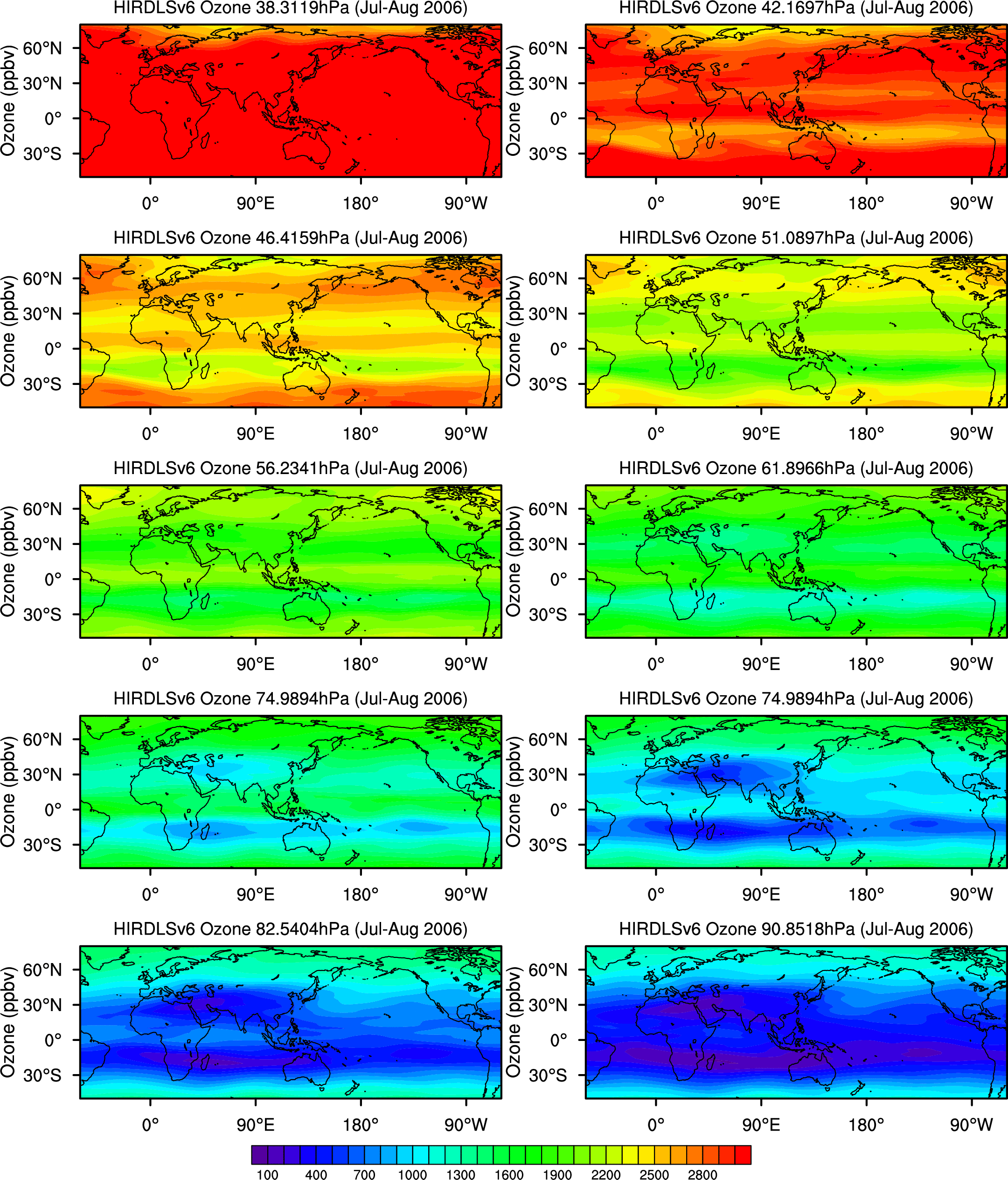
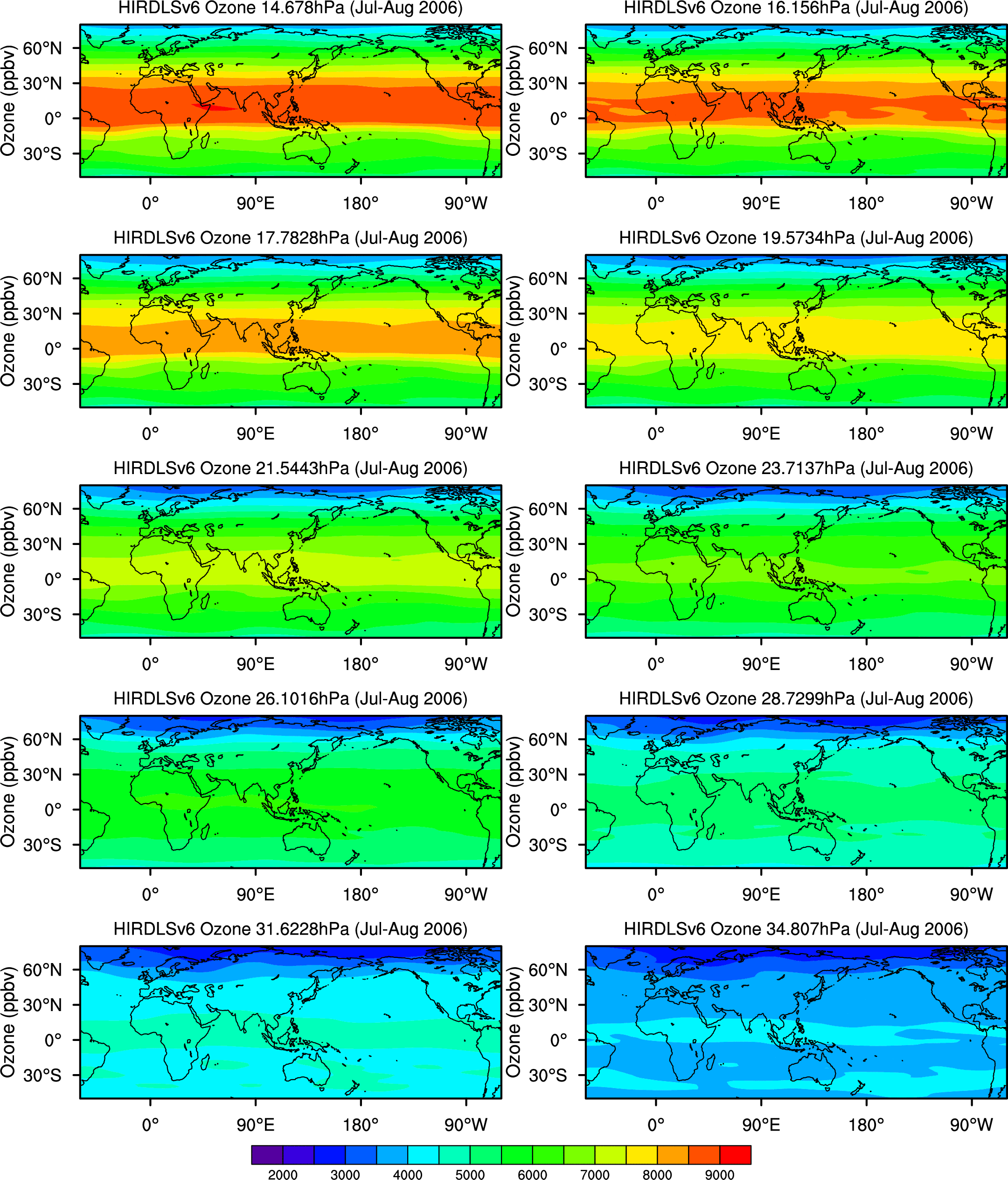
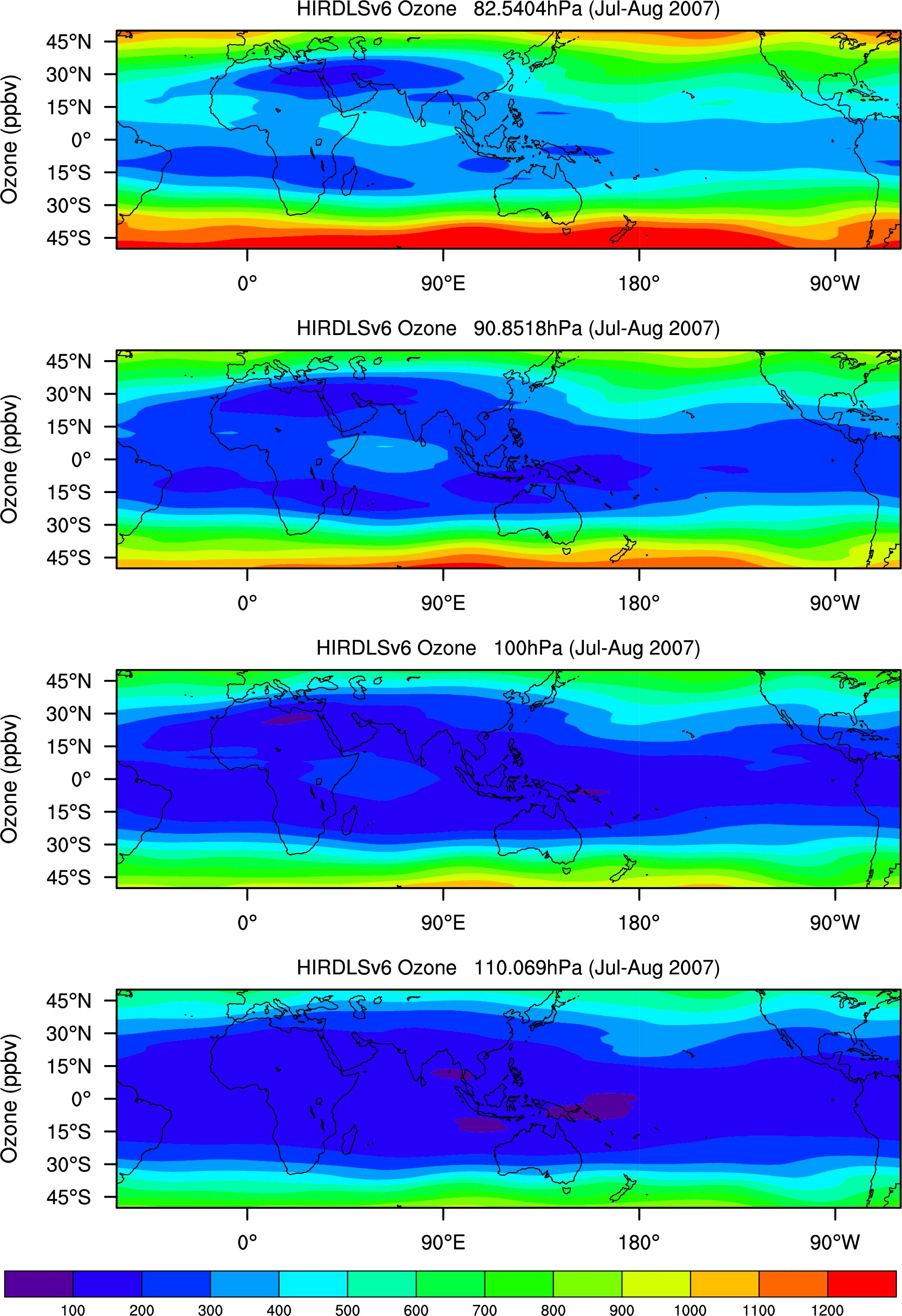
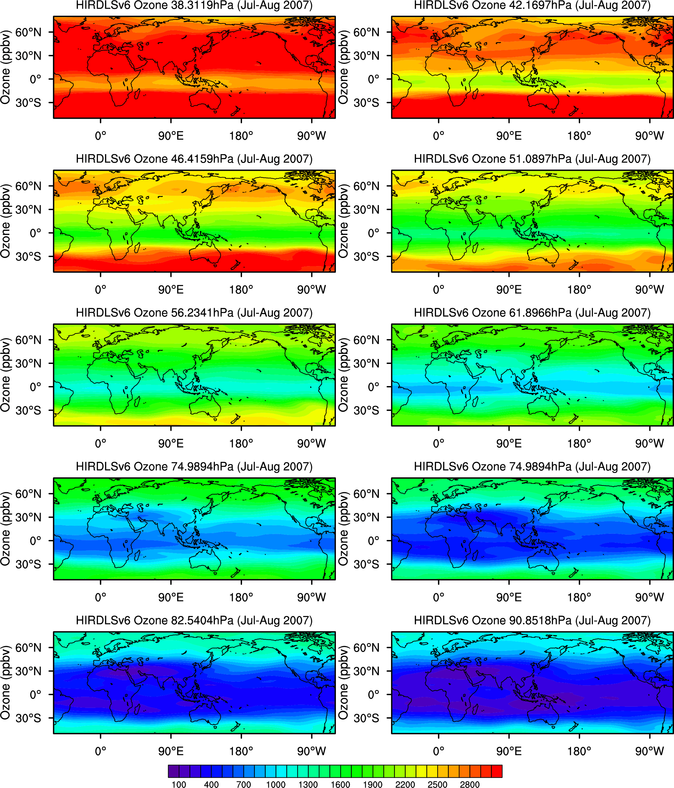
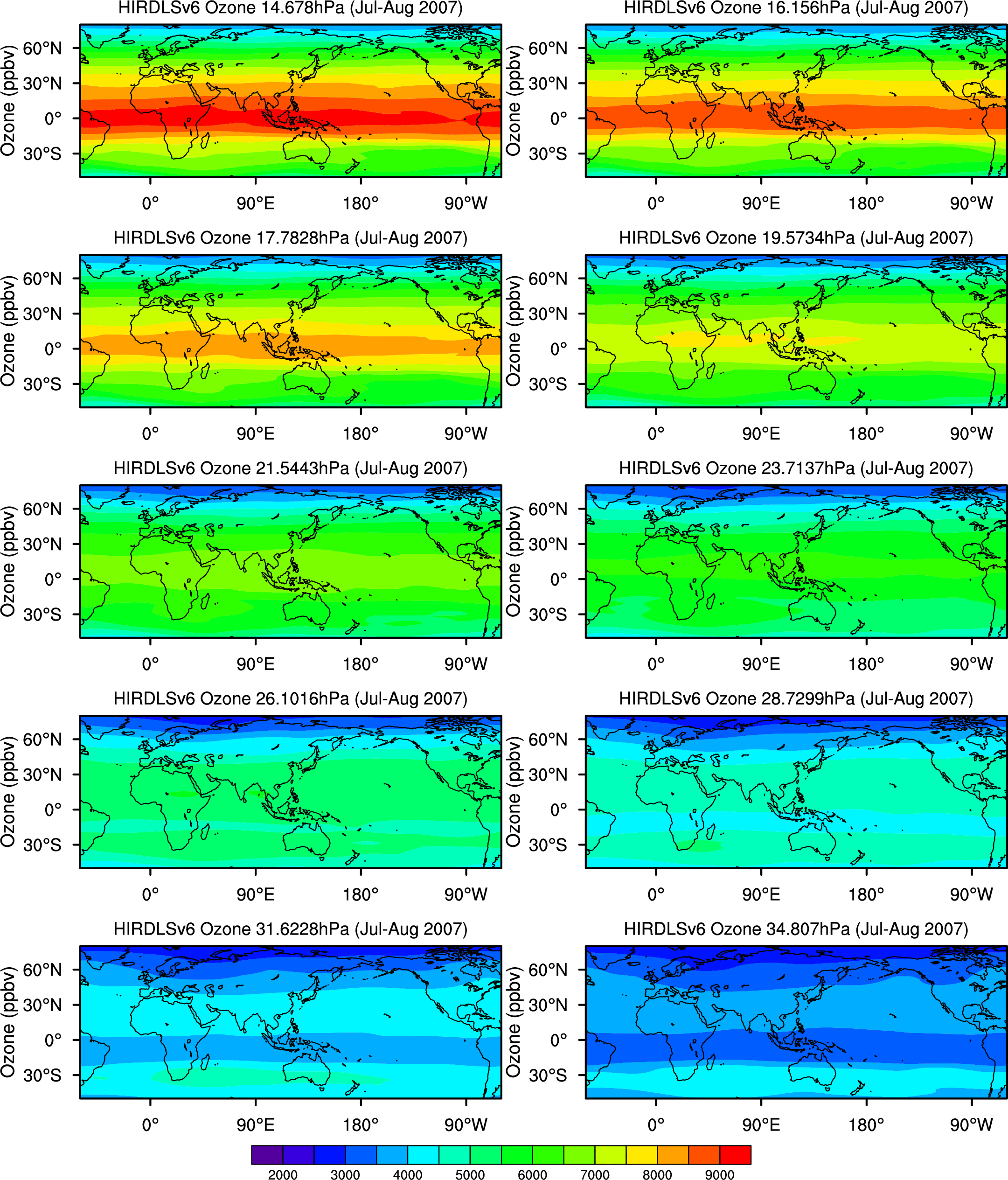
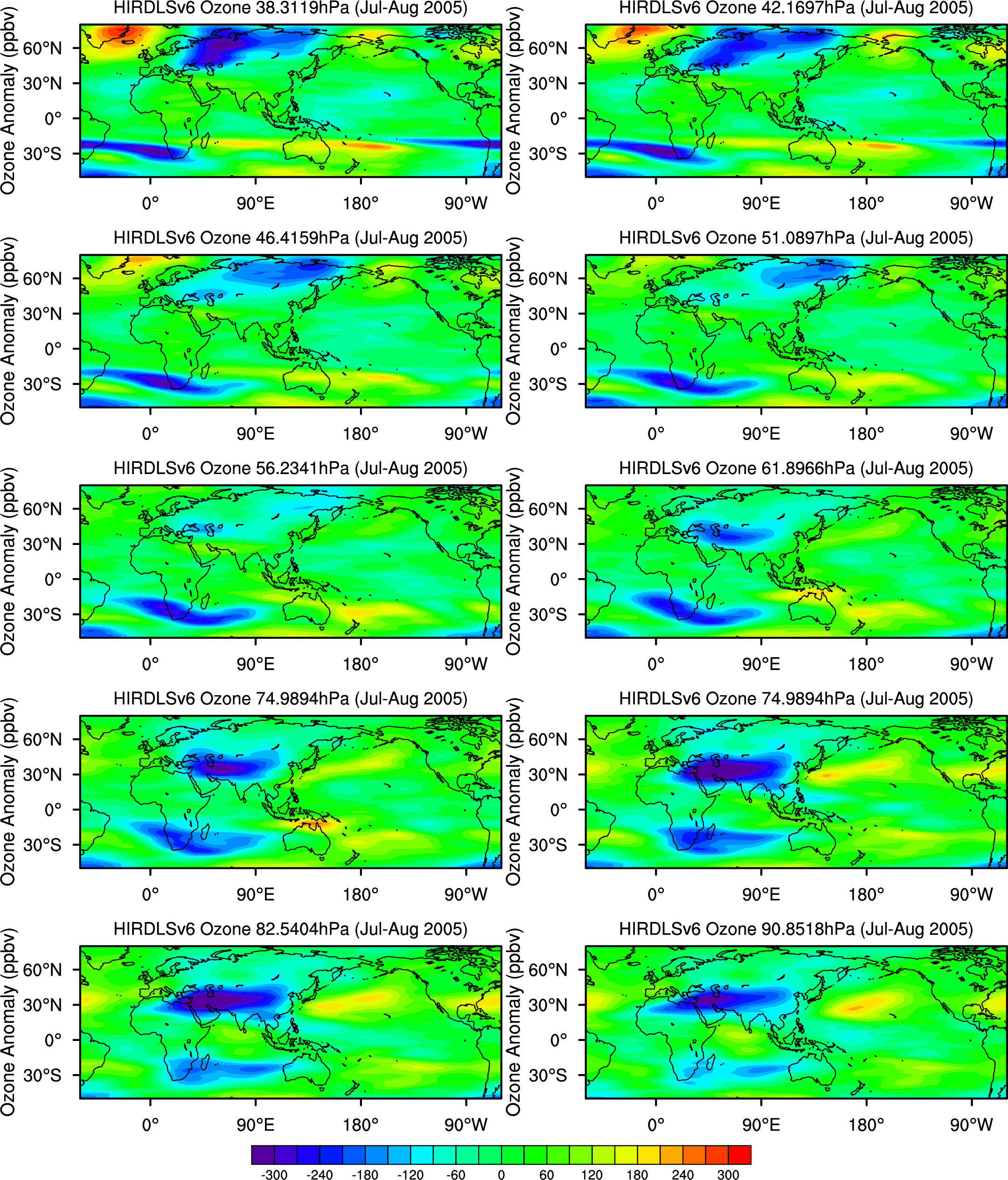
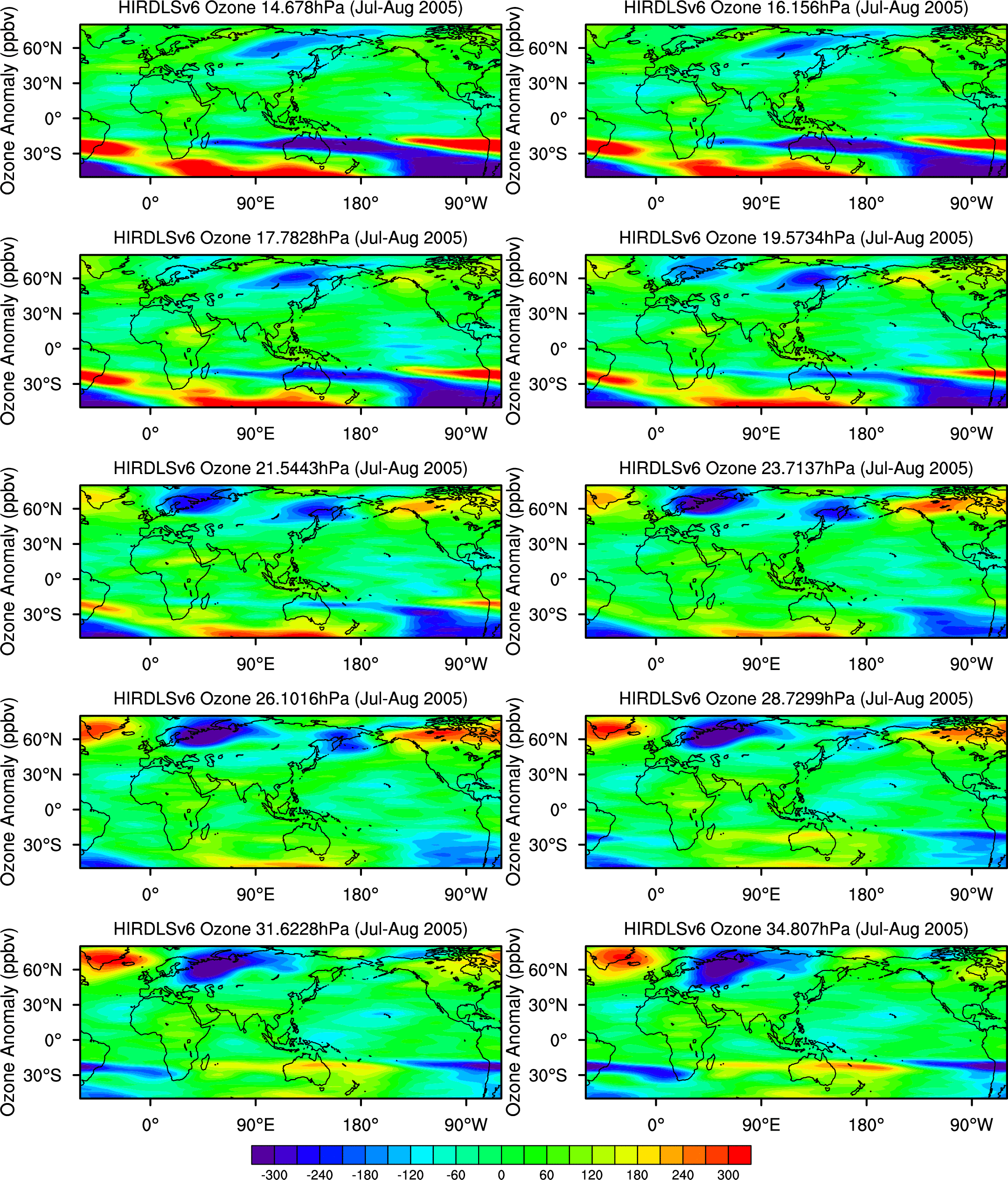
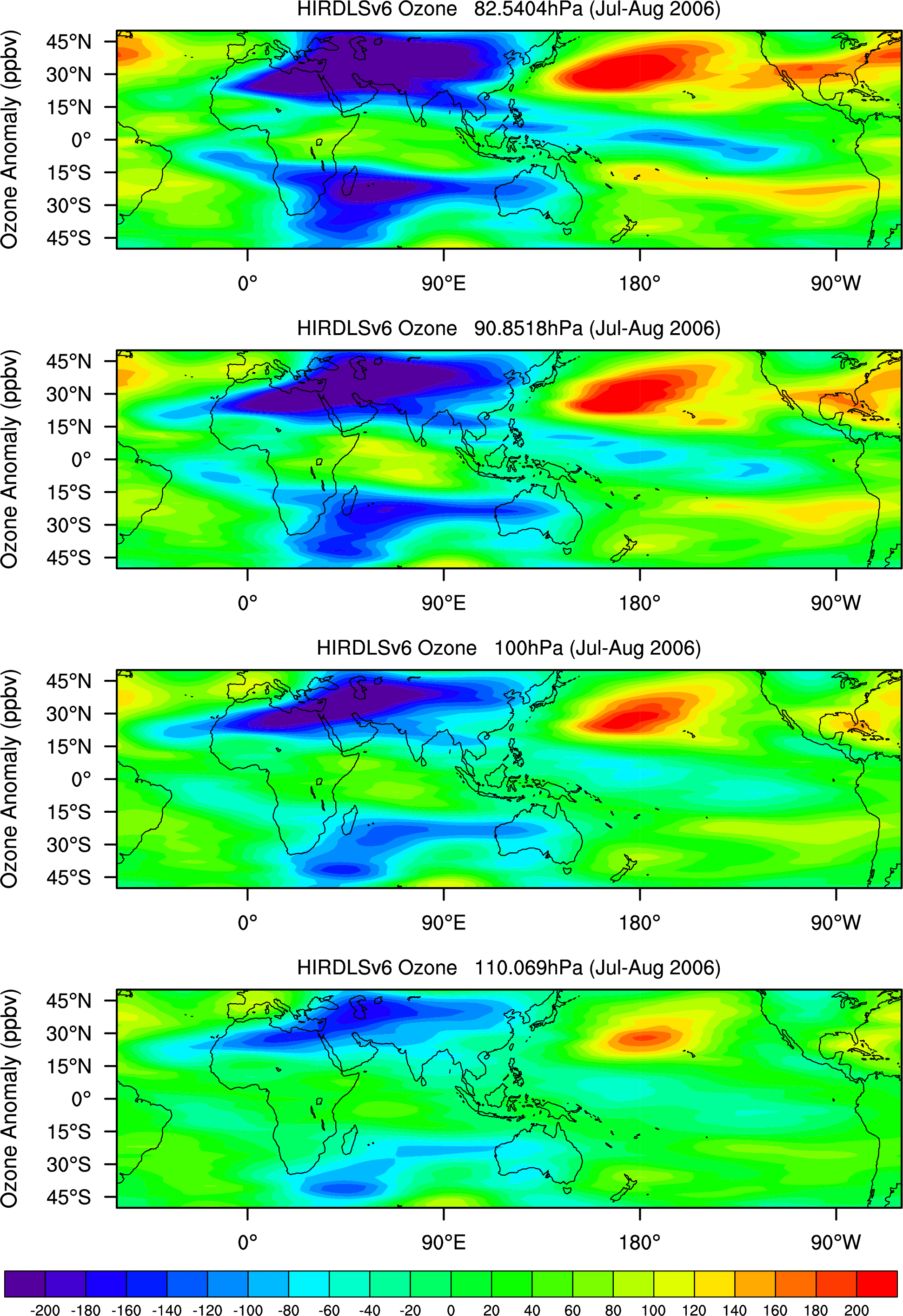
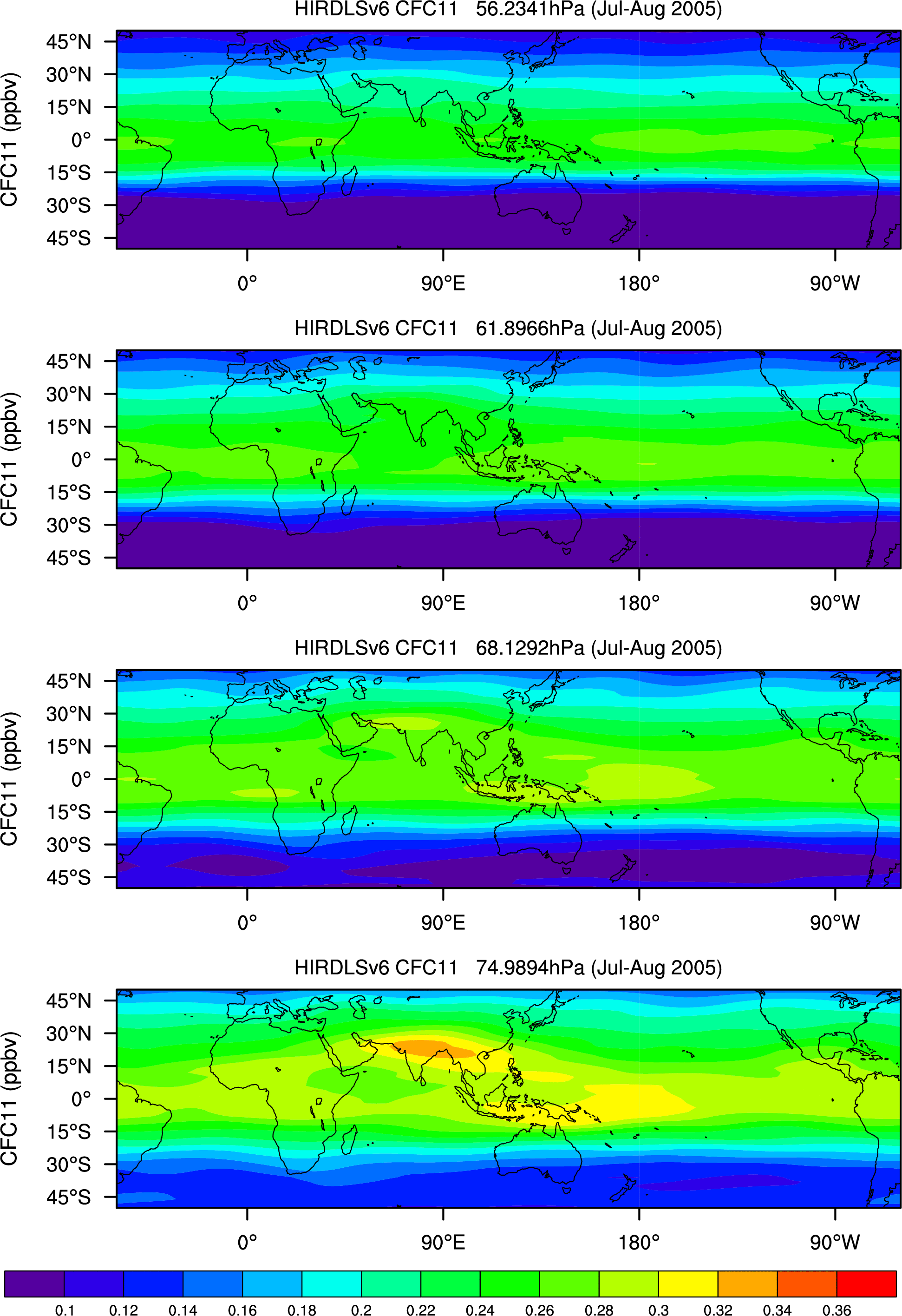
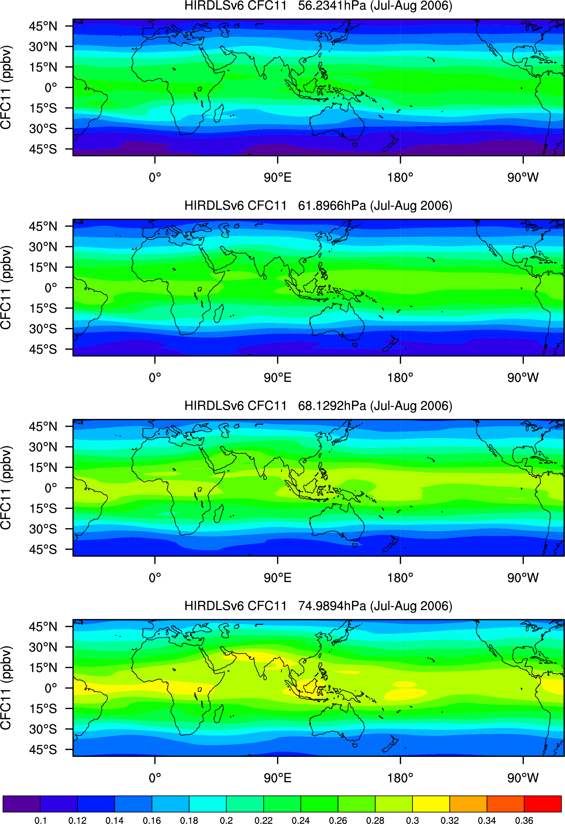
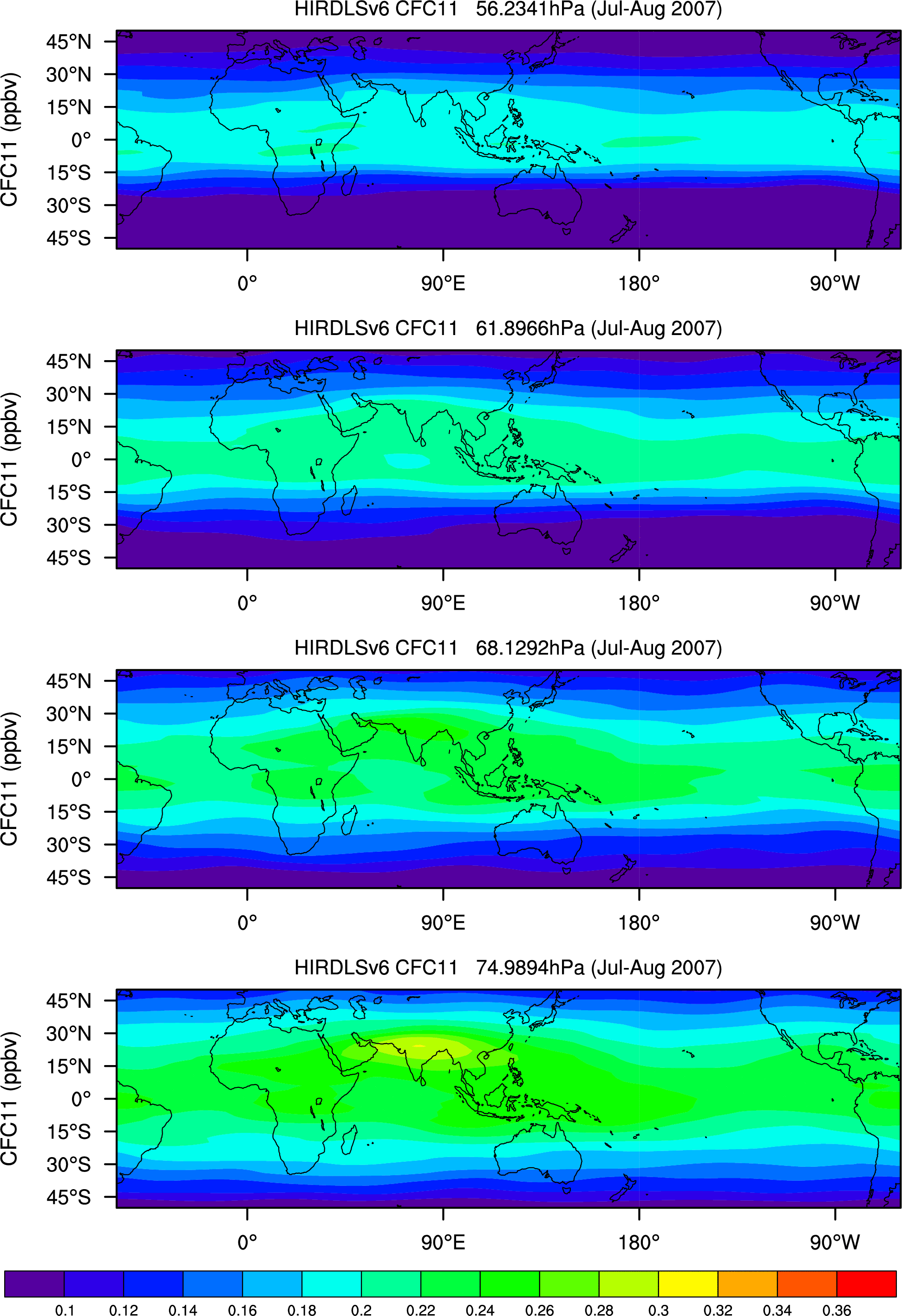
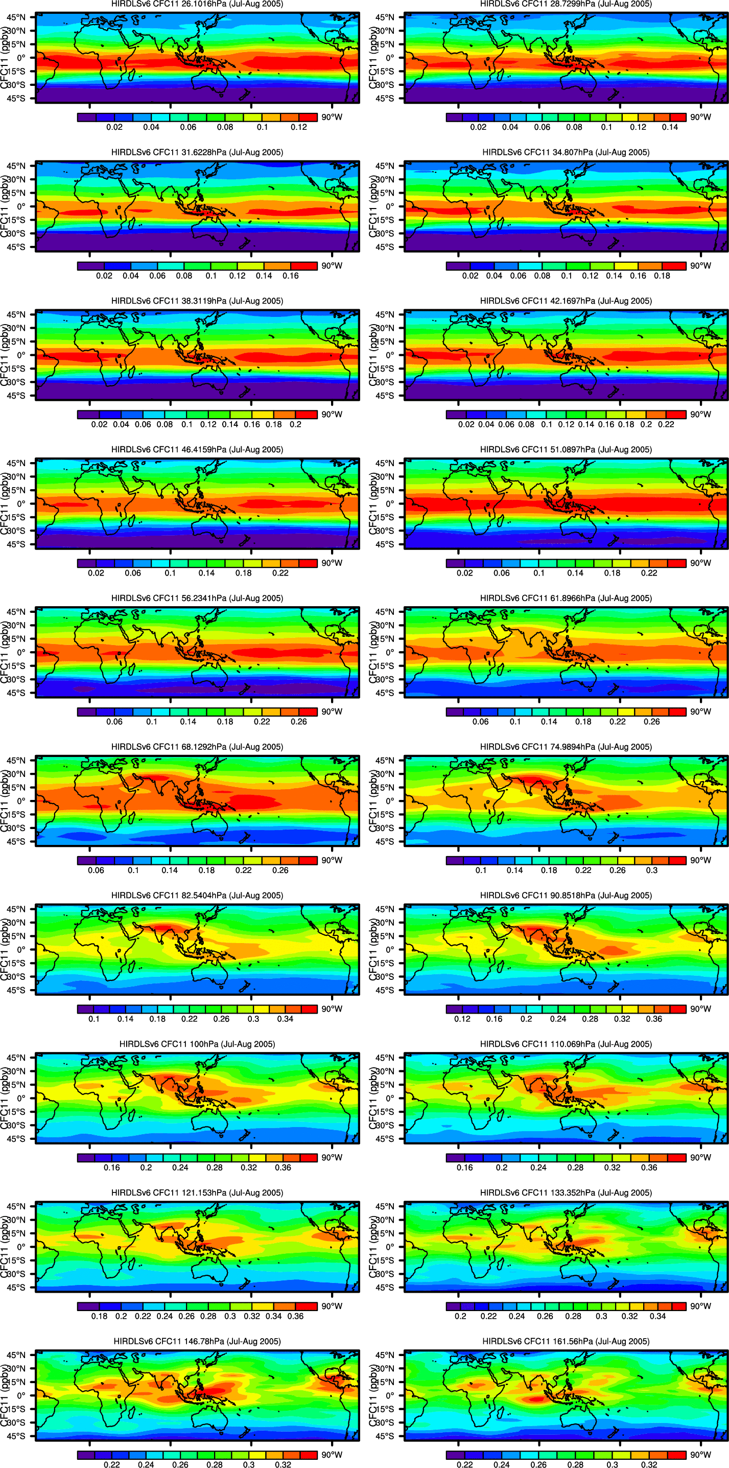
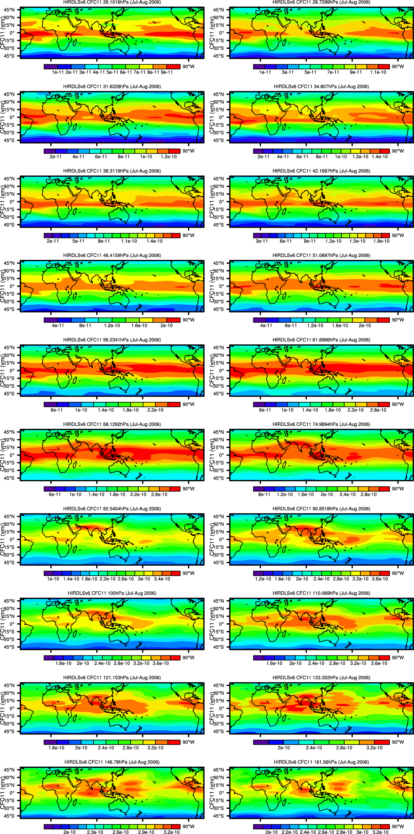
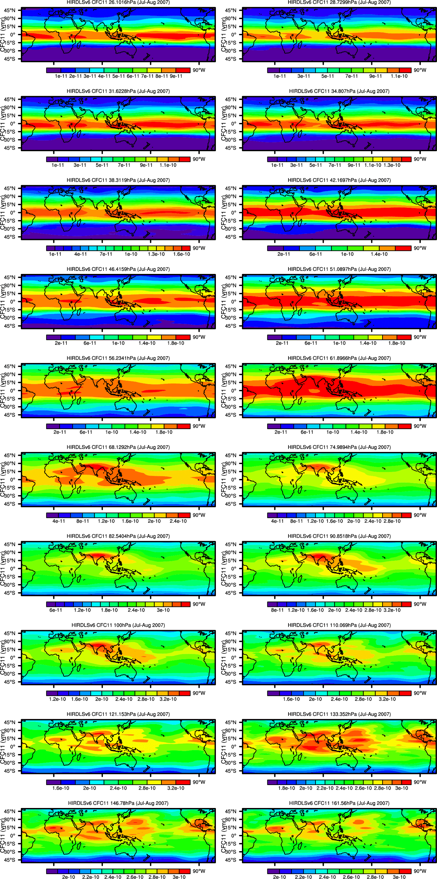
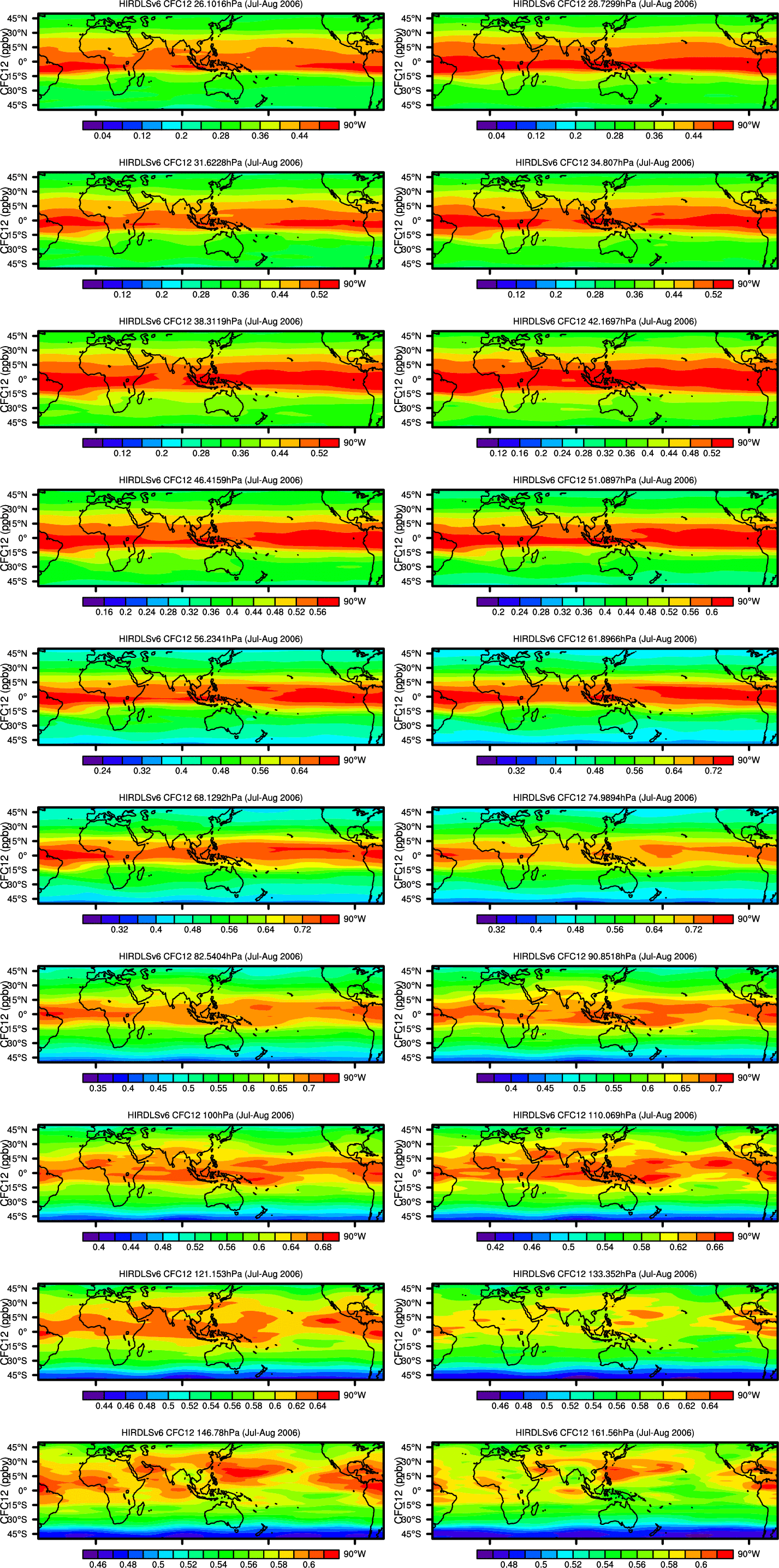
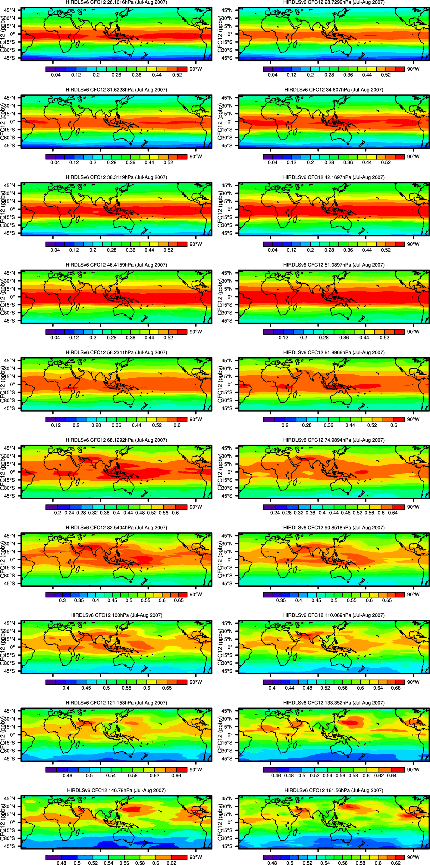
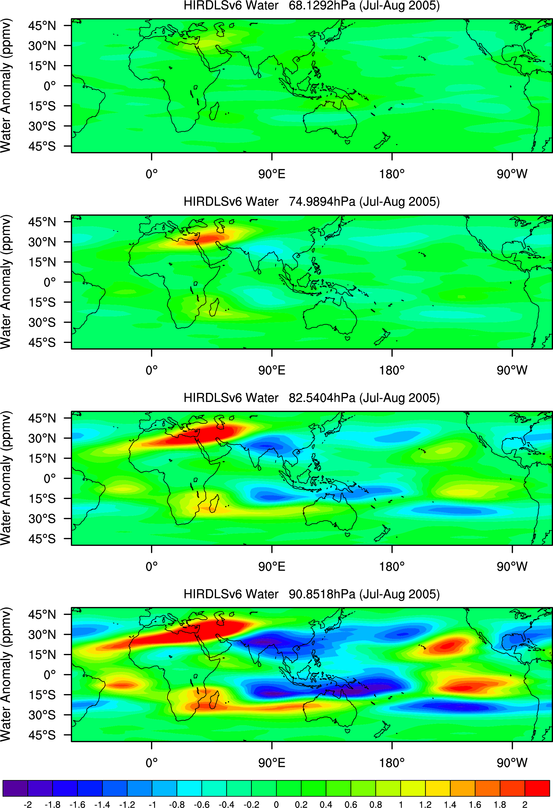
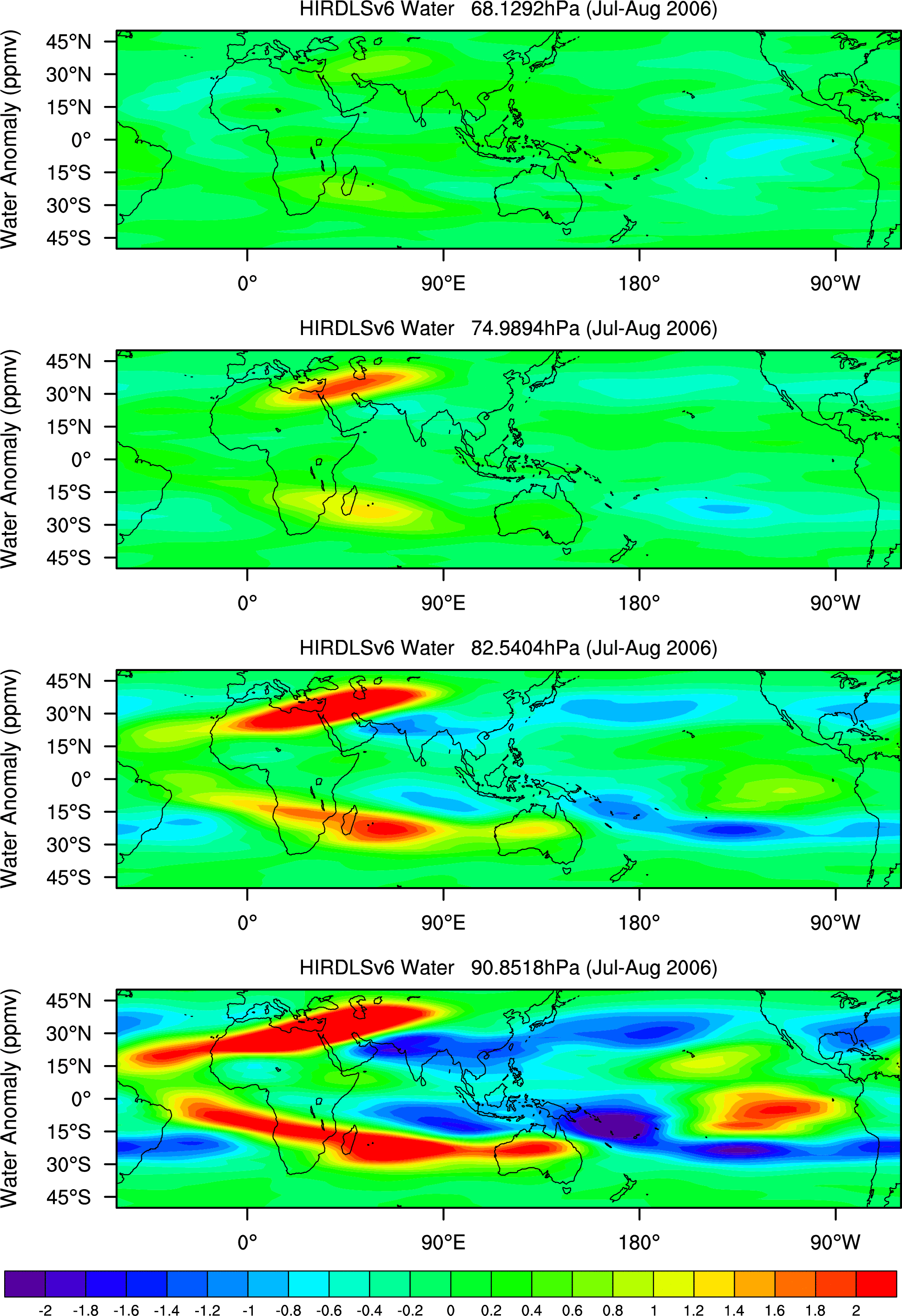
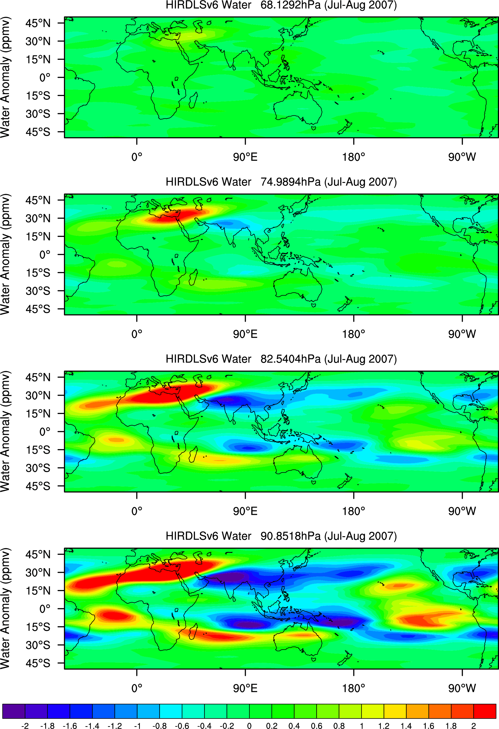
- mean HIRDLS V.6 maps for July-August, different levels:
- GPH 83-110mb: '05, '06, '07,GPH Anomalies 83-110mb:'05, '06, '07
- Temperature 83-110mb:
'05, '06, '07, 22-133mb: '05, '06, '07
Temperature Anomalies: 83-110mb:'05, '06, '07
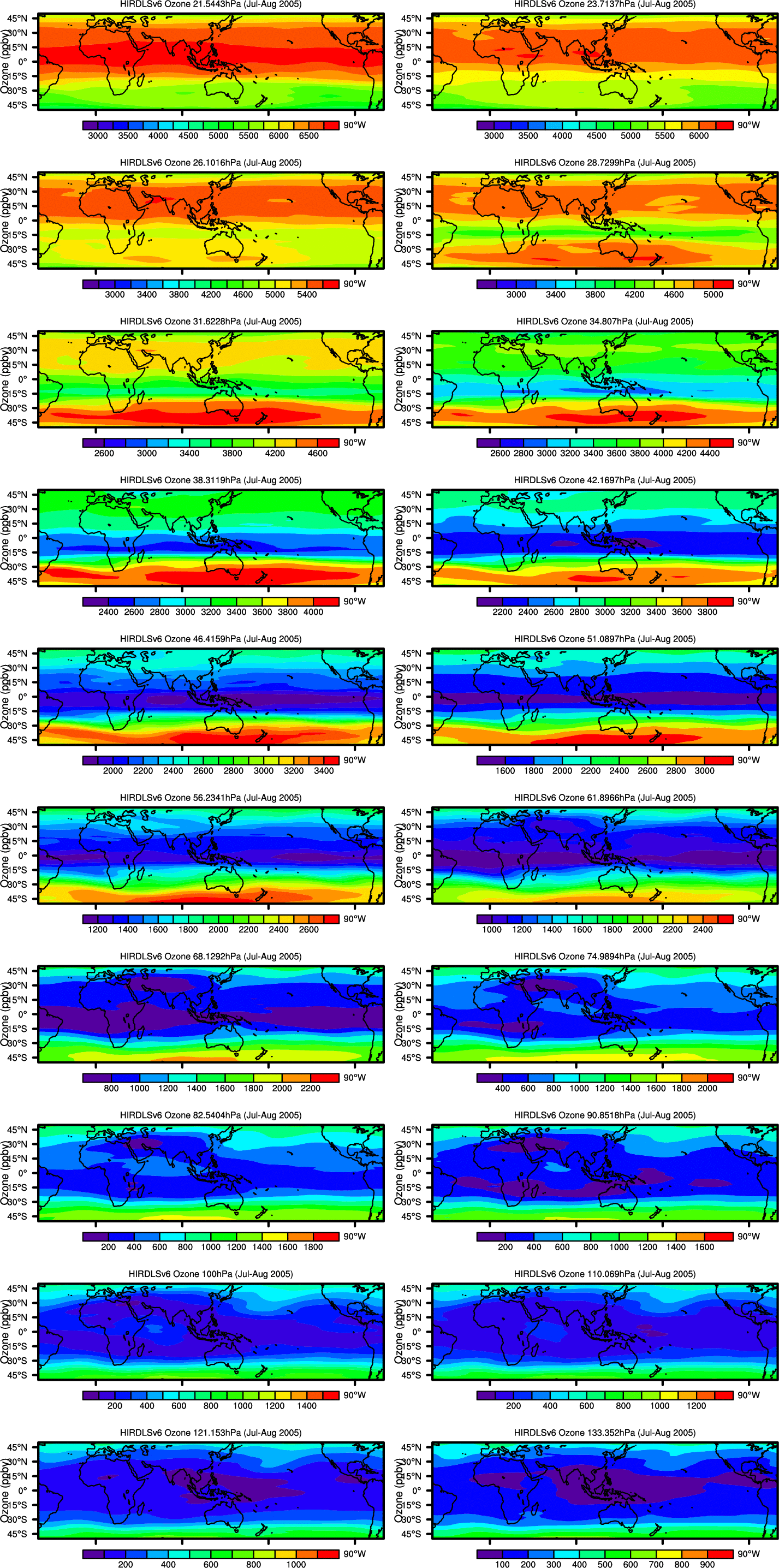
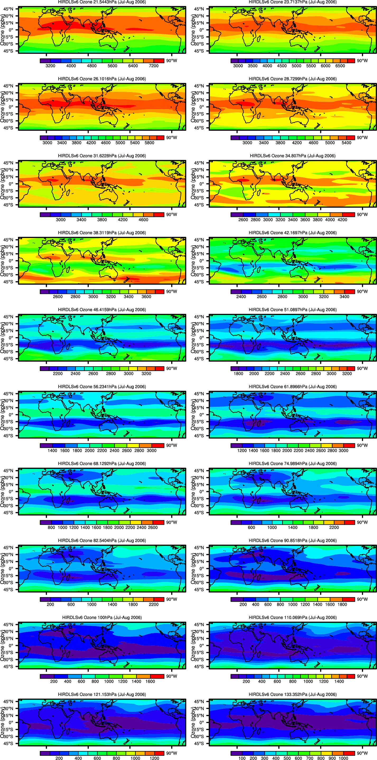
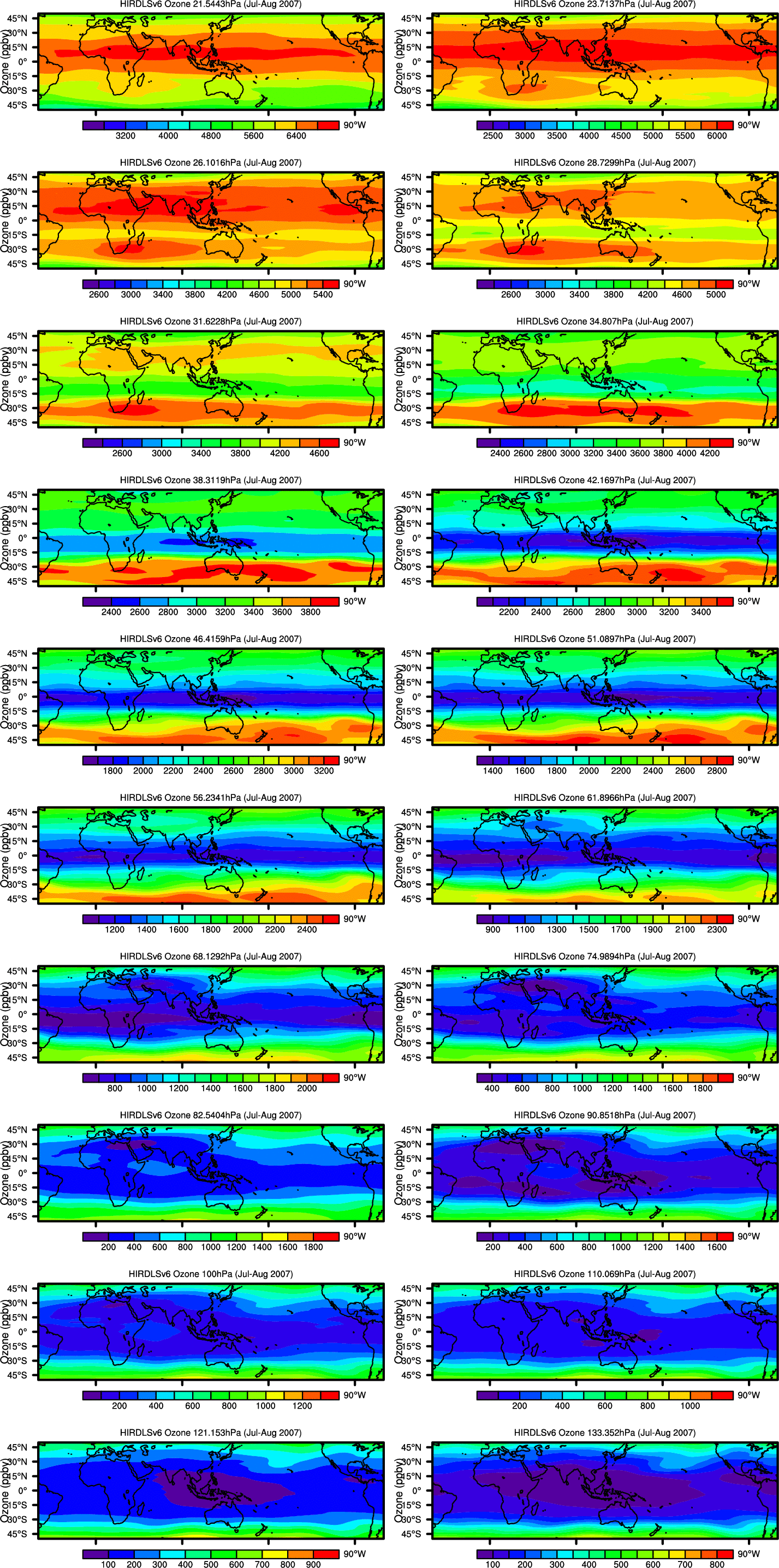
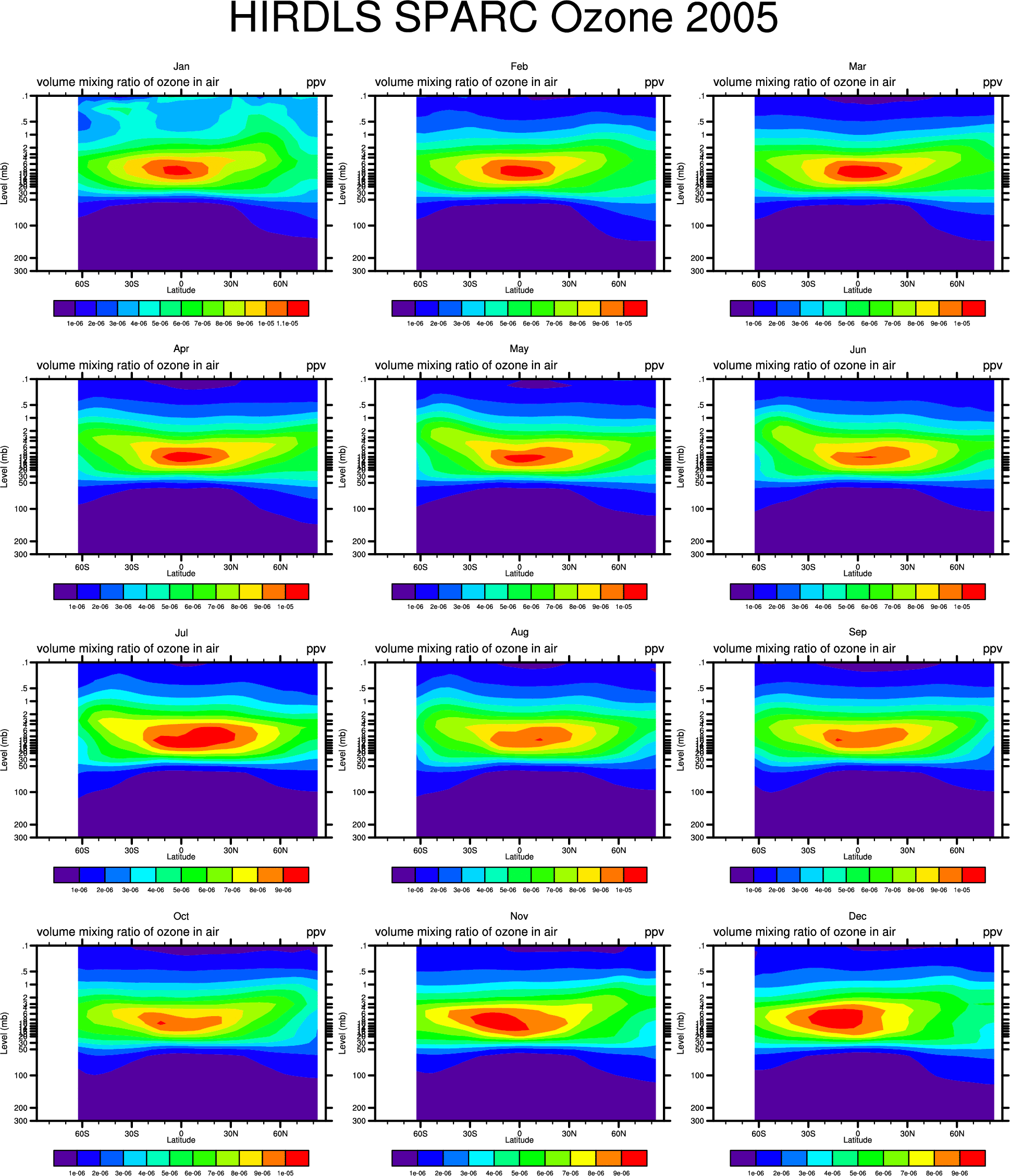
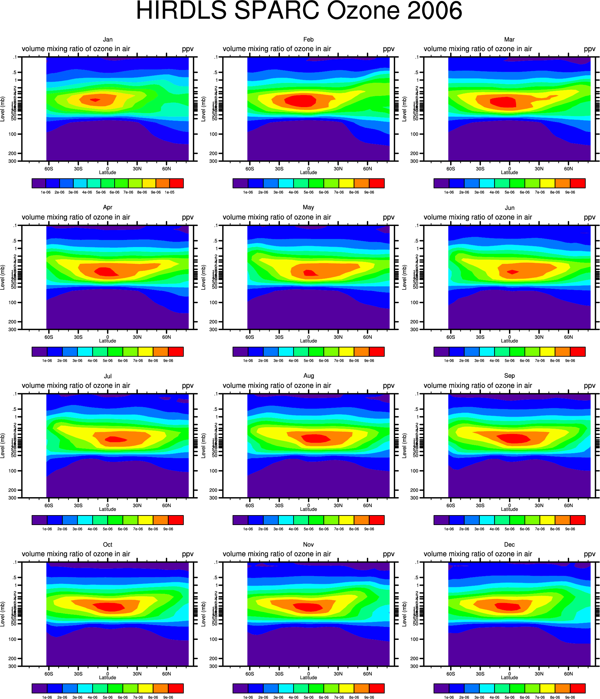
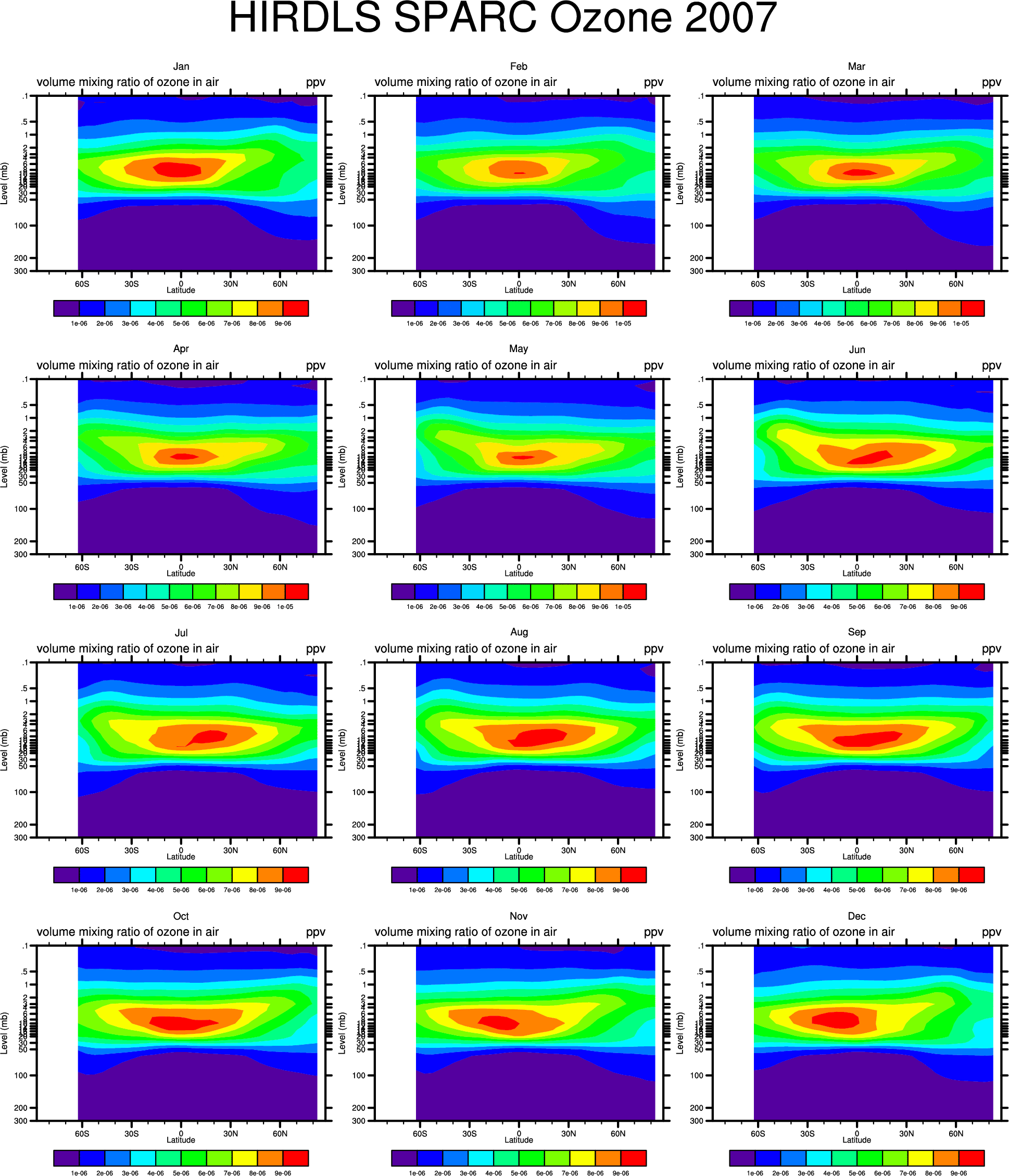
- Ozone: '05:
83-110mb, 38-91mb,15-35mb, '06: 83-110mb, 38-91mb, 15-35mb,'07: 83-110mb, 38-91mb, 15-35mb,
(22-133mb: '05,'06,'07)
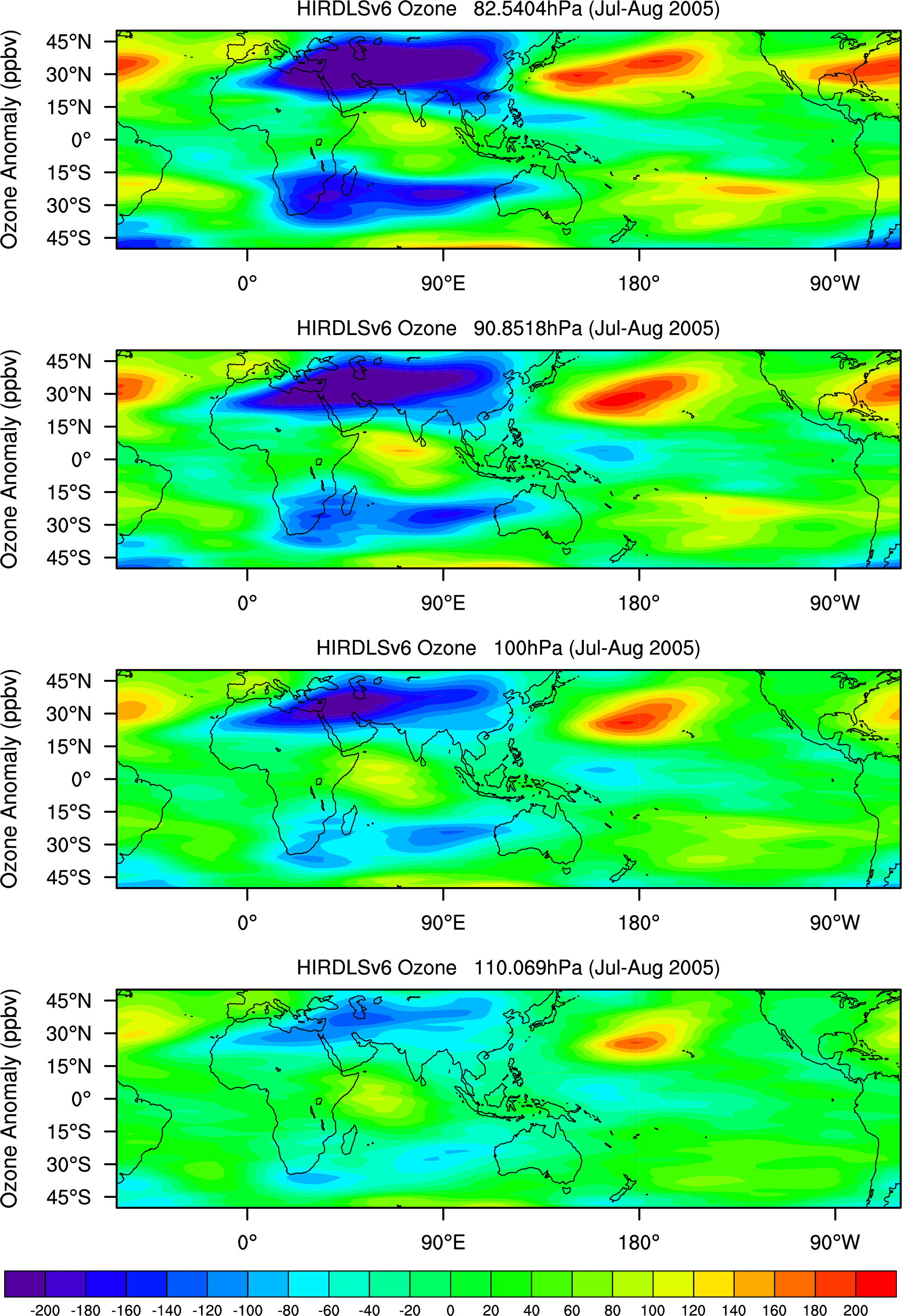
Ozone Anomalies: '05: 83-110mb,38-91mb,15-35mb,'06: 83-110mb, 38-91mb, 15-35mb, '07: 83-110mb, 38-91mb, 15-35mb
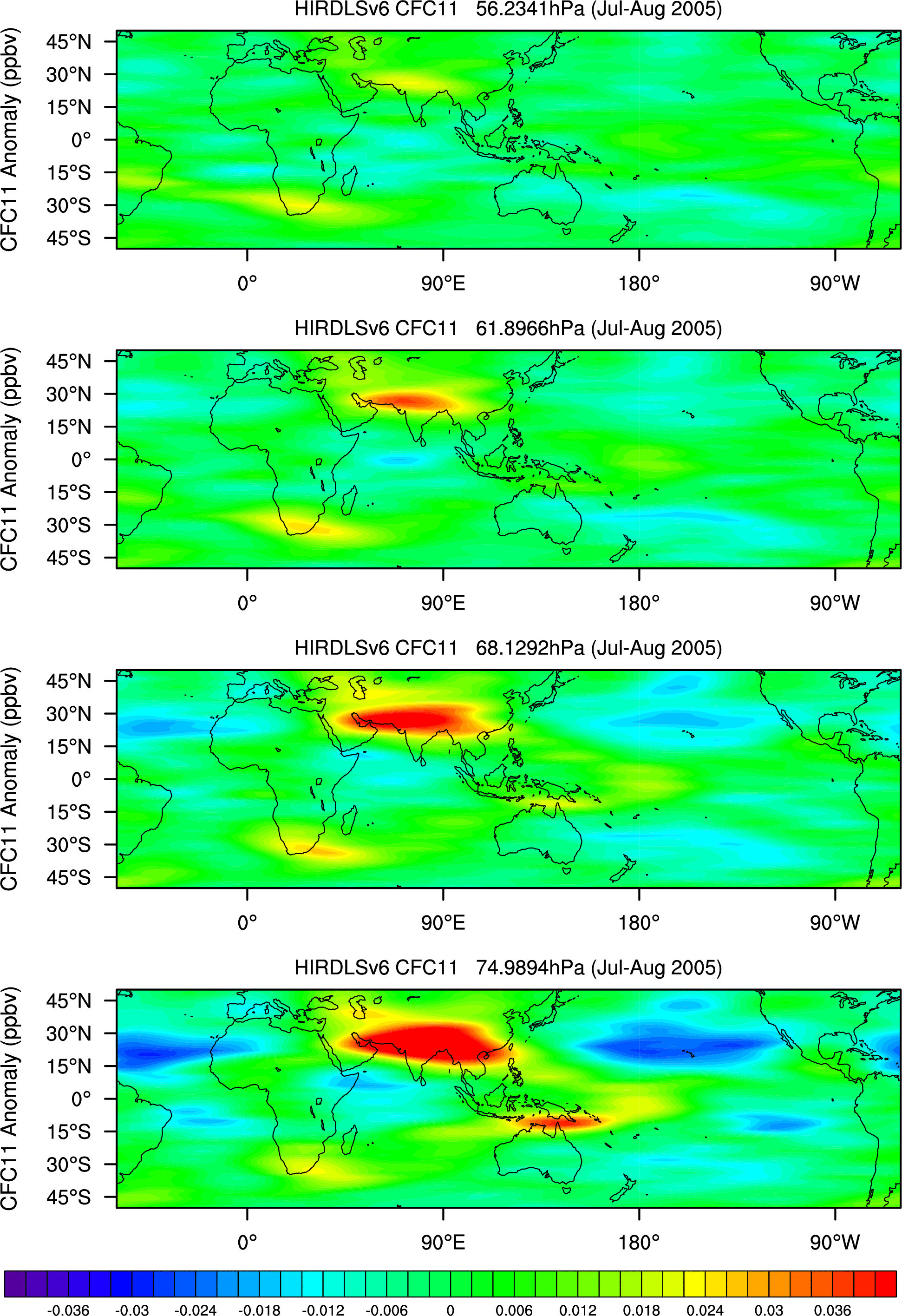
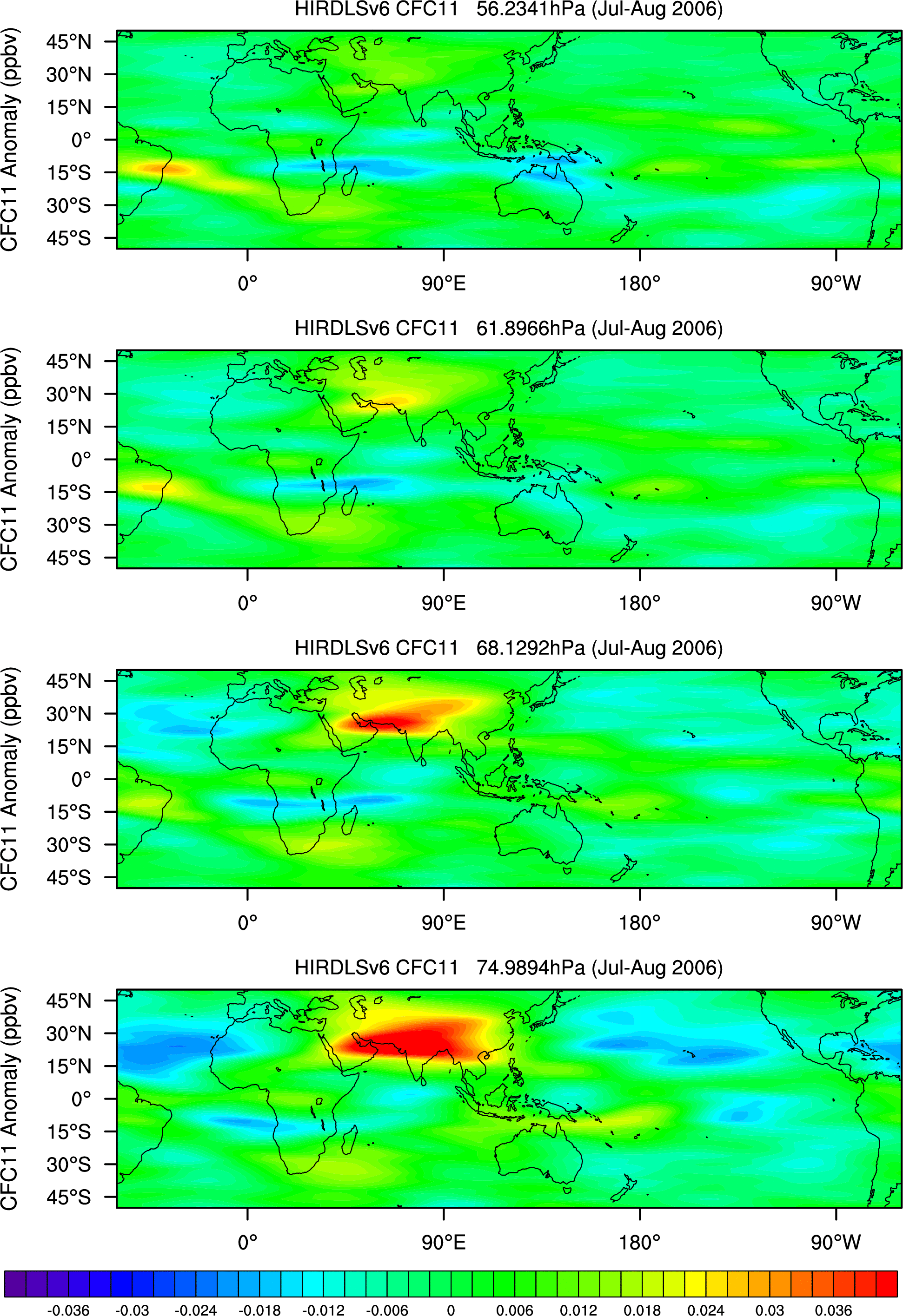
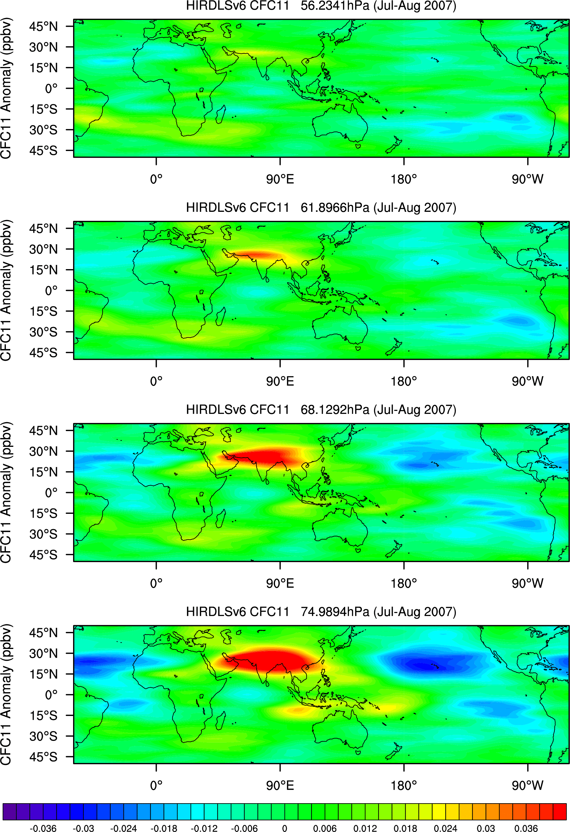
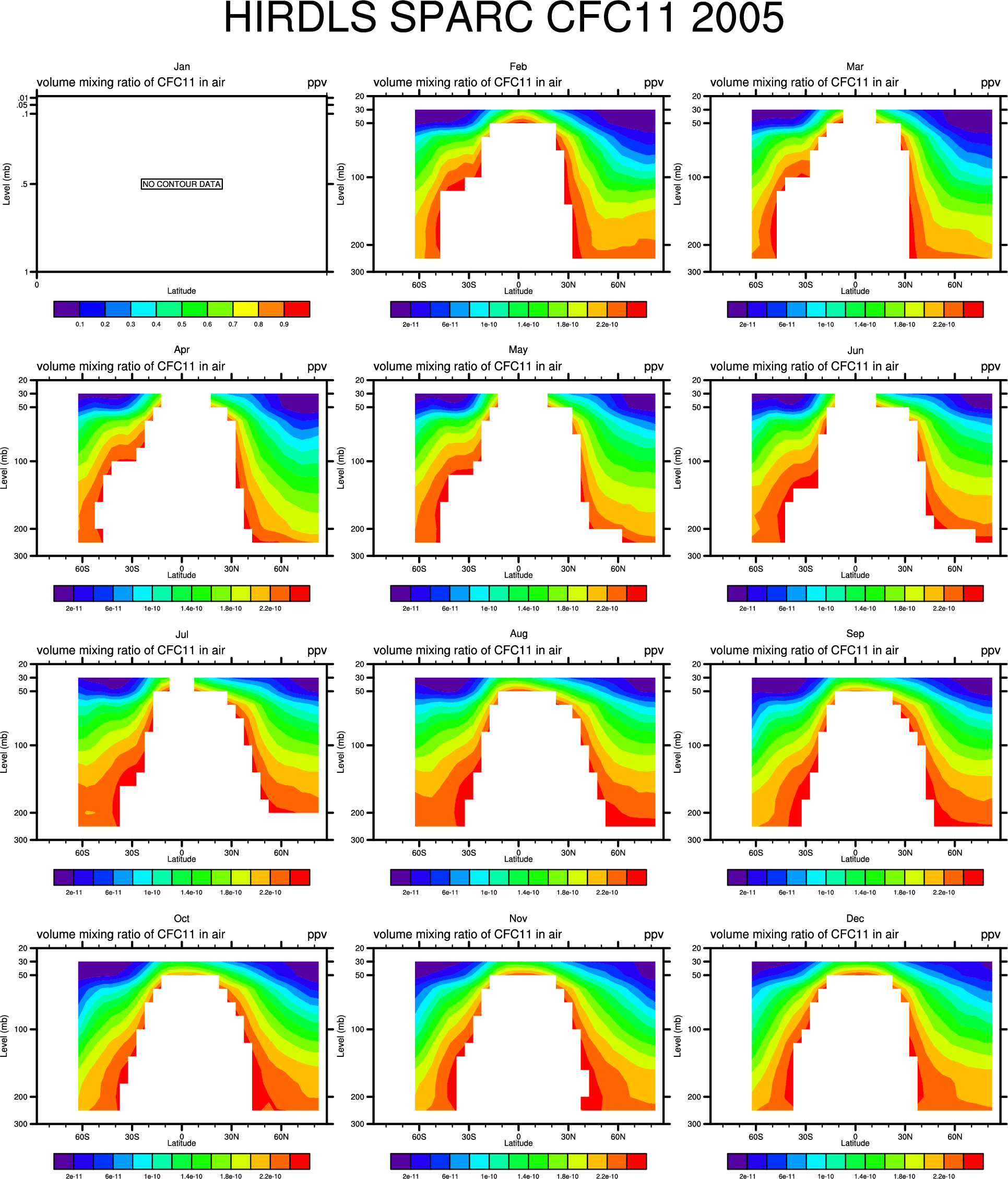
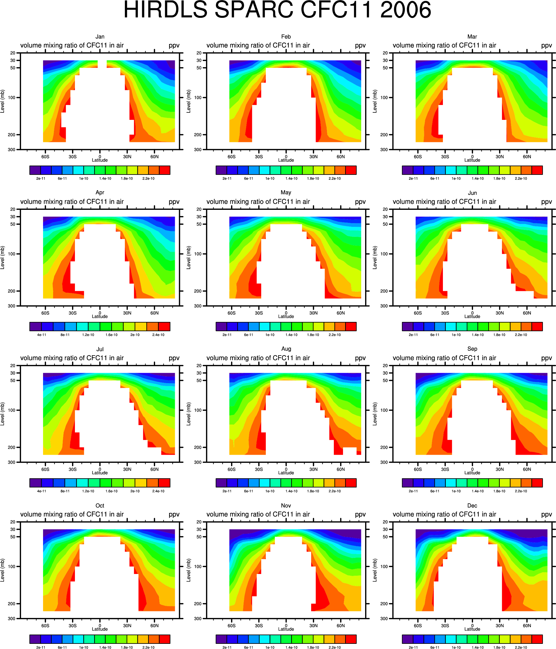
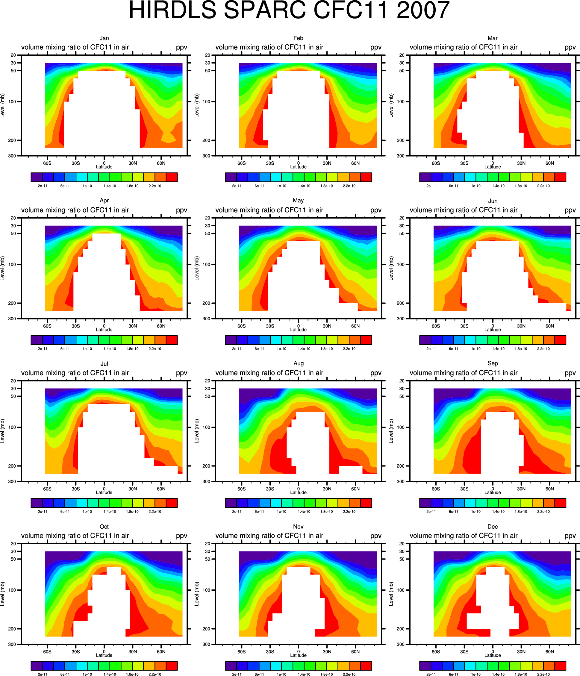
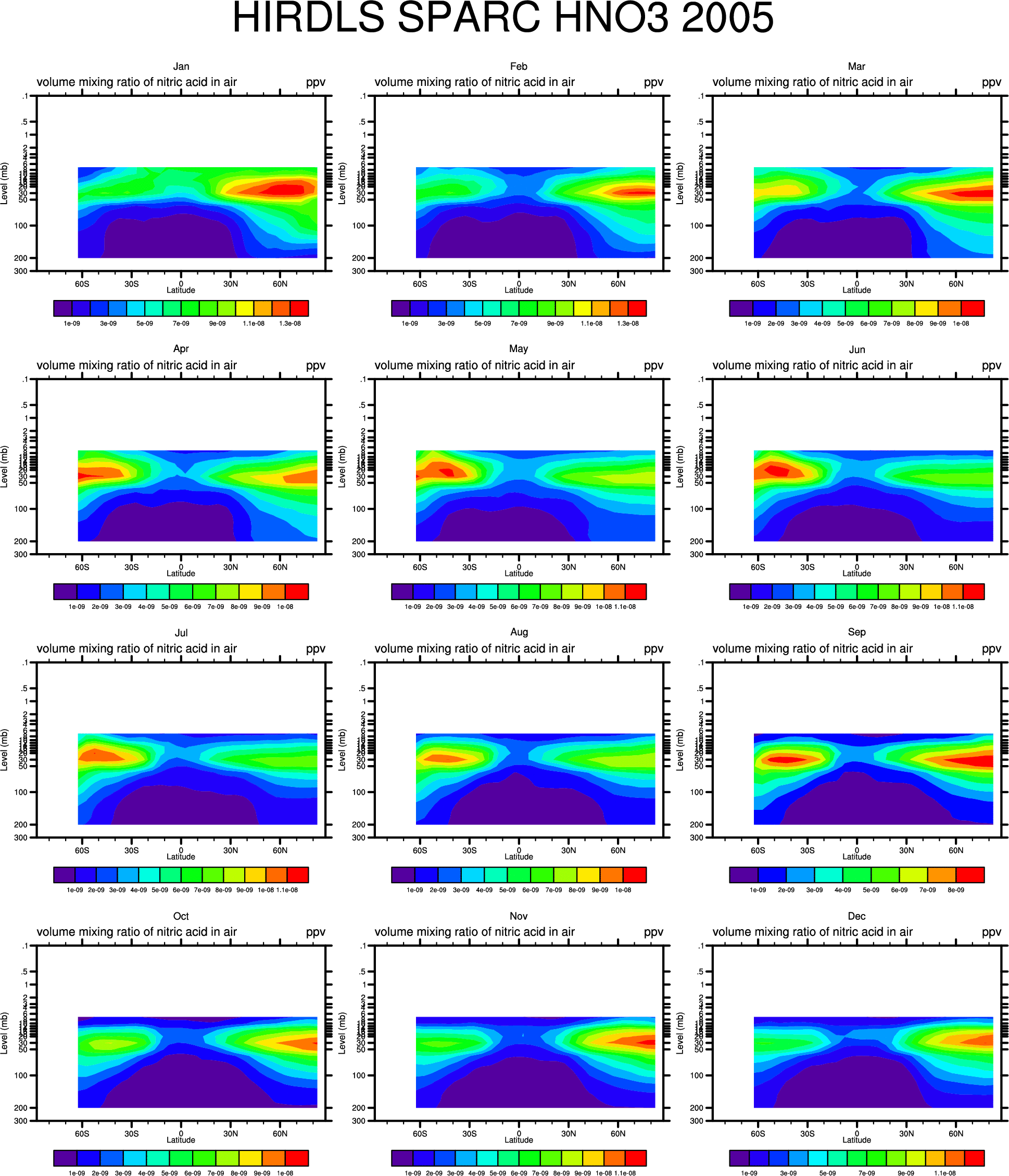
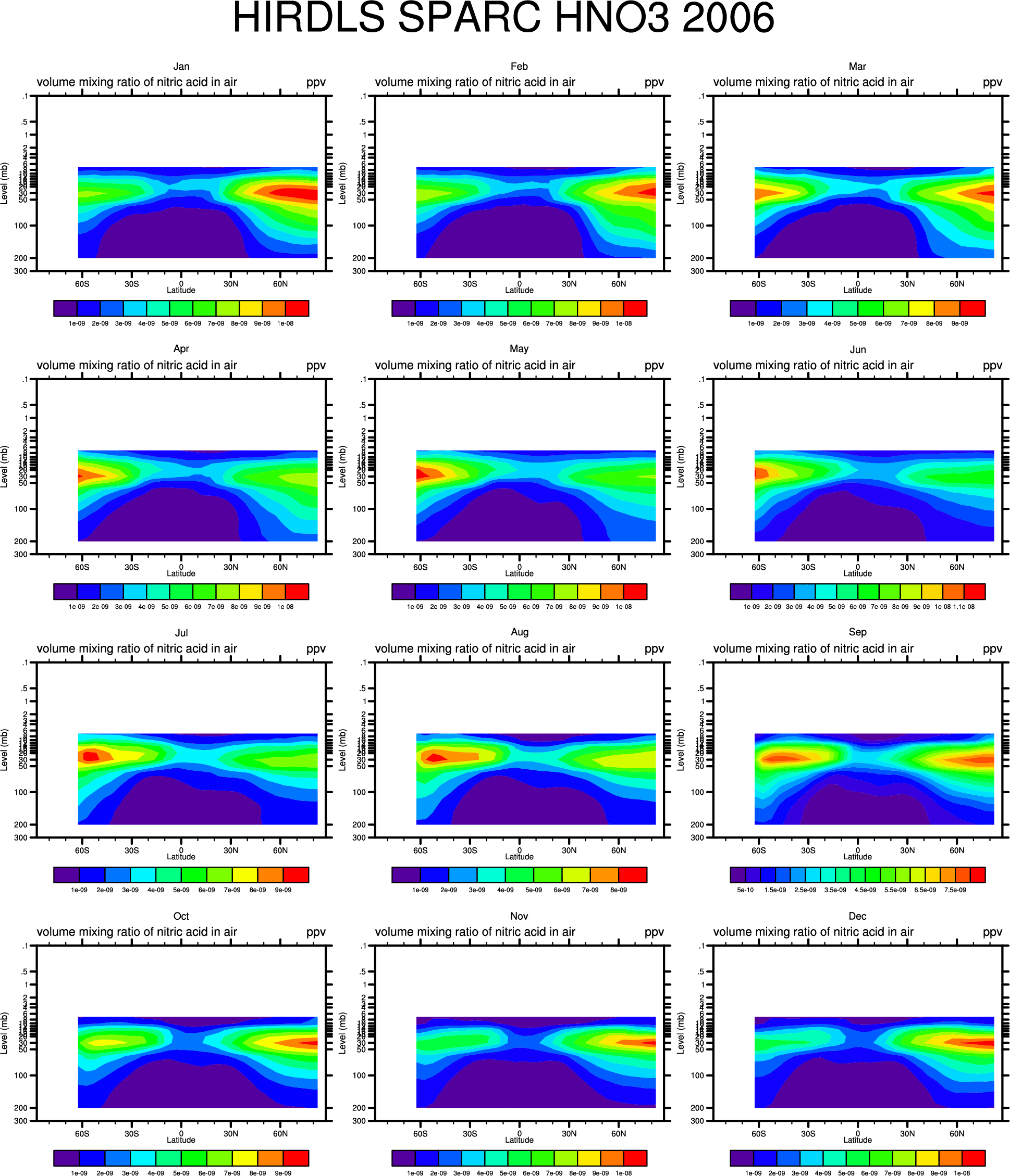
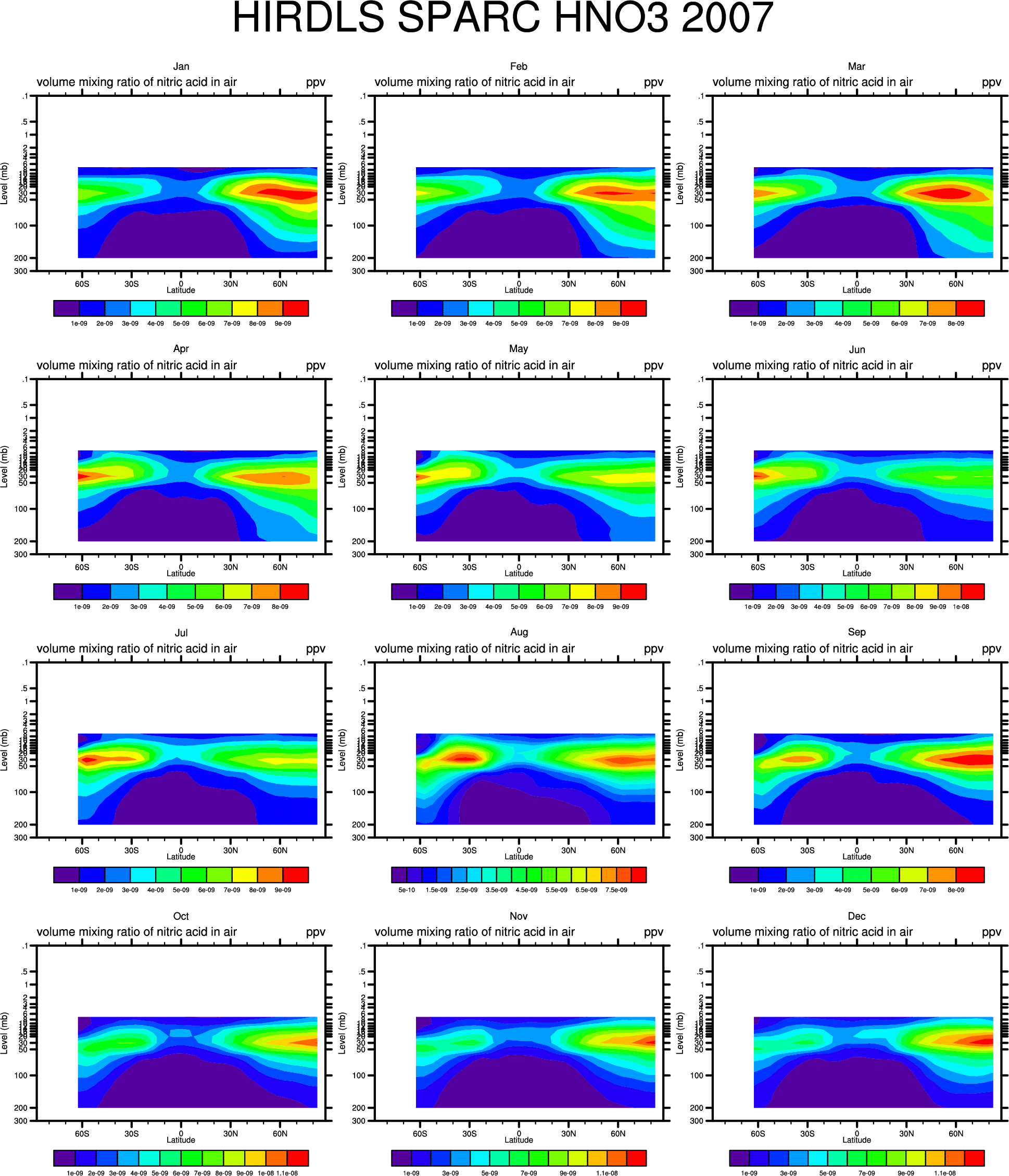
- CFC11: 56-75mb:
'05, '06, '07,
26-162mb: '05,'06,'07,
CFC11 Anomalies: 56-75mb:'05, '06, '07
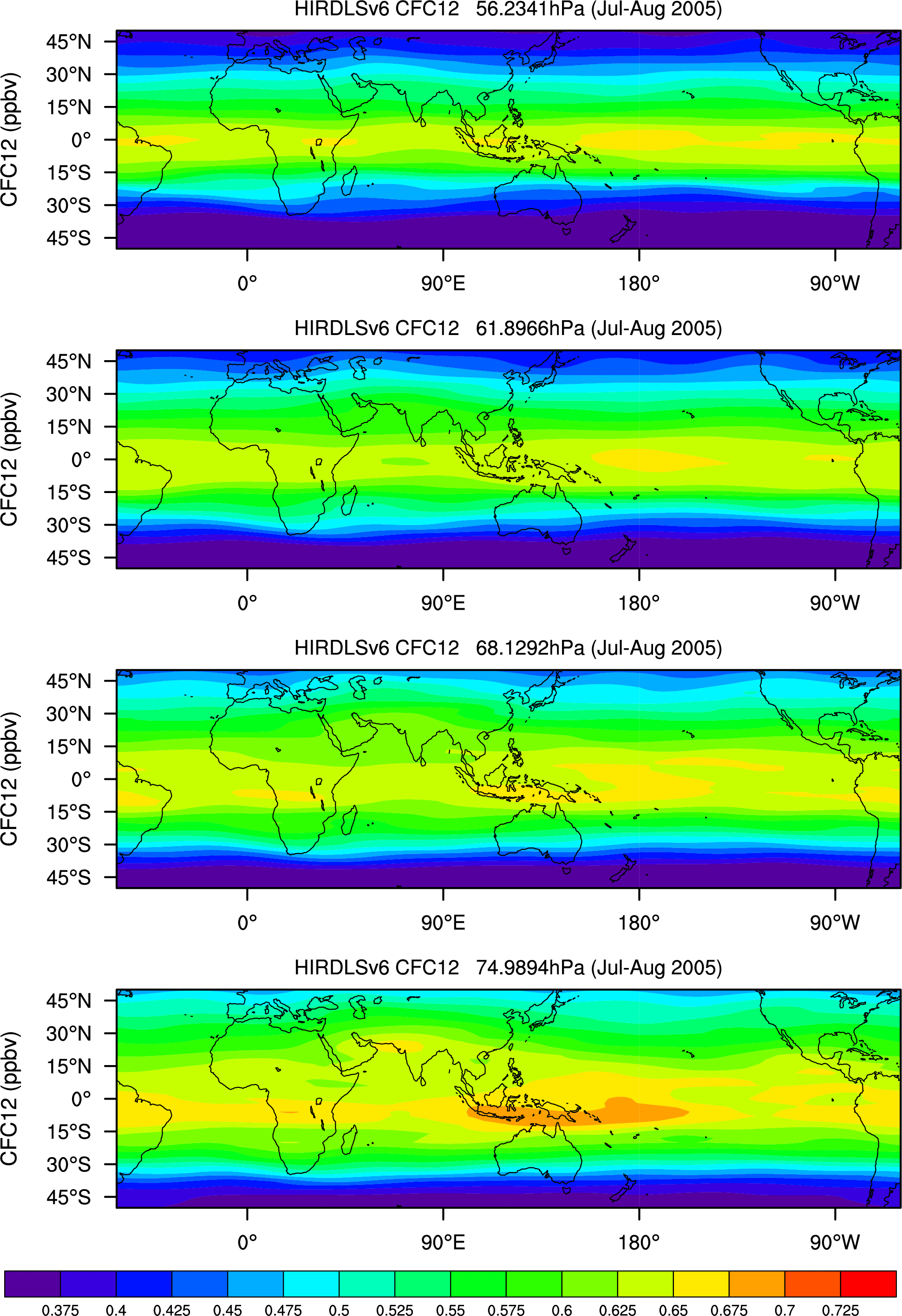
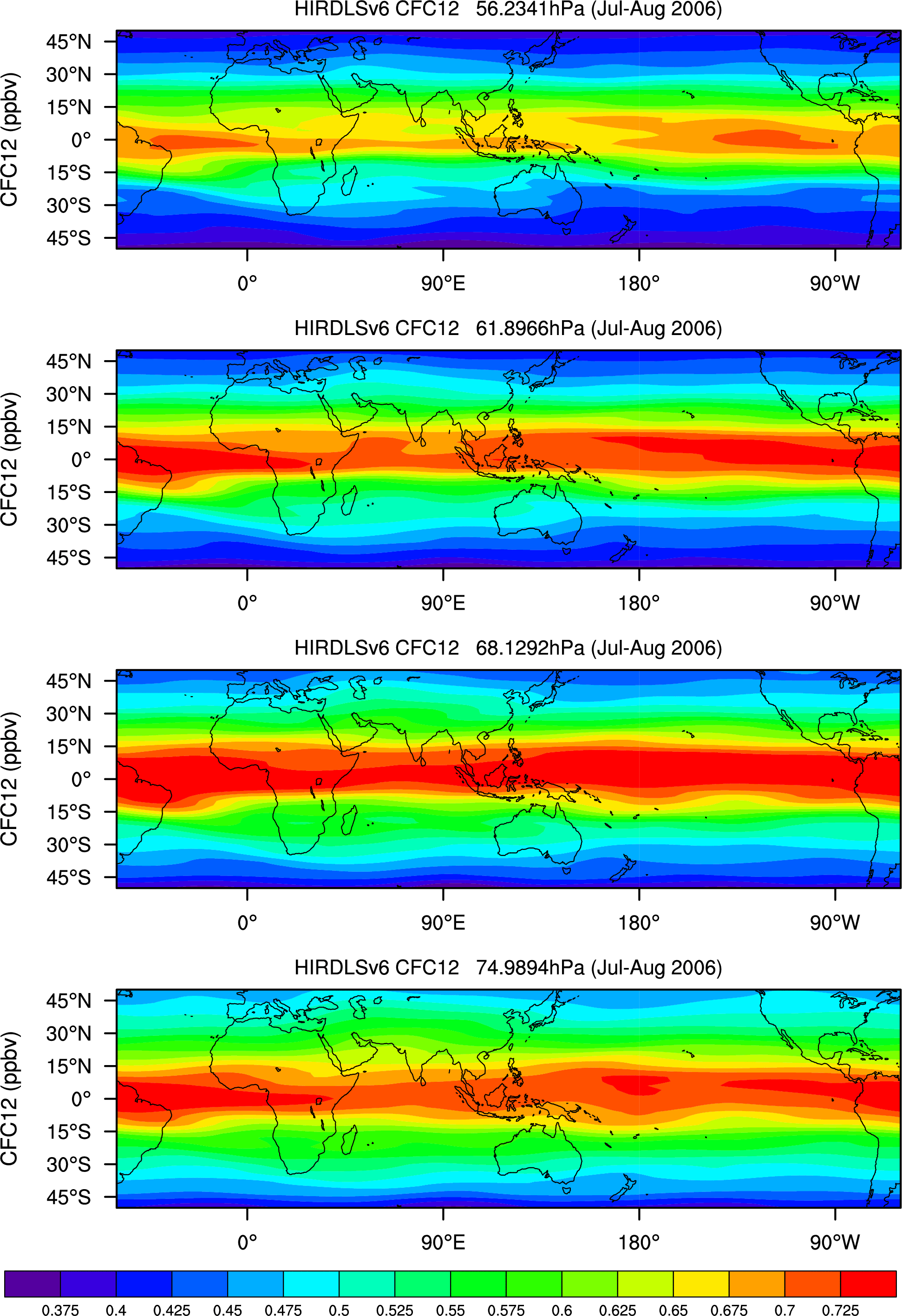
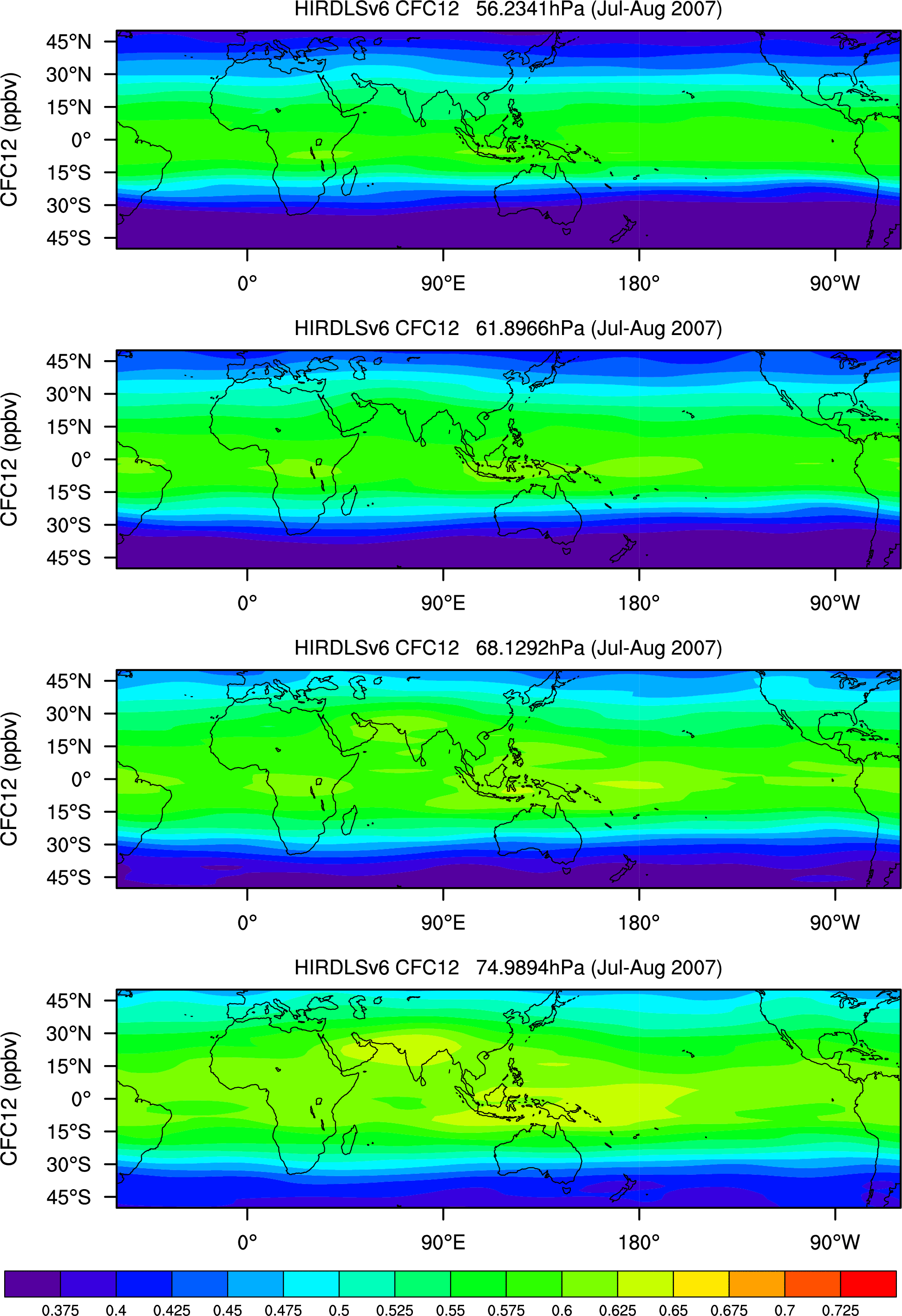
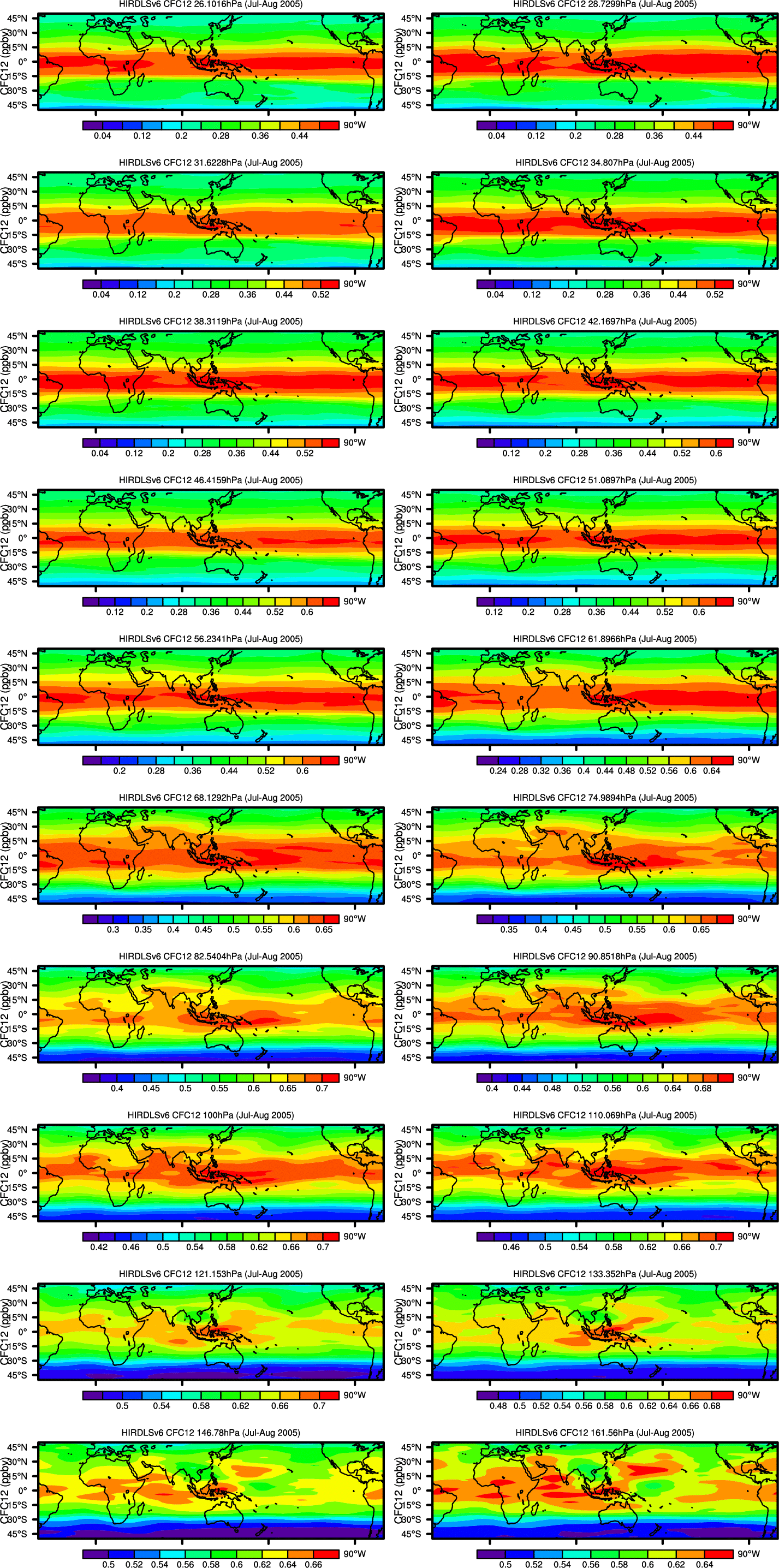
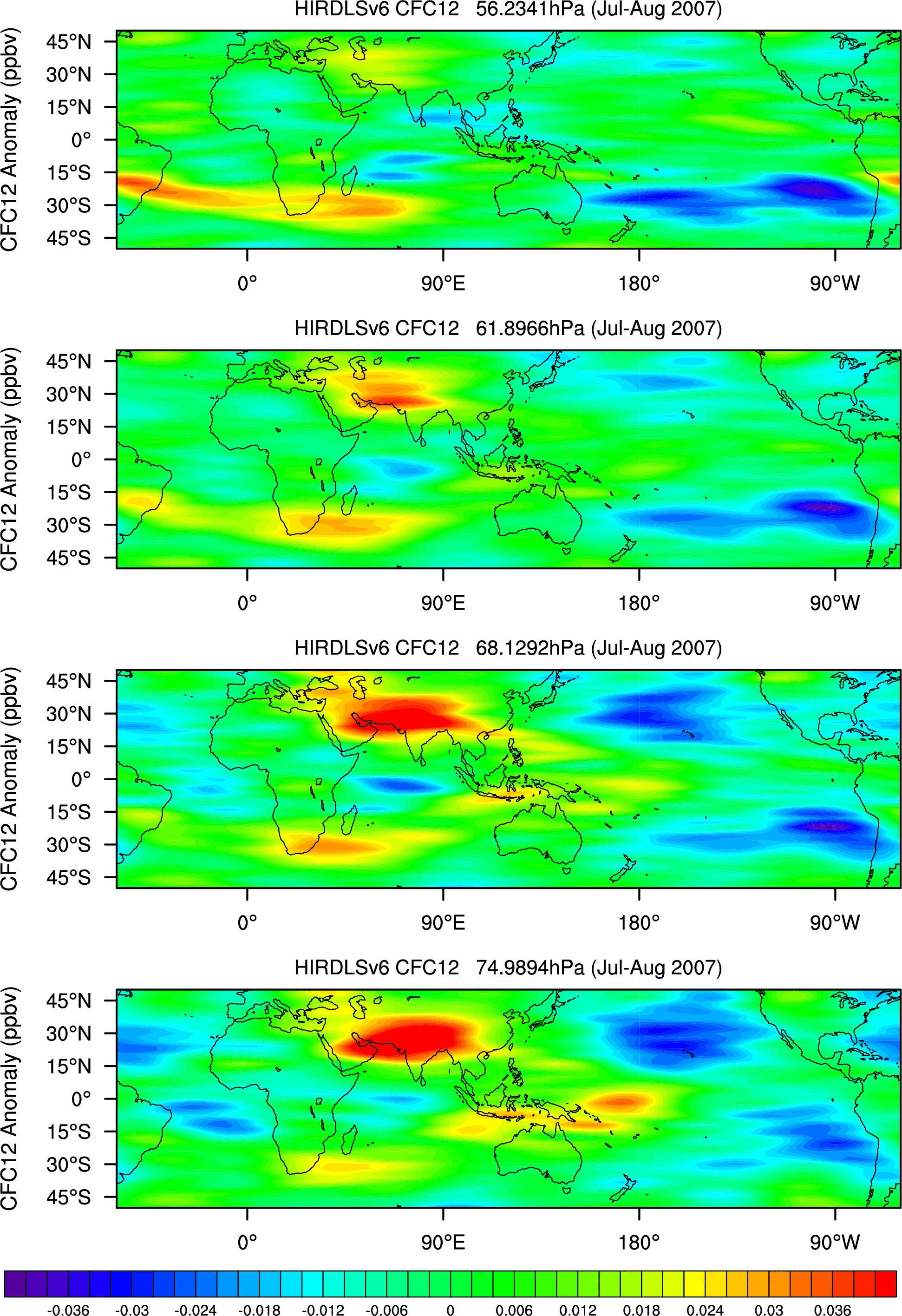
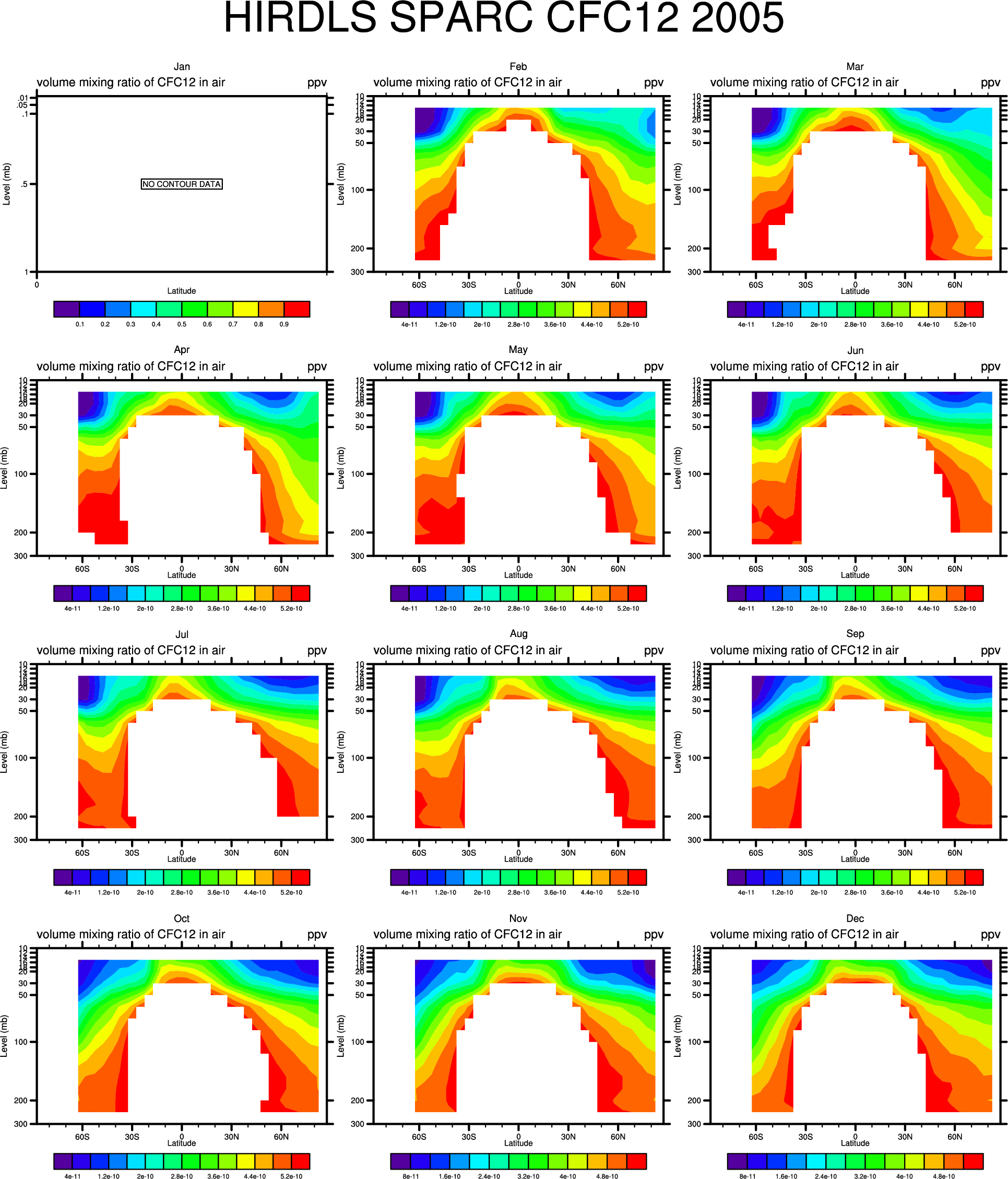
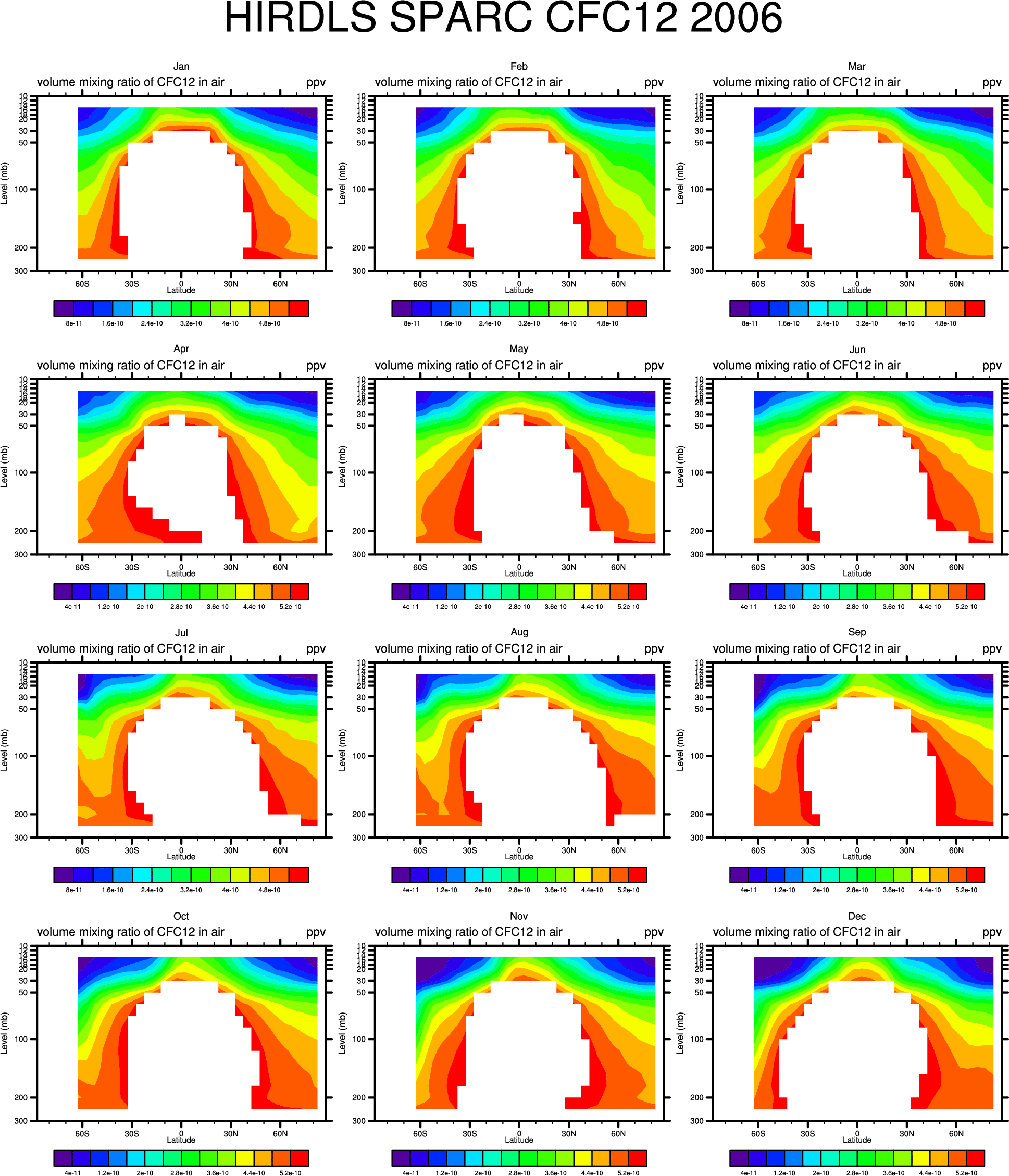
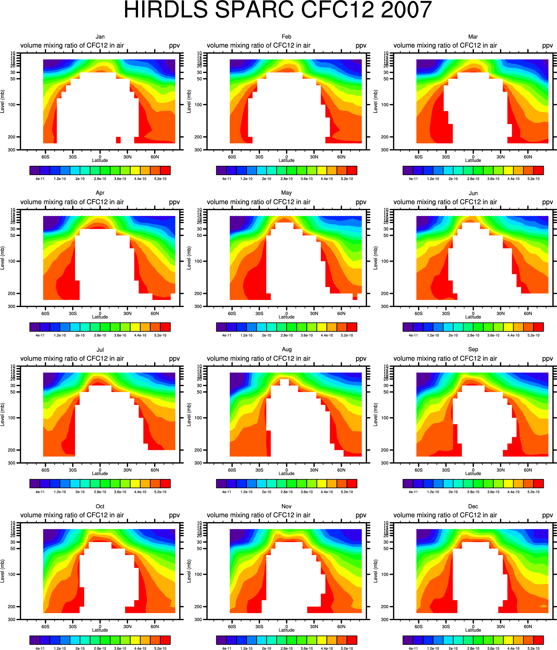
- CFC12: 56-75mb:
'05, '06, '07,
26-162mb: '05,'06,'07,
CFC12 Anomalies: 56-75mb:'05, '06, '07
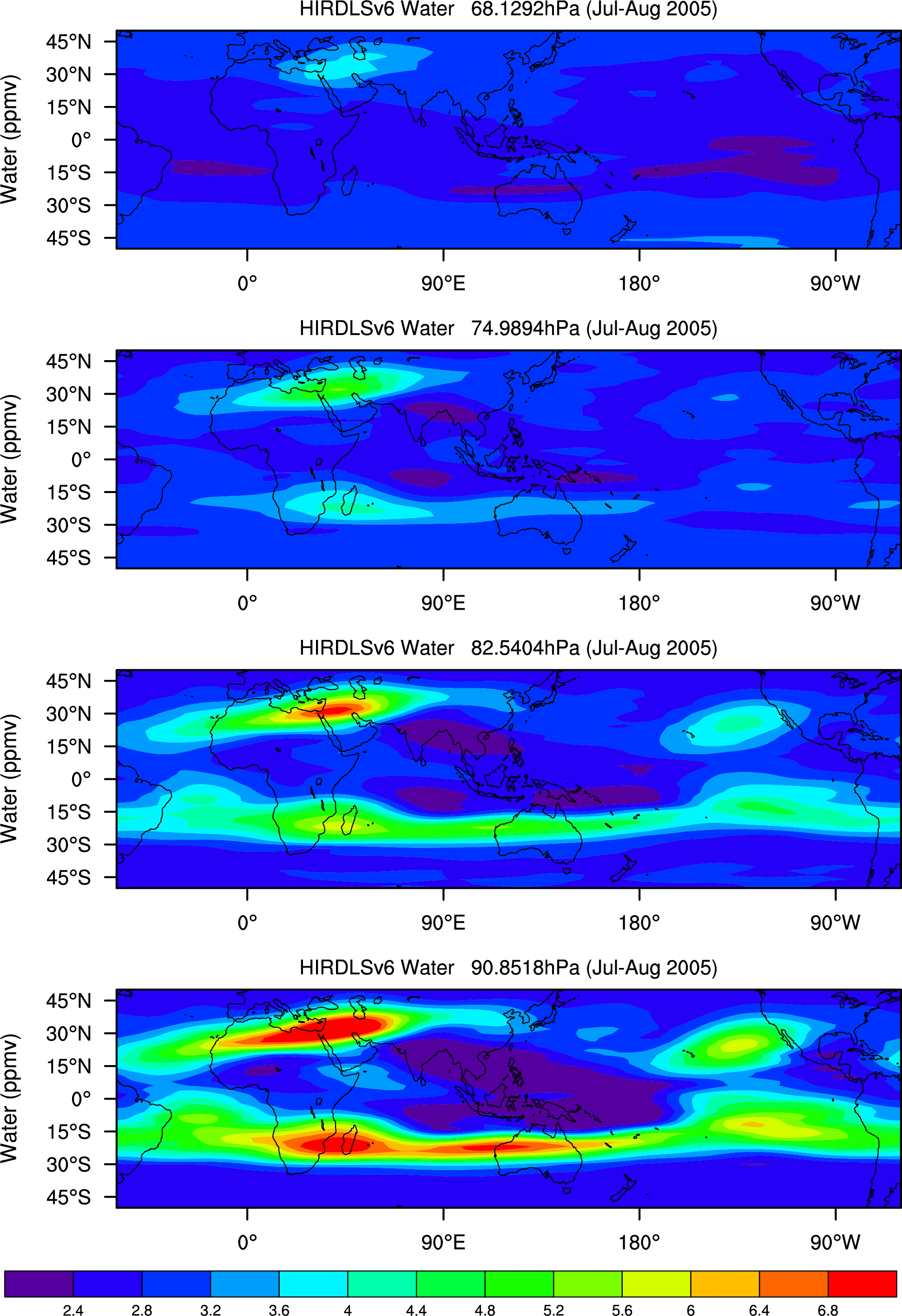
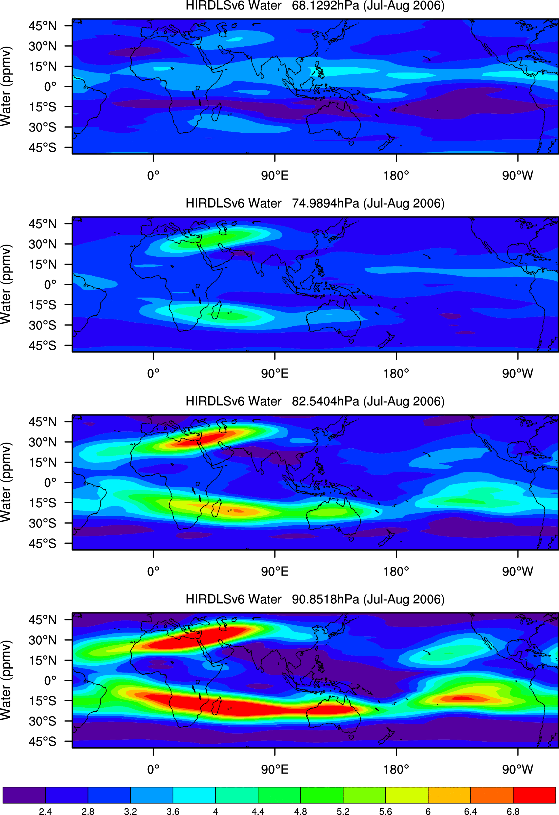
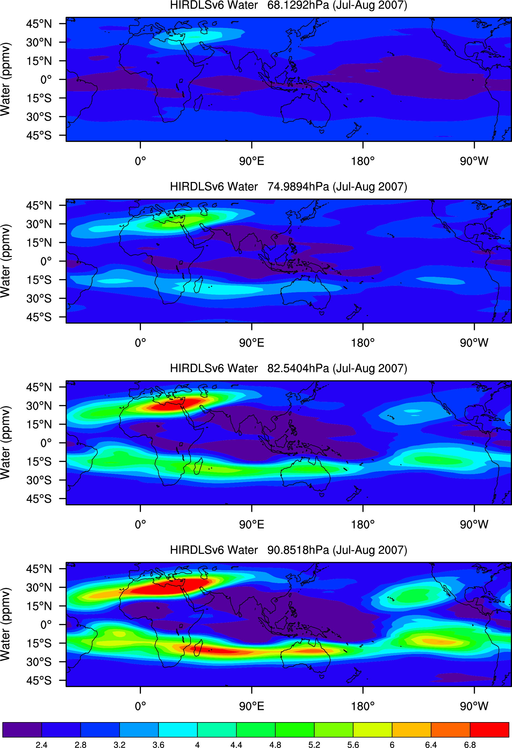
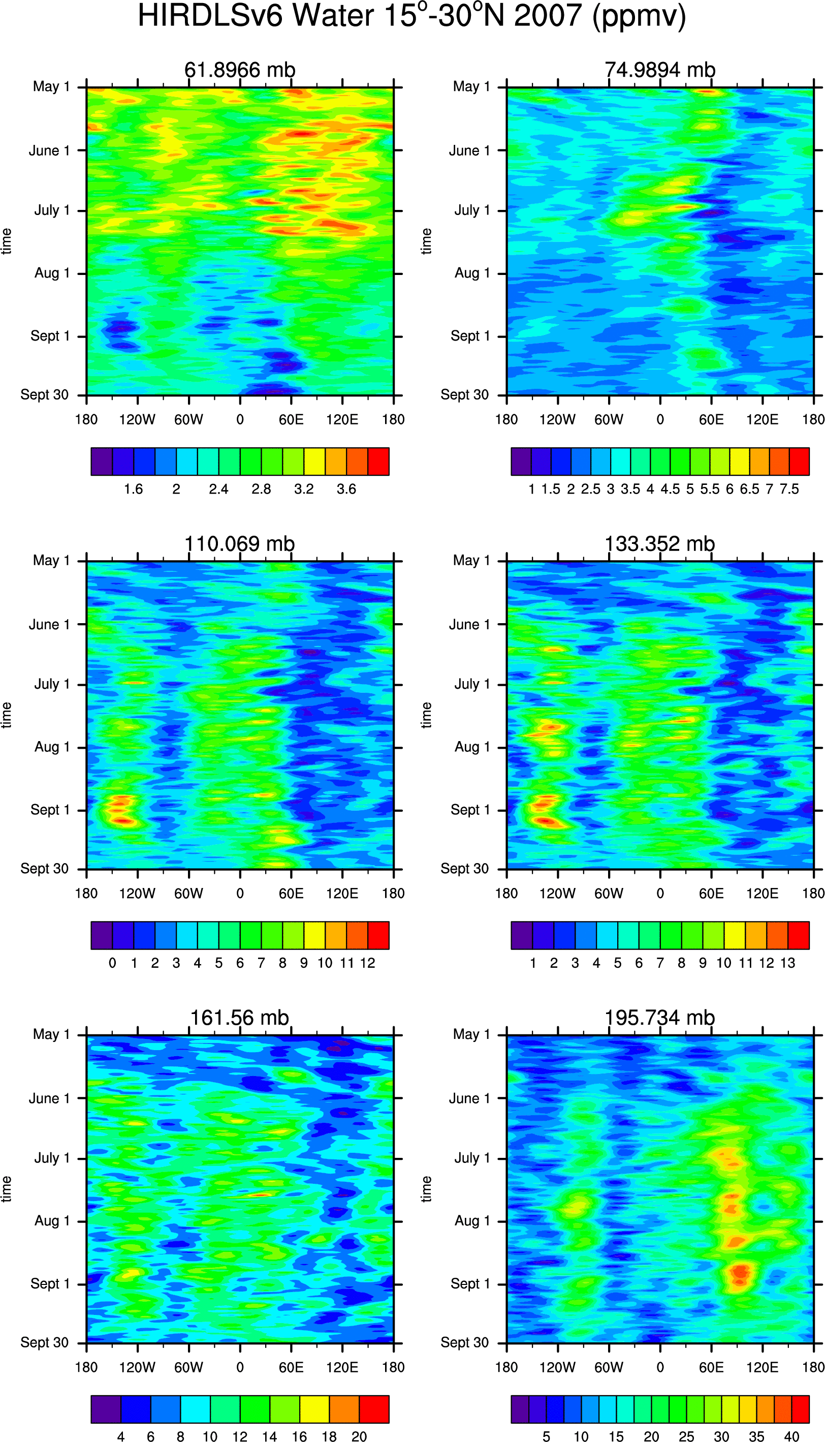
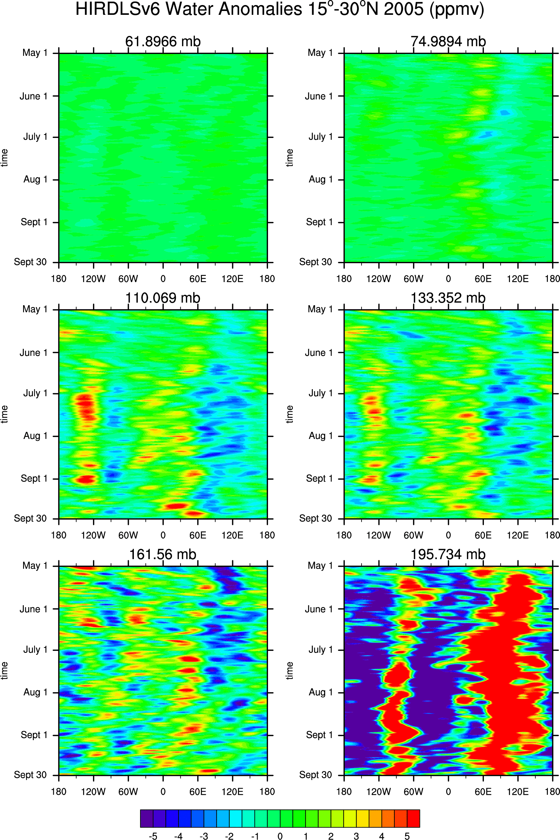
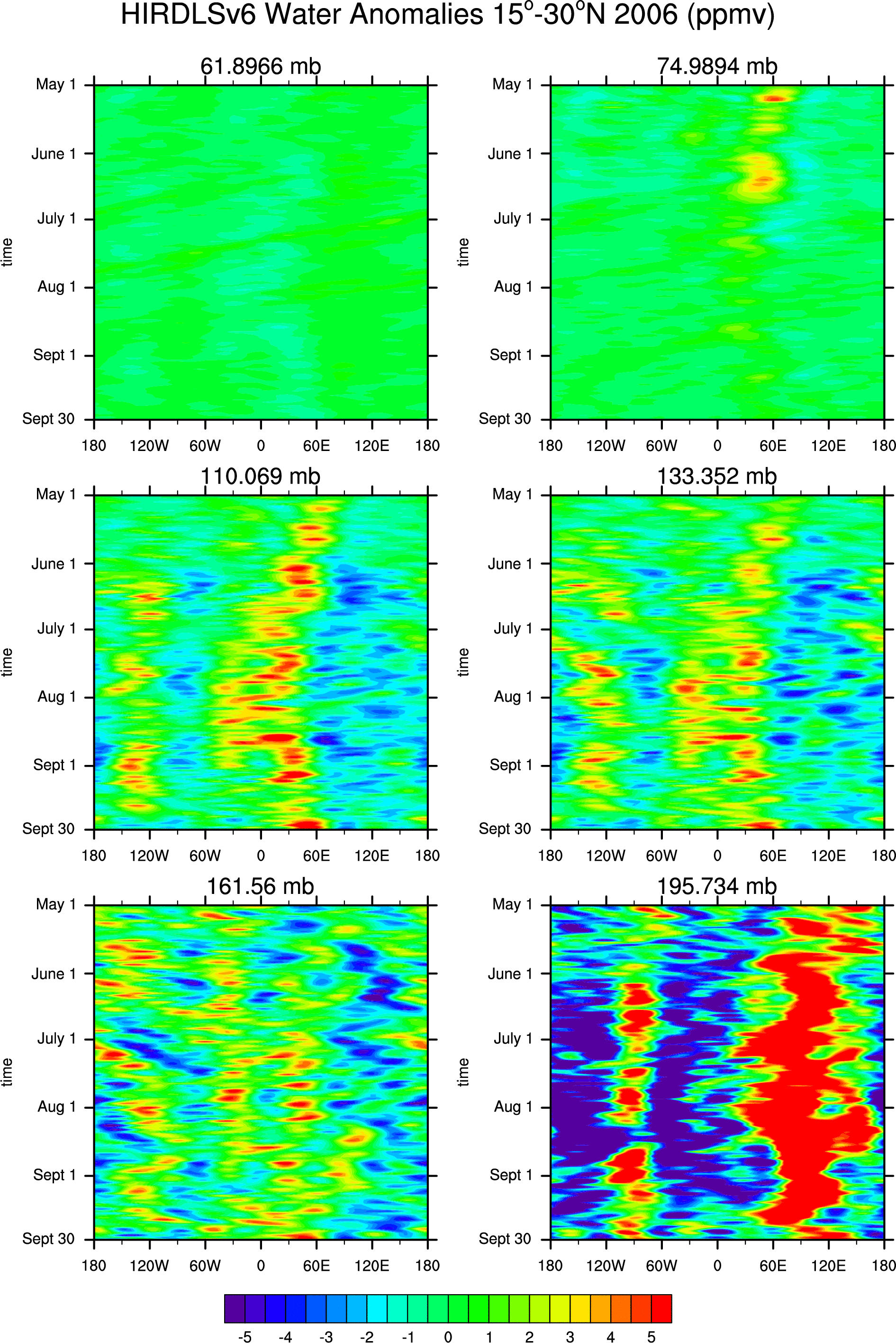
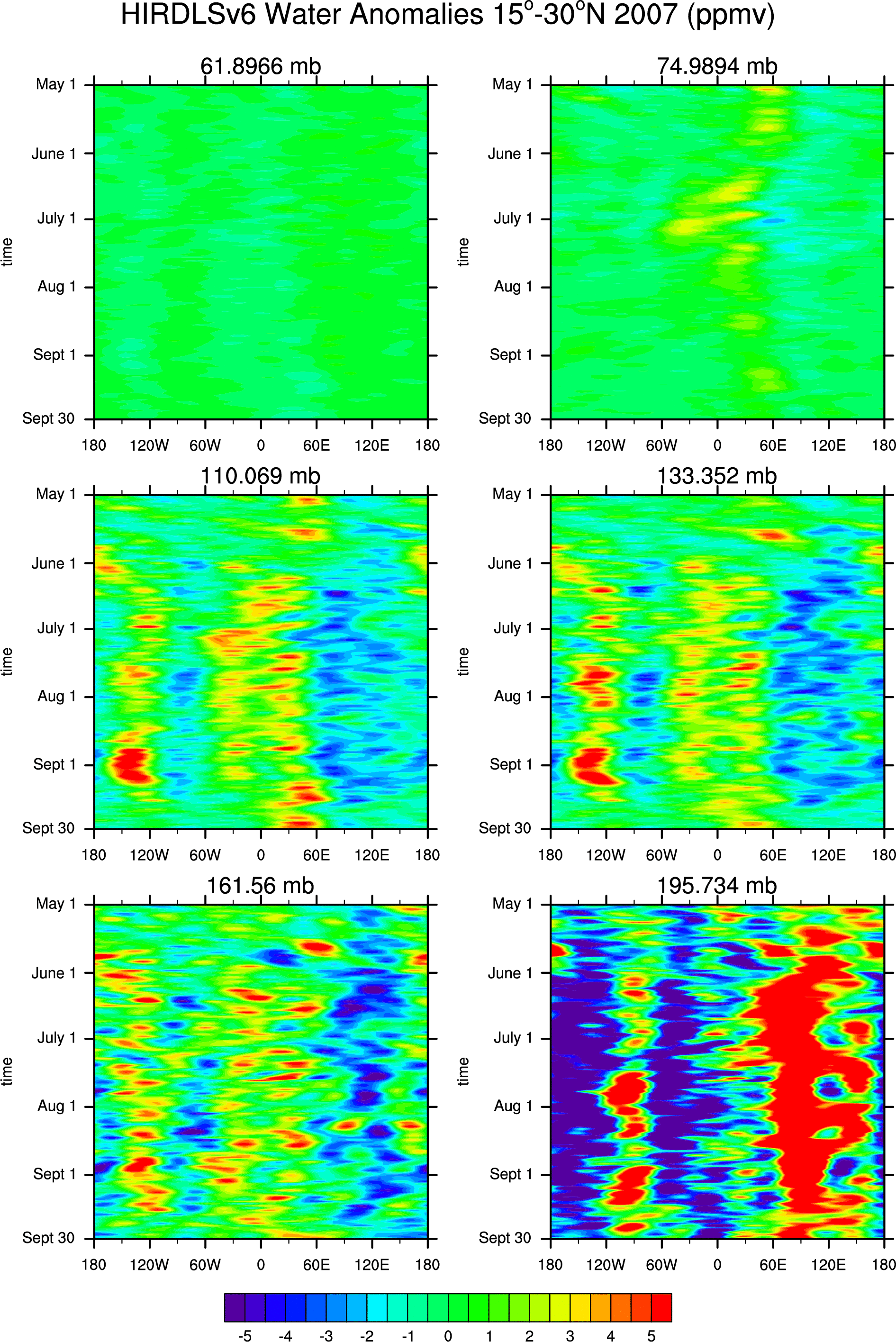
- water: 68-91mb:
'05, '06, '07,water anomalies: 68-91:'05, '06, '07
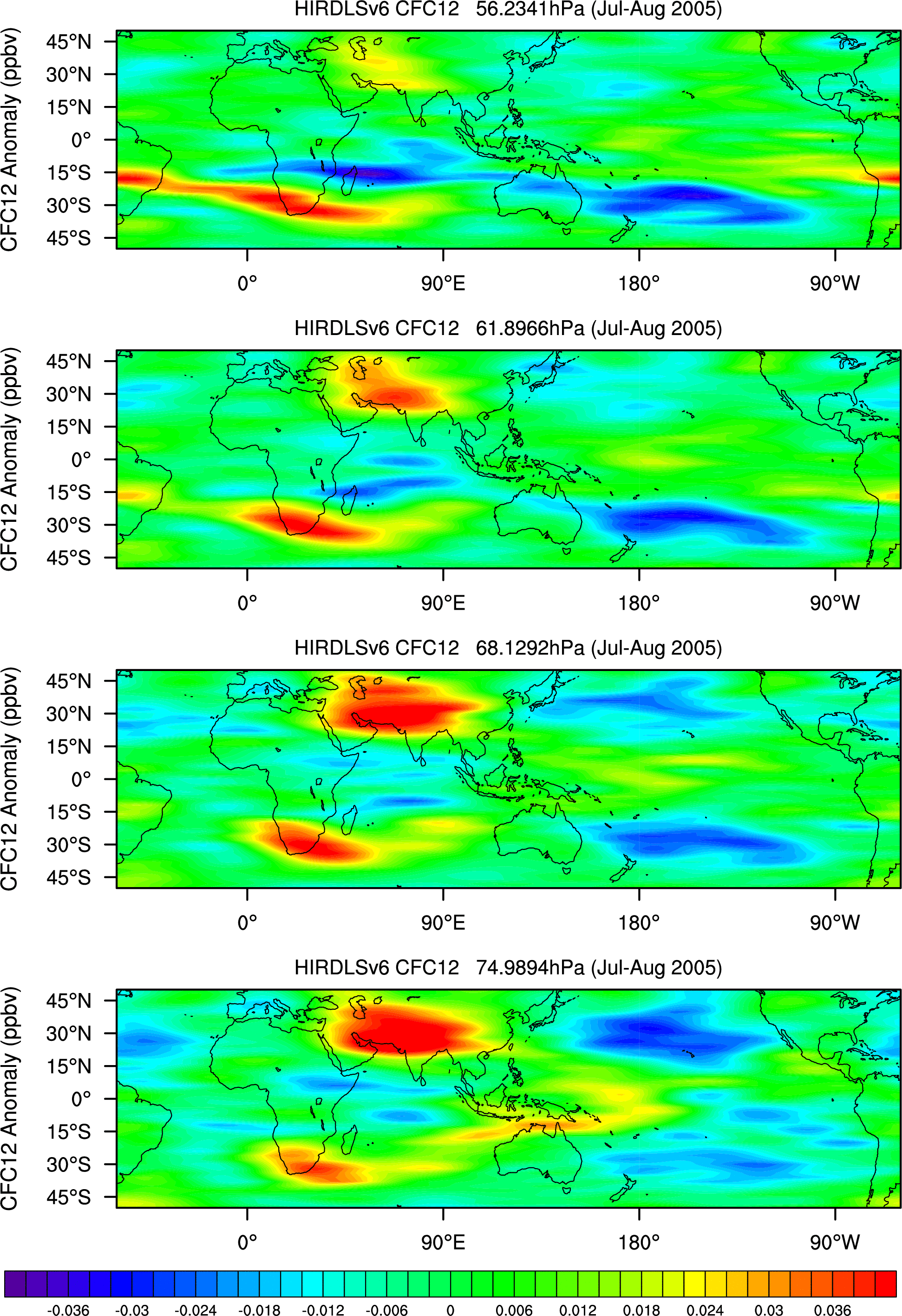
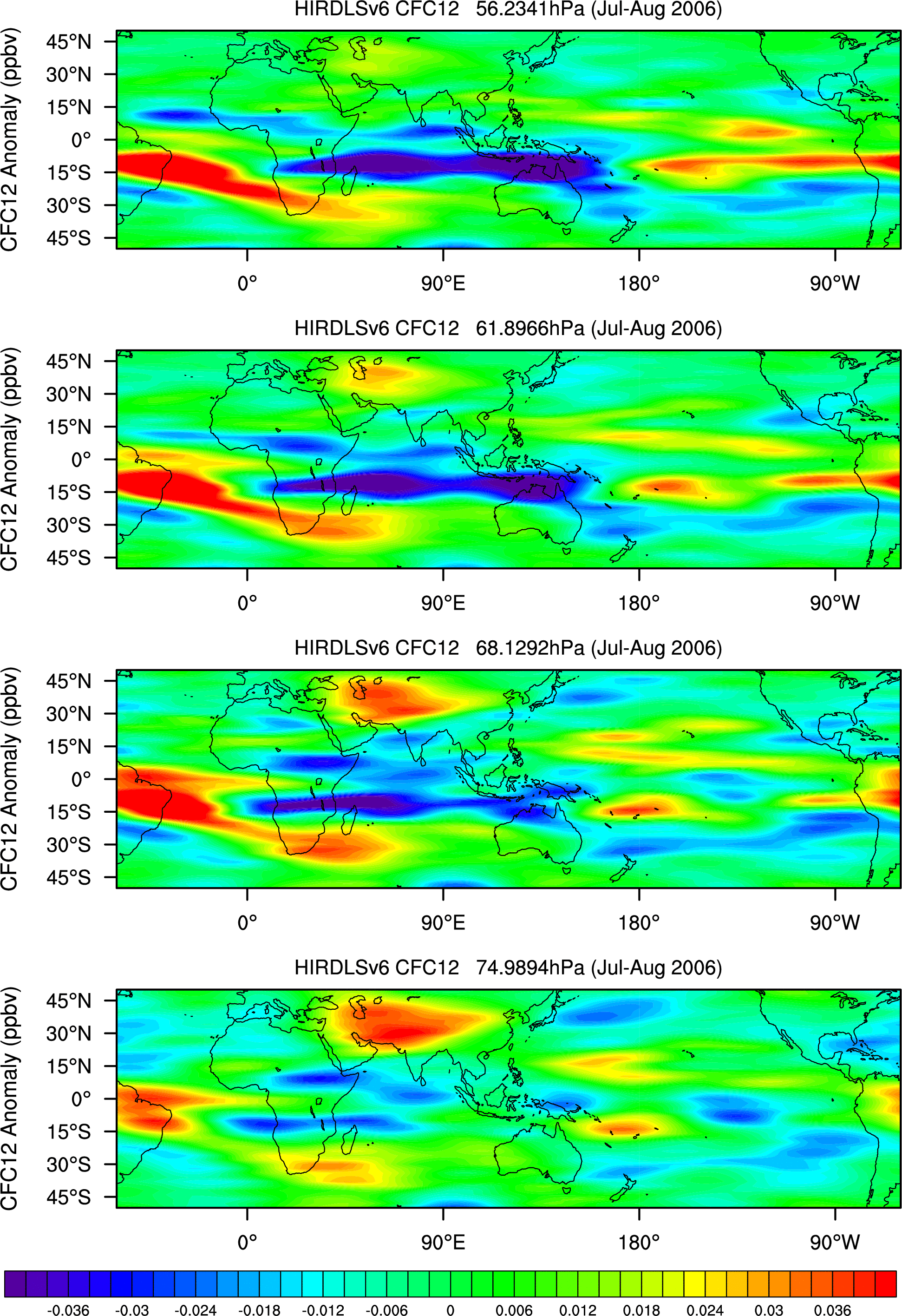
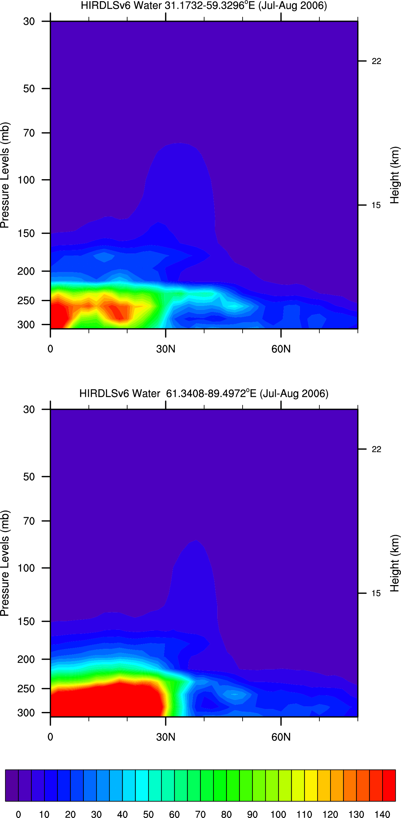
- Cross-sections of HIRDLS V.6 (30-60E) and (60-90E) for July-August mean:
- GPH: '05, '06, '07, GPH Anomalies: '05, '06, '07
- Temperature:
'05, '06, '07, Temperature Anomalies: '05, '06, '07
- Ozone:
'05, '06, '07, Ozone Anomalies: '05, '06, '07
- CFC11:
'05, '06, '07, CFC11 Anomalies: '05, '06, '07
- CFC12:
'05, '06, '07, CFC12 Anomalies:'05, '06, '07
- water:
'05, '06, '07, water anomalies:'05, '06, '07
- Daily Cross-sections of HIRDLS V.6 Temperature, Ozone, CFC12 Anomalies for (30-60E) and (60-90E):
- 2005: July1: 1 day, 5 day running average,
10 day running average
- 2005: July15: 1 day, 5 day running average,
10 day running average
- 2005: Aug1: 1 day, 5 day running average,
10 day running average
- 2005: Aug15: 1 day, 5 day running average,
10 day running average
- 2005: Aug31: 1 day, 5 day running average,
10 day running average
- 2006: July1: 1 day, 5 day running average,
10 day running average
- 2006: July15: 1 day, 5 day running average,
10 day running average
- 2006: Aug1: 1 day, 5 day running average,
10 day running average
- 2006: Aug15: 1 day, 5 day running average,
10 day running average
- 2006: Aug31: 1 day, 5 day running average,
10 day running average
- 2007: July1: 1 day, 5 day running average,
10 day running average
- 2007: July15: 1 day, 5 day running average,
10 day running average
- 2007: Aug1: 1 day, 5 day running average,
10 day running average
- 2007: Aug15: 1 day, 5 day running average,
10 day running average
- 2007: Aug31: 1 day, 5 day running average,
10 day running average
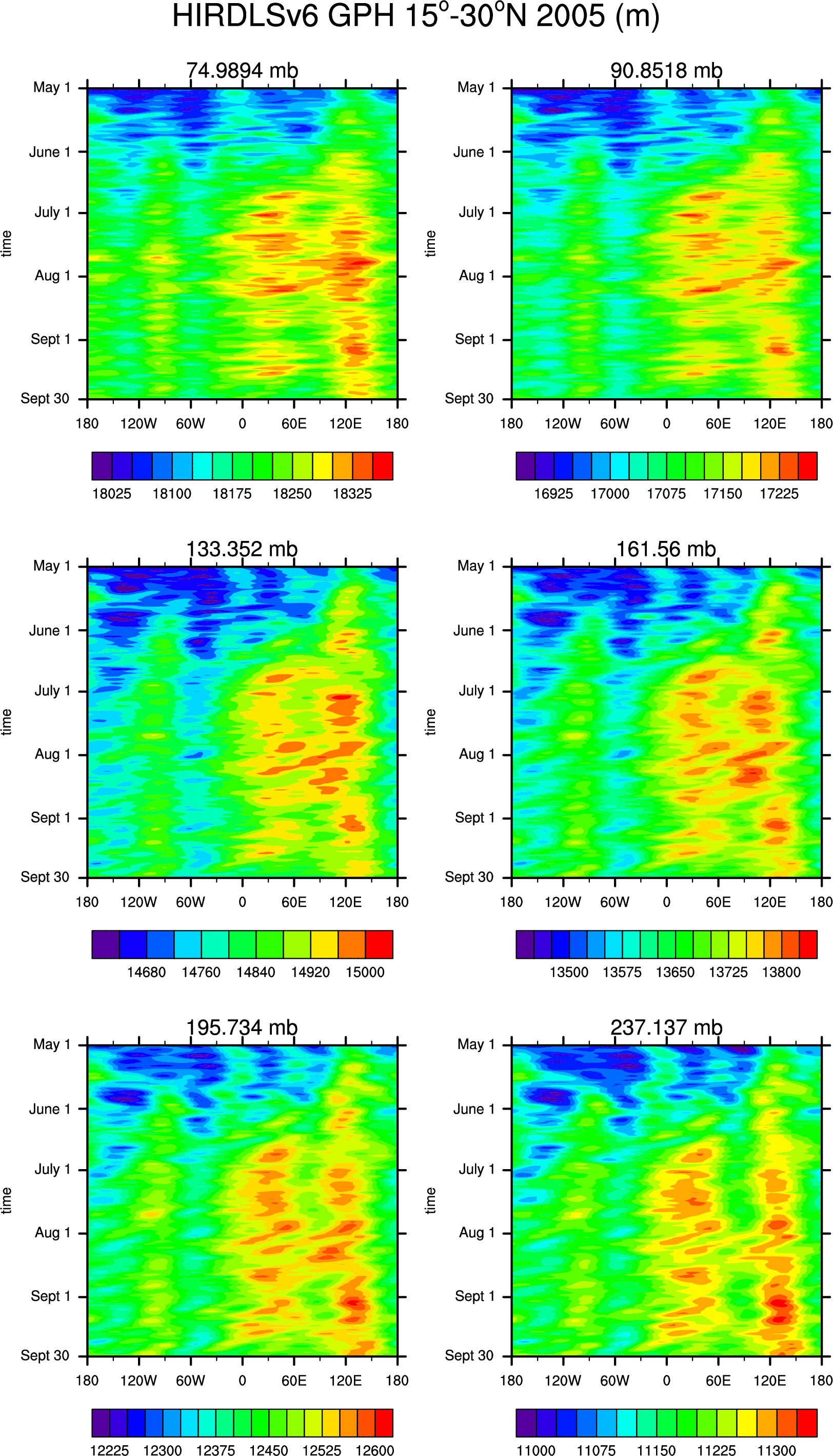
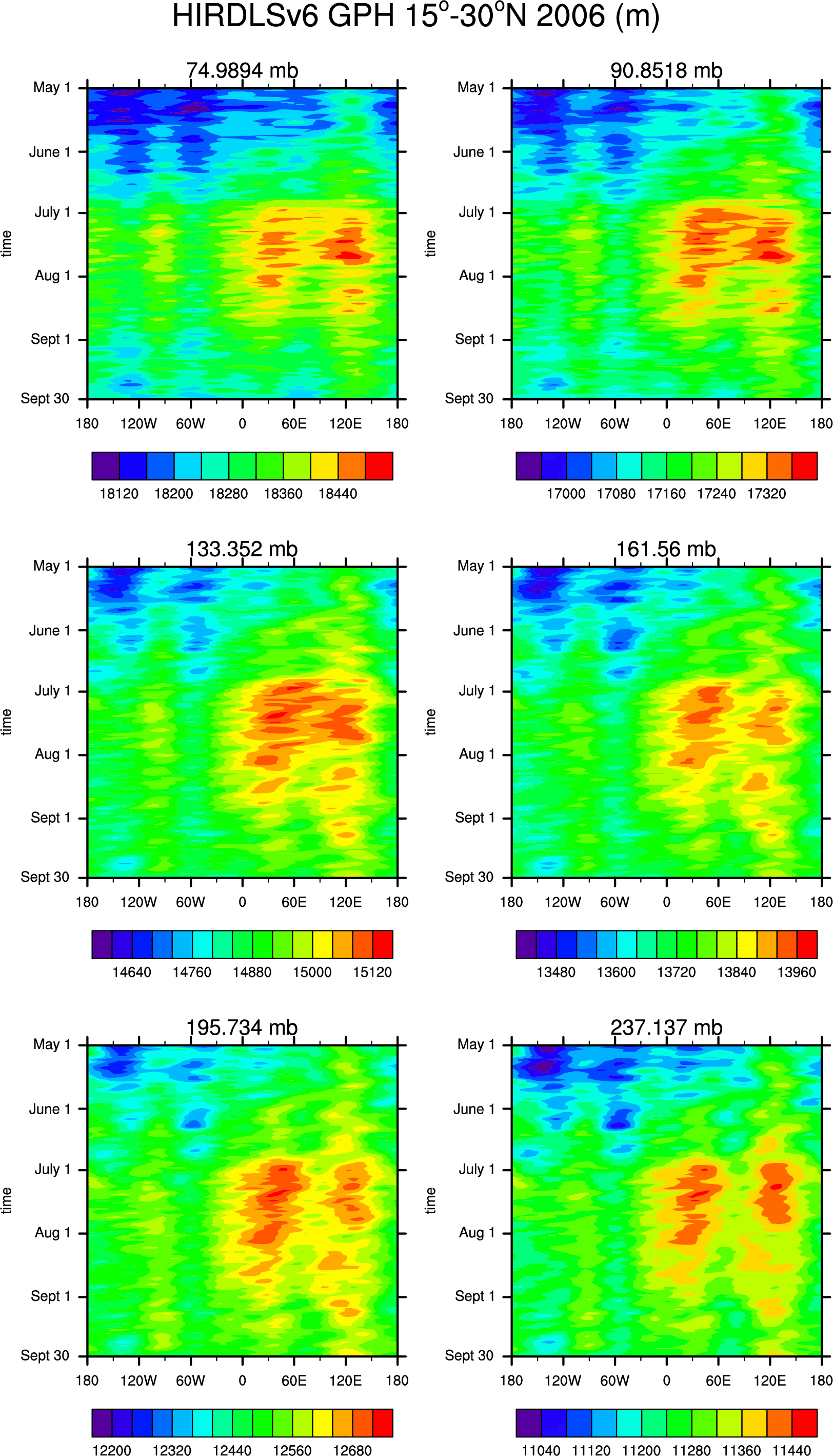
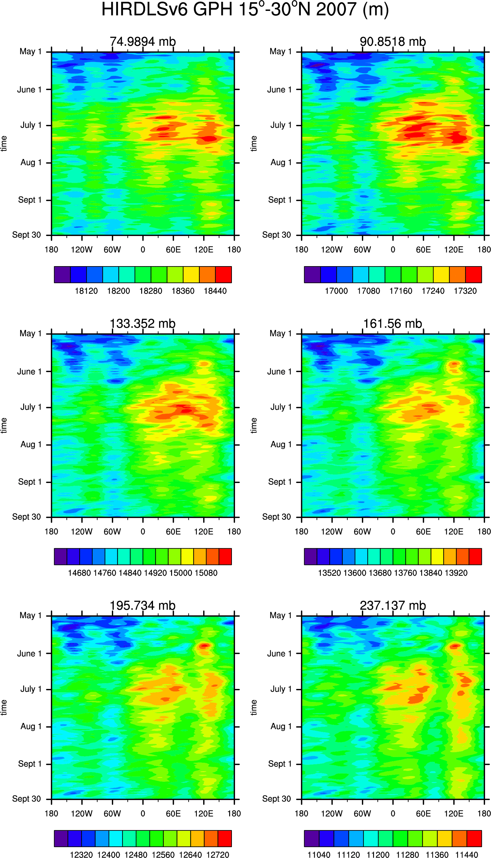
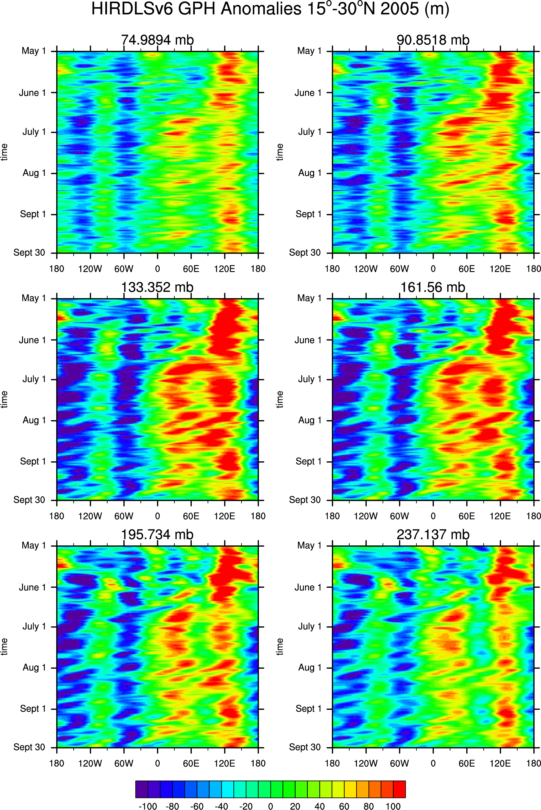
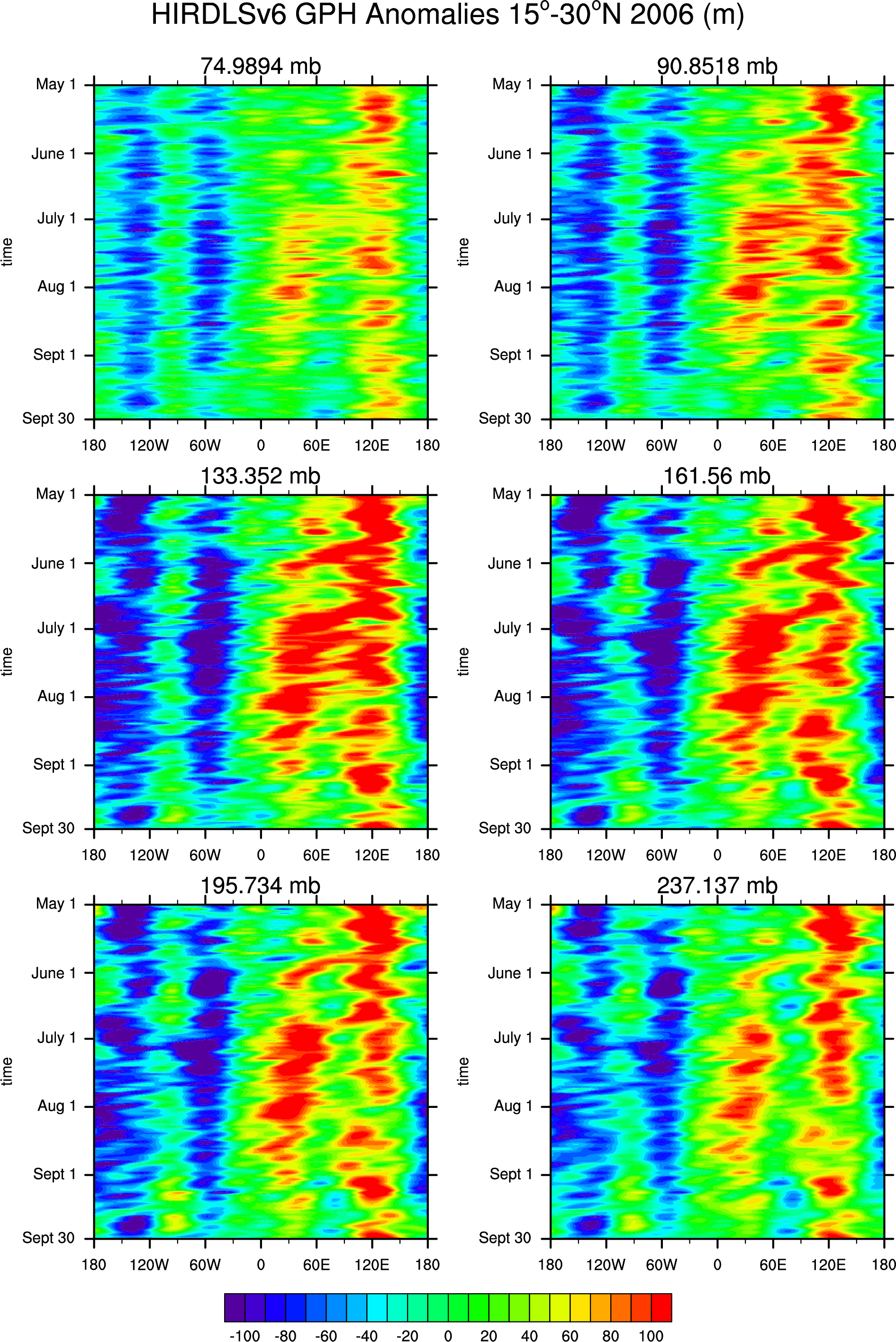
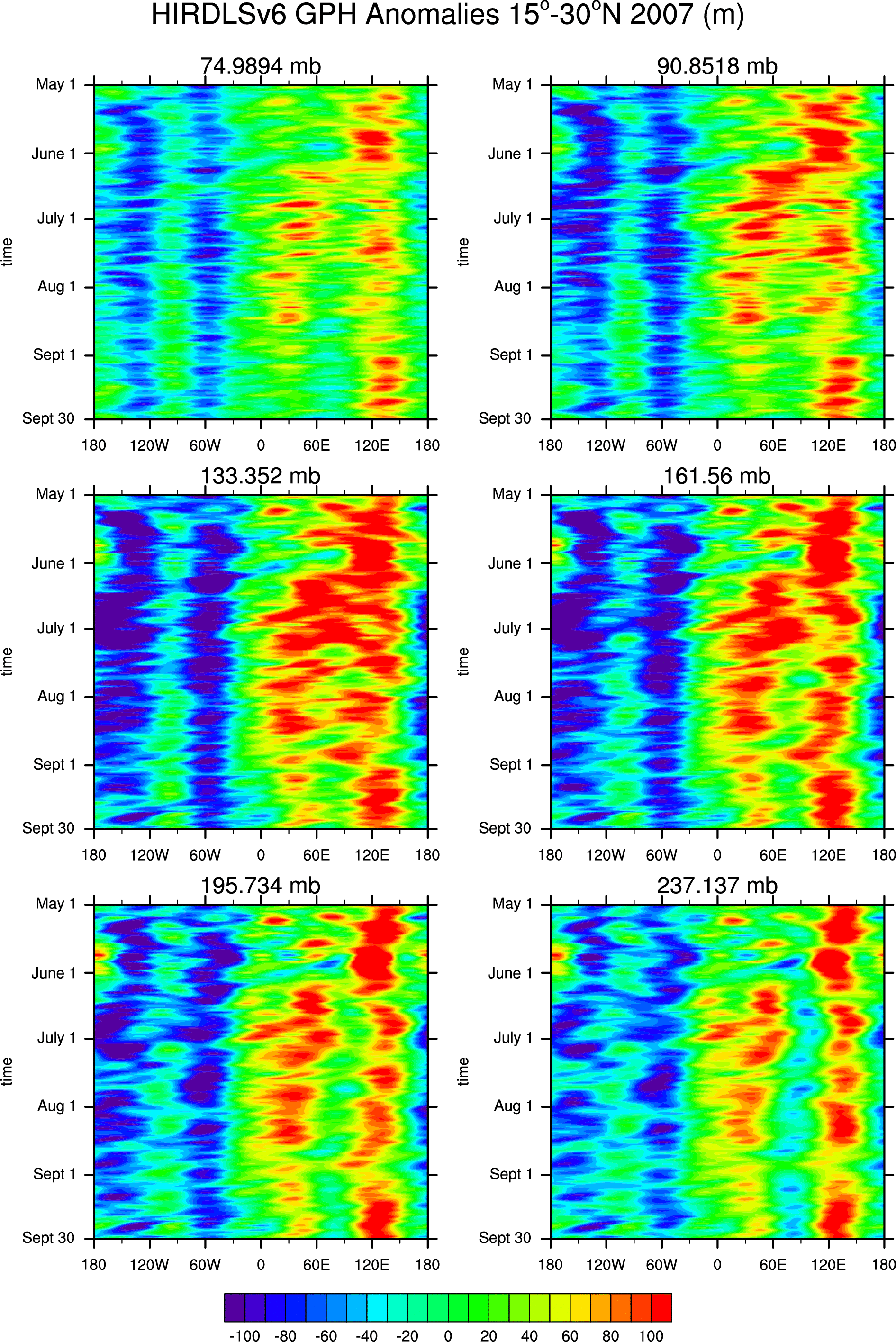
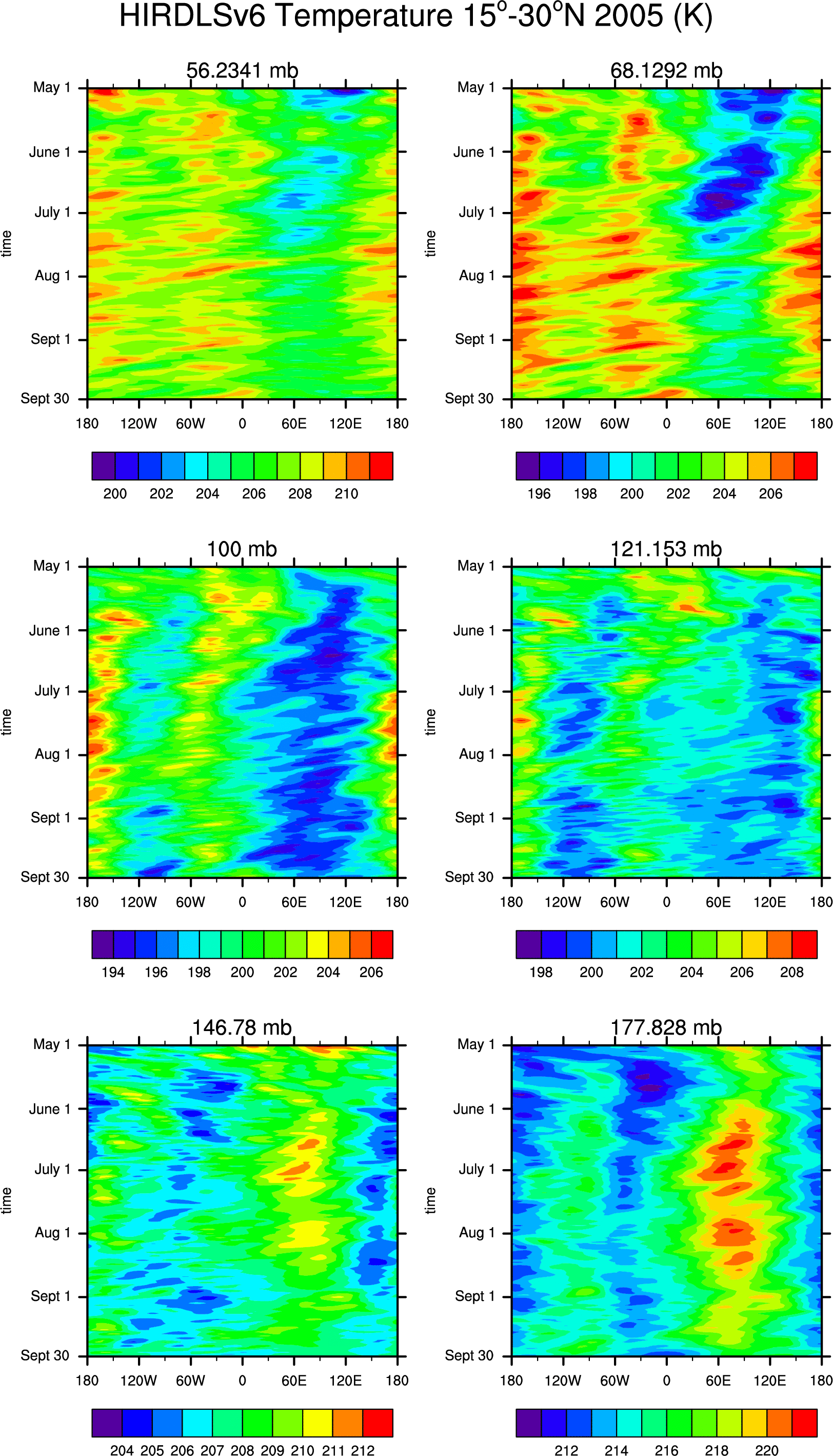
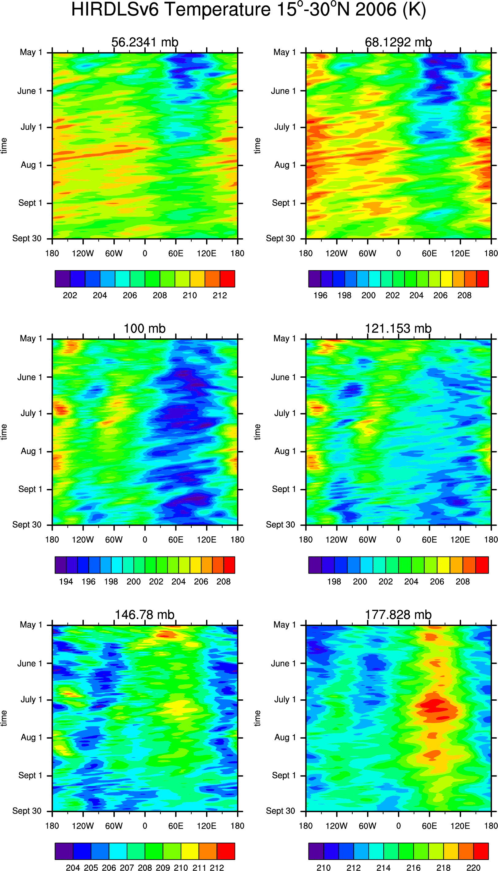
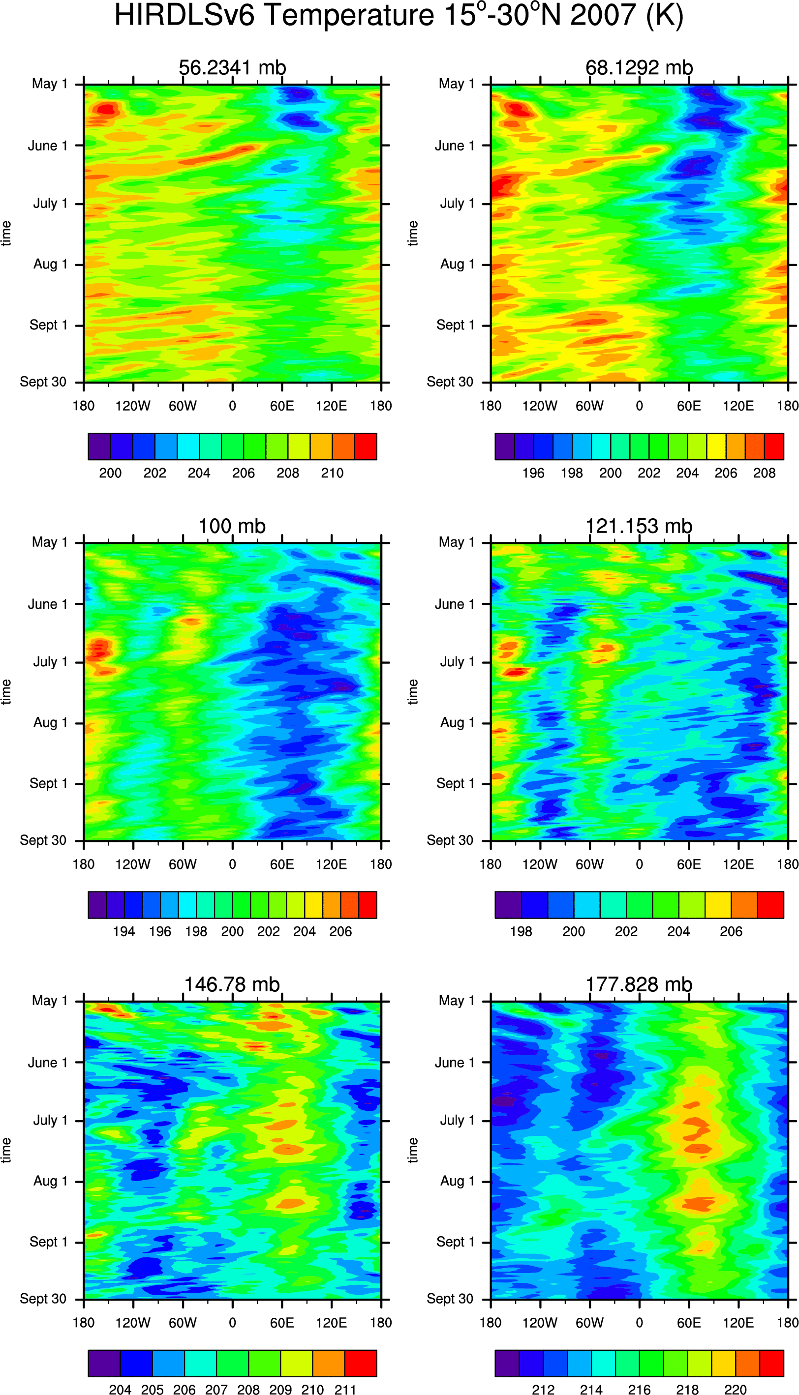
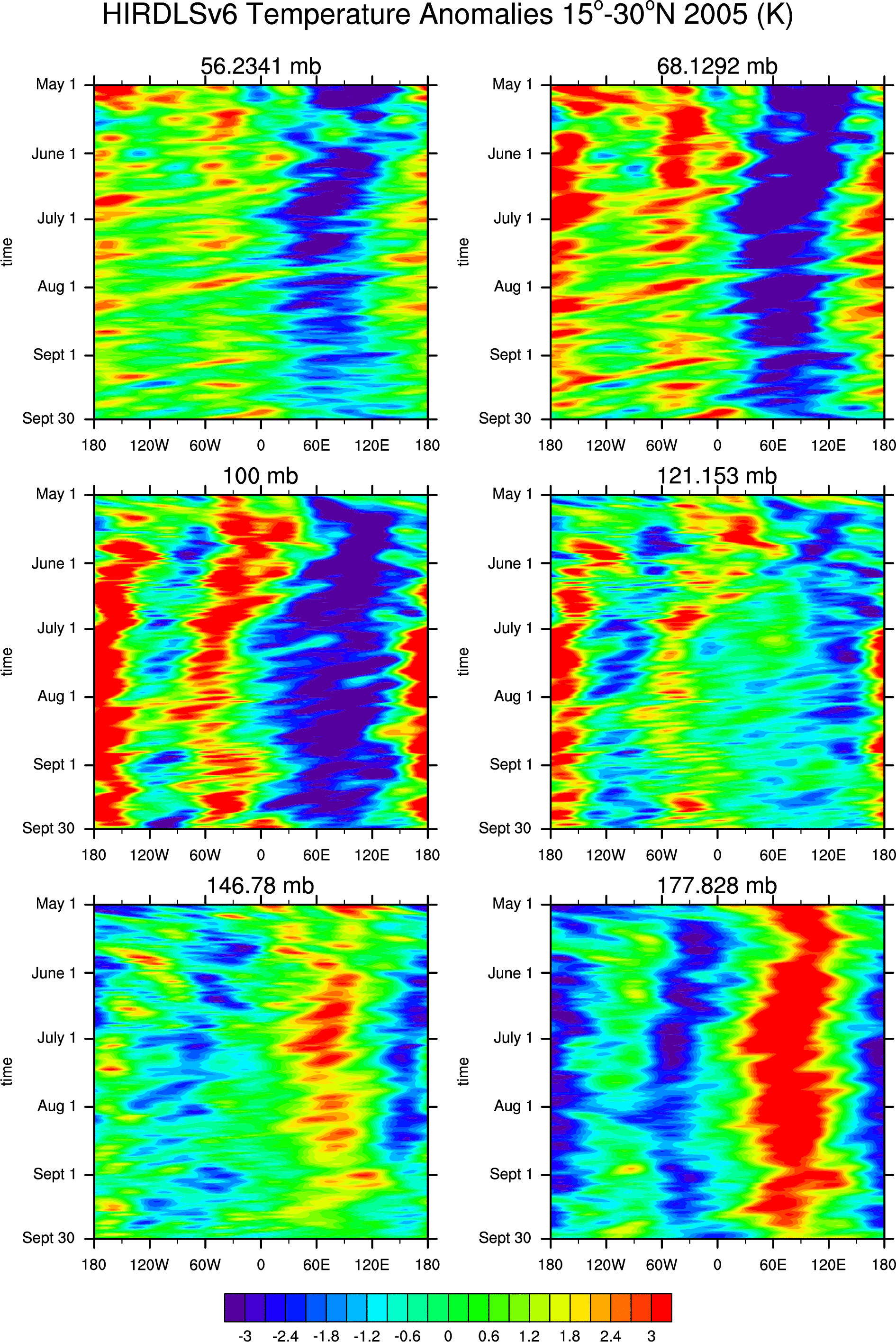
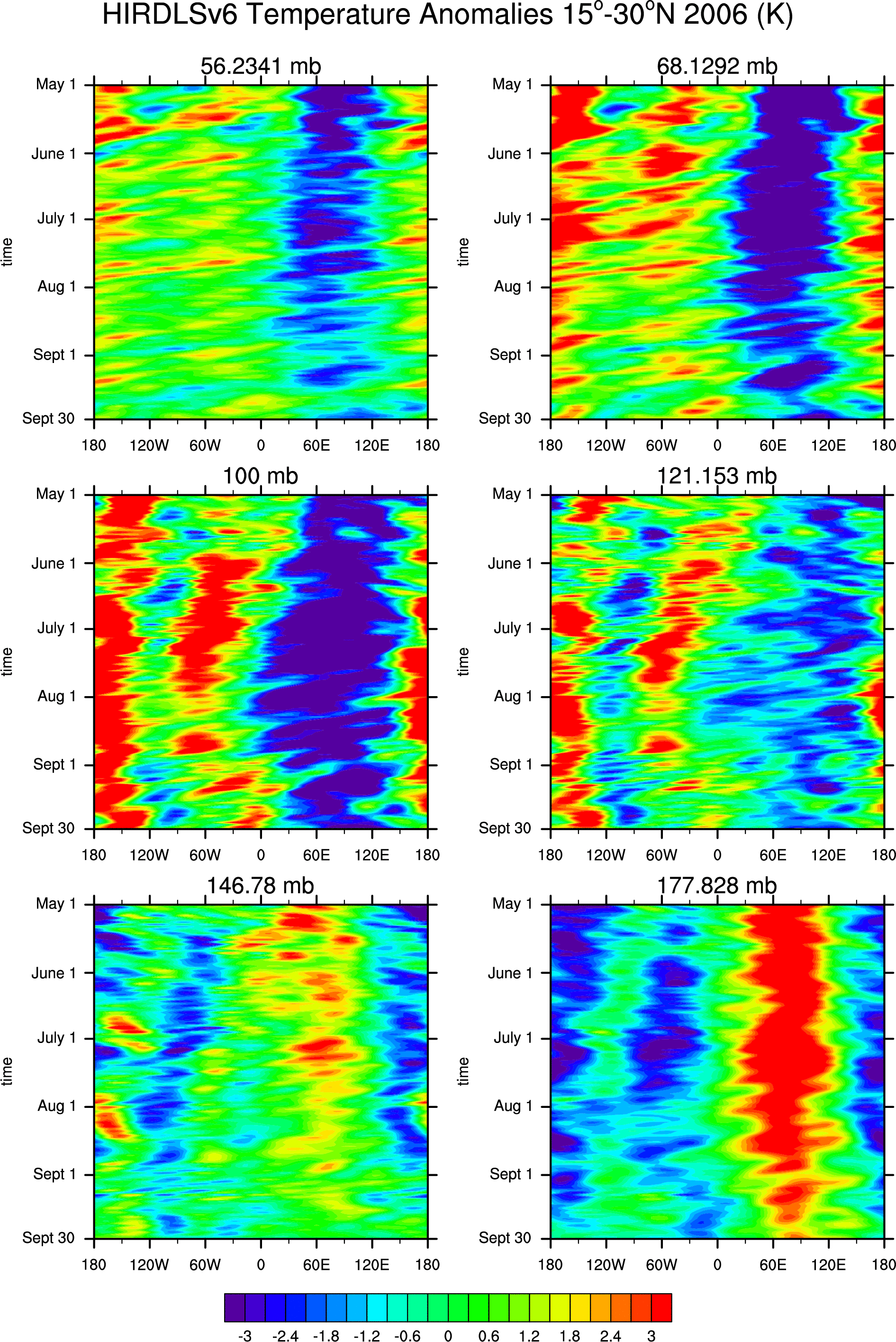
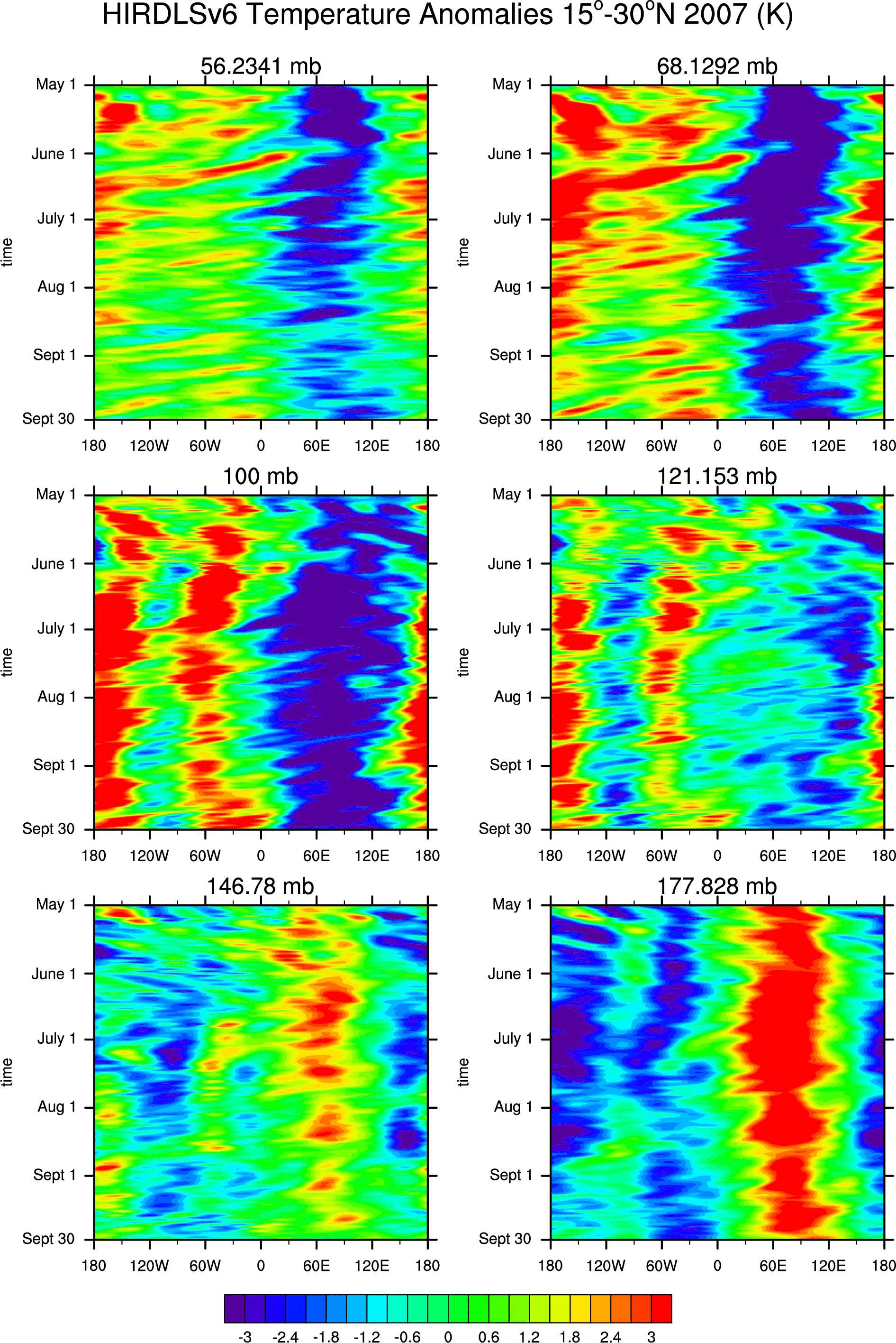
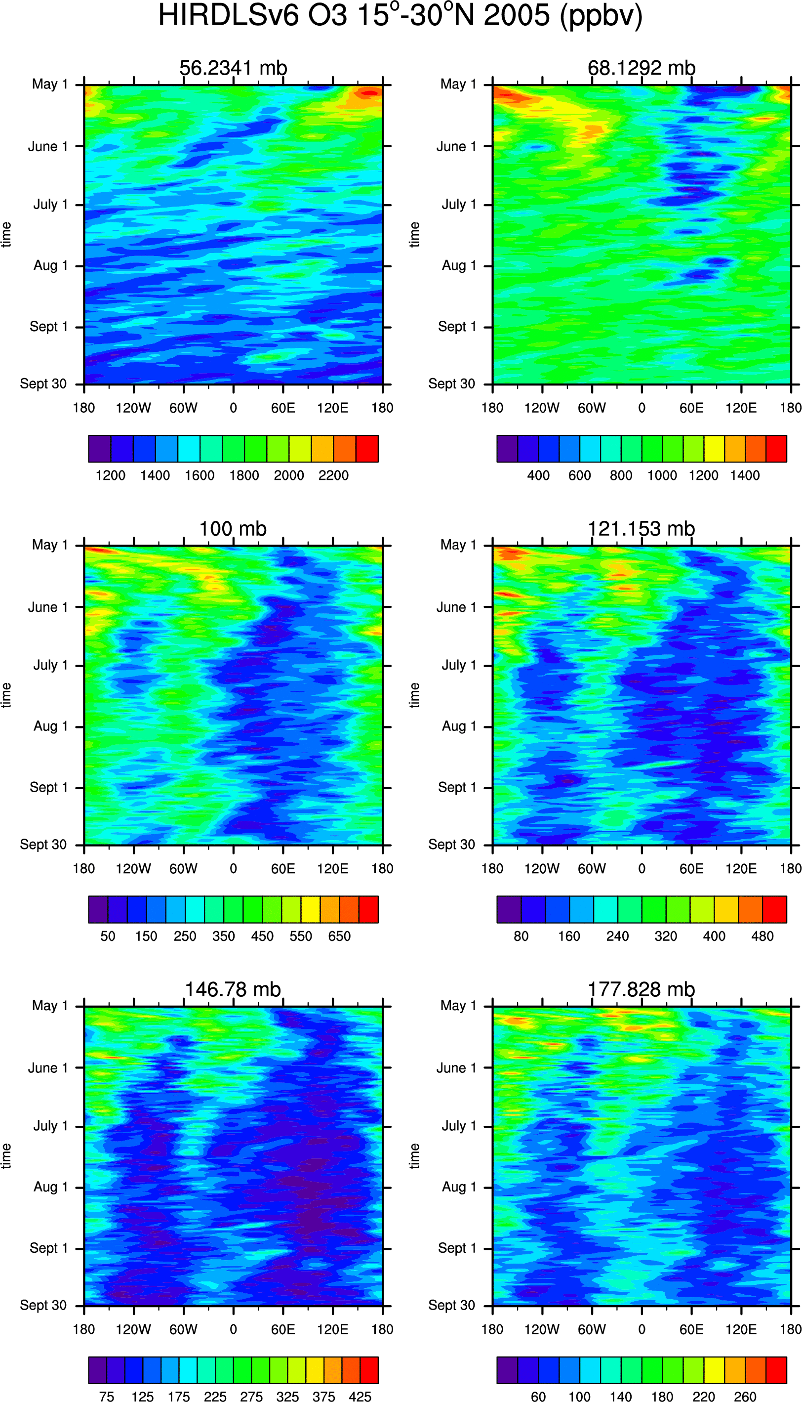
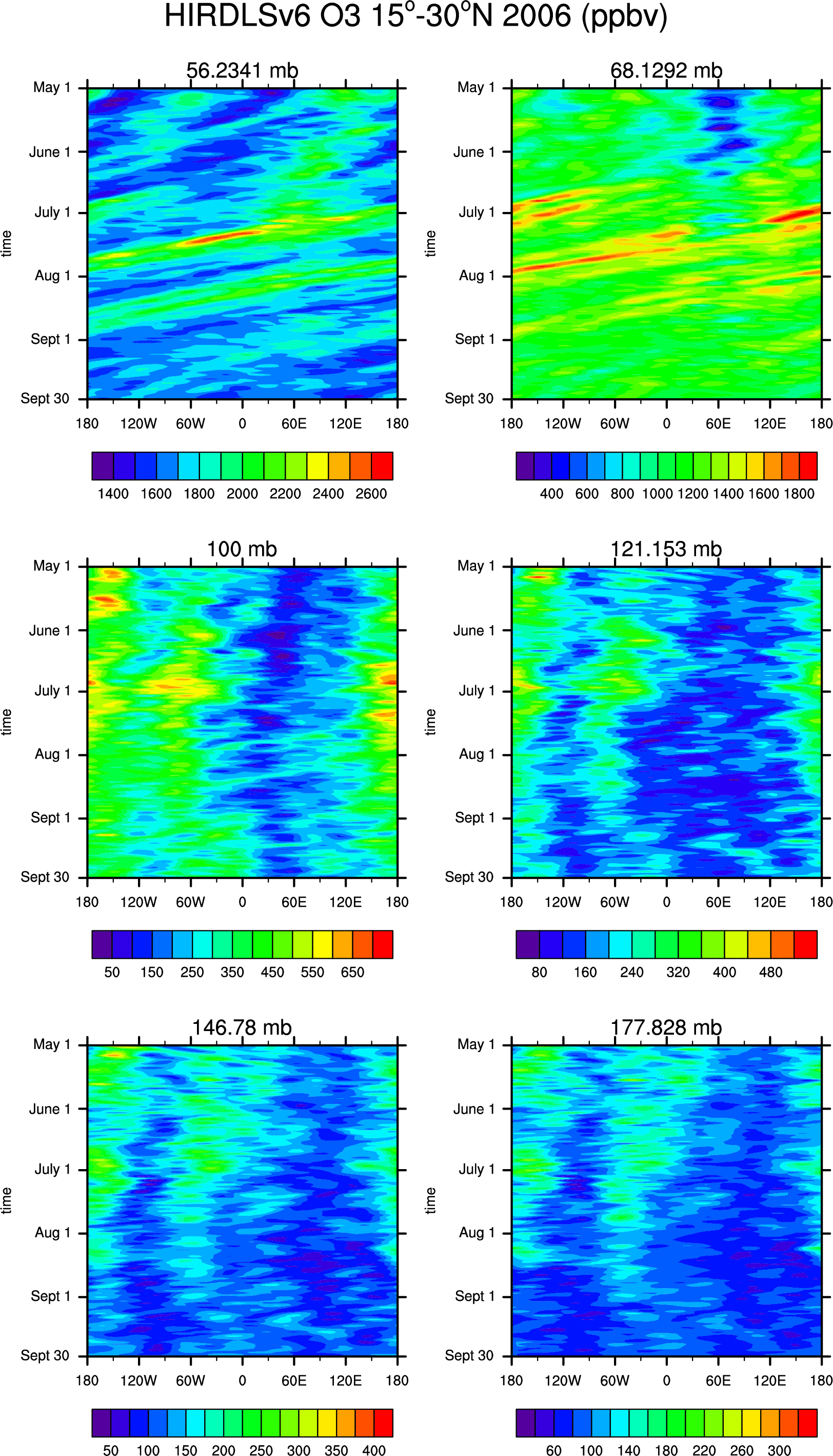
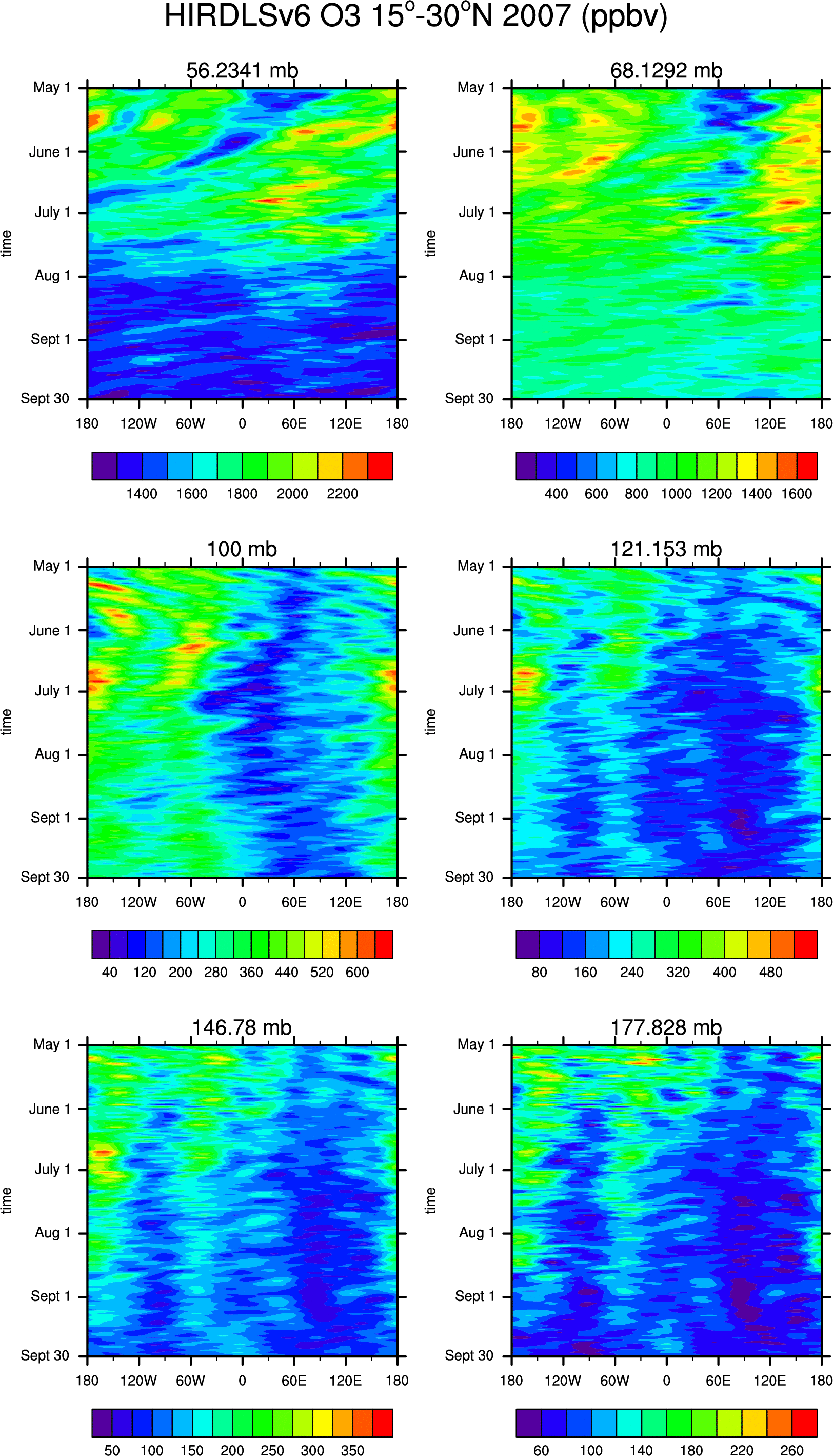
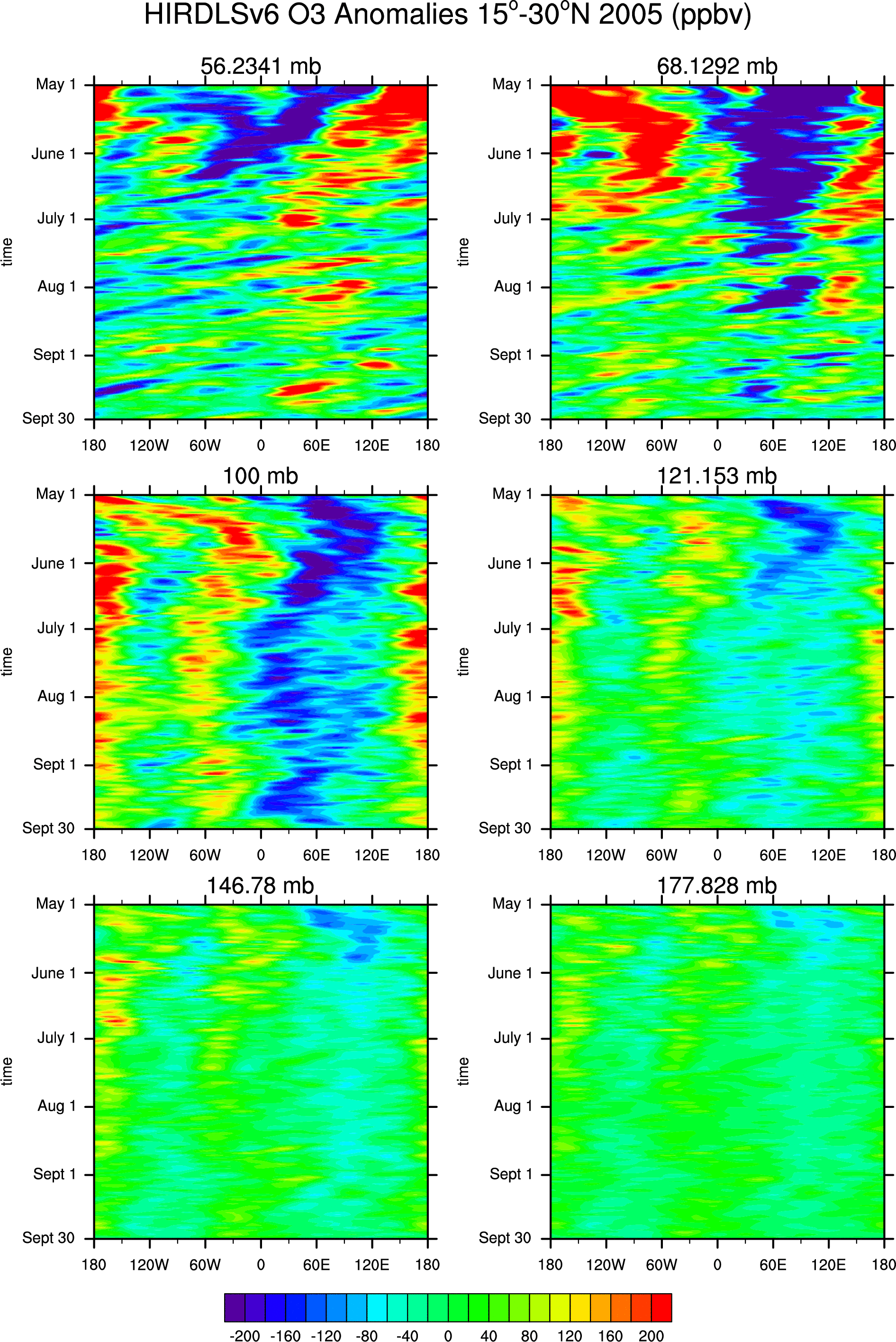
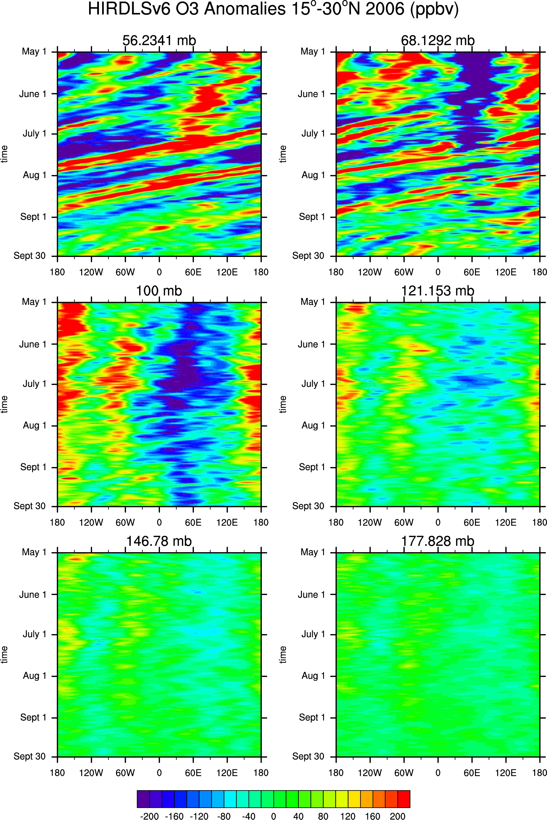
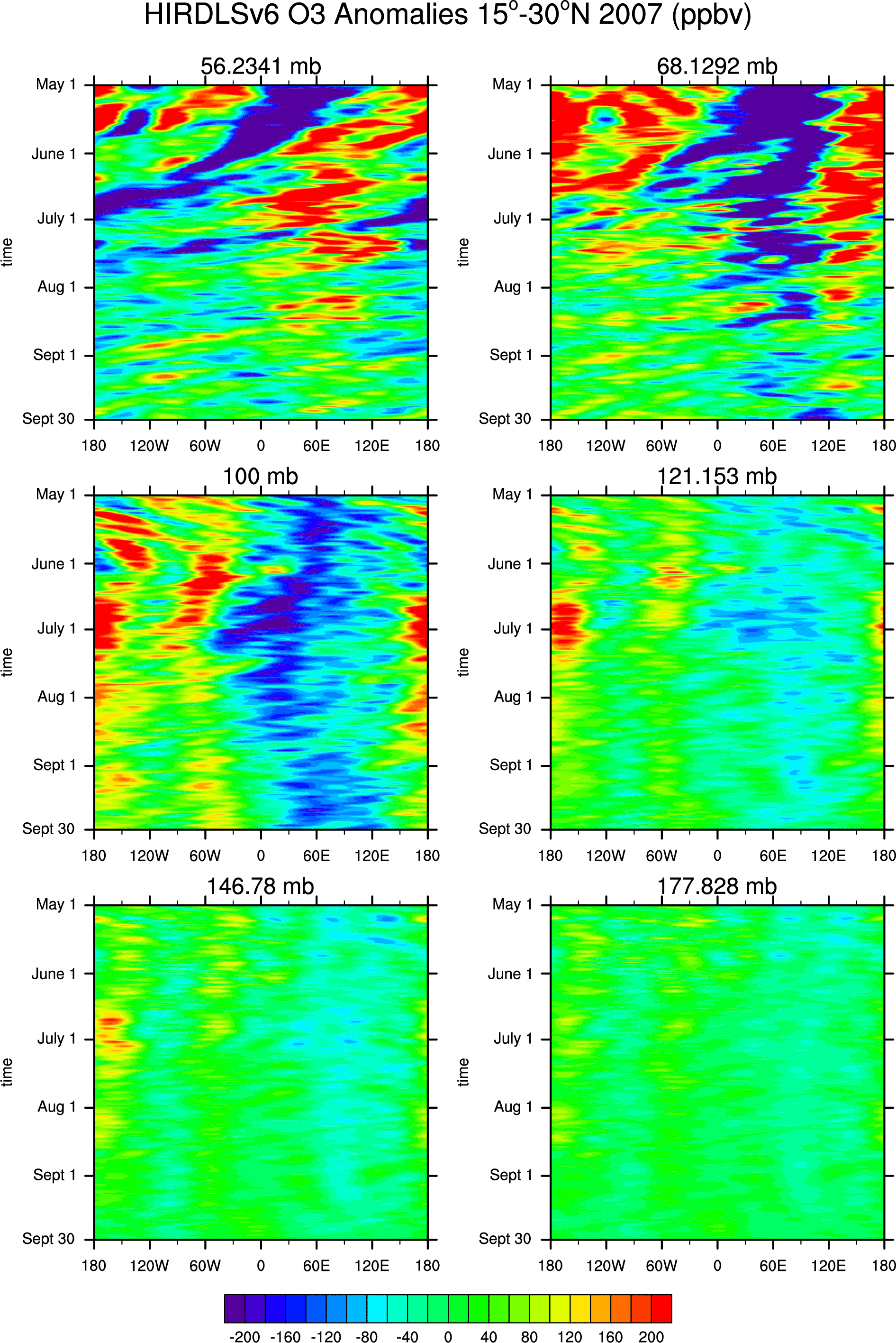
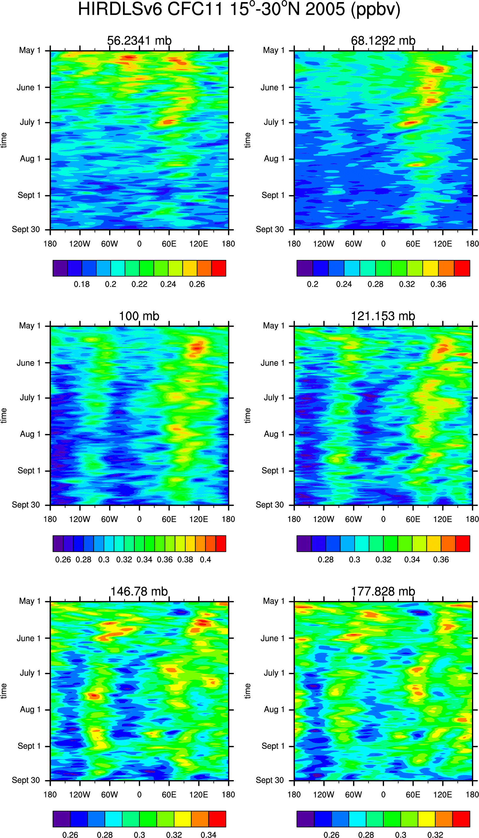
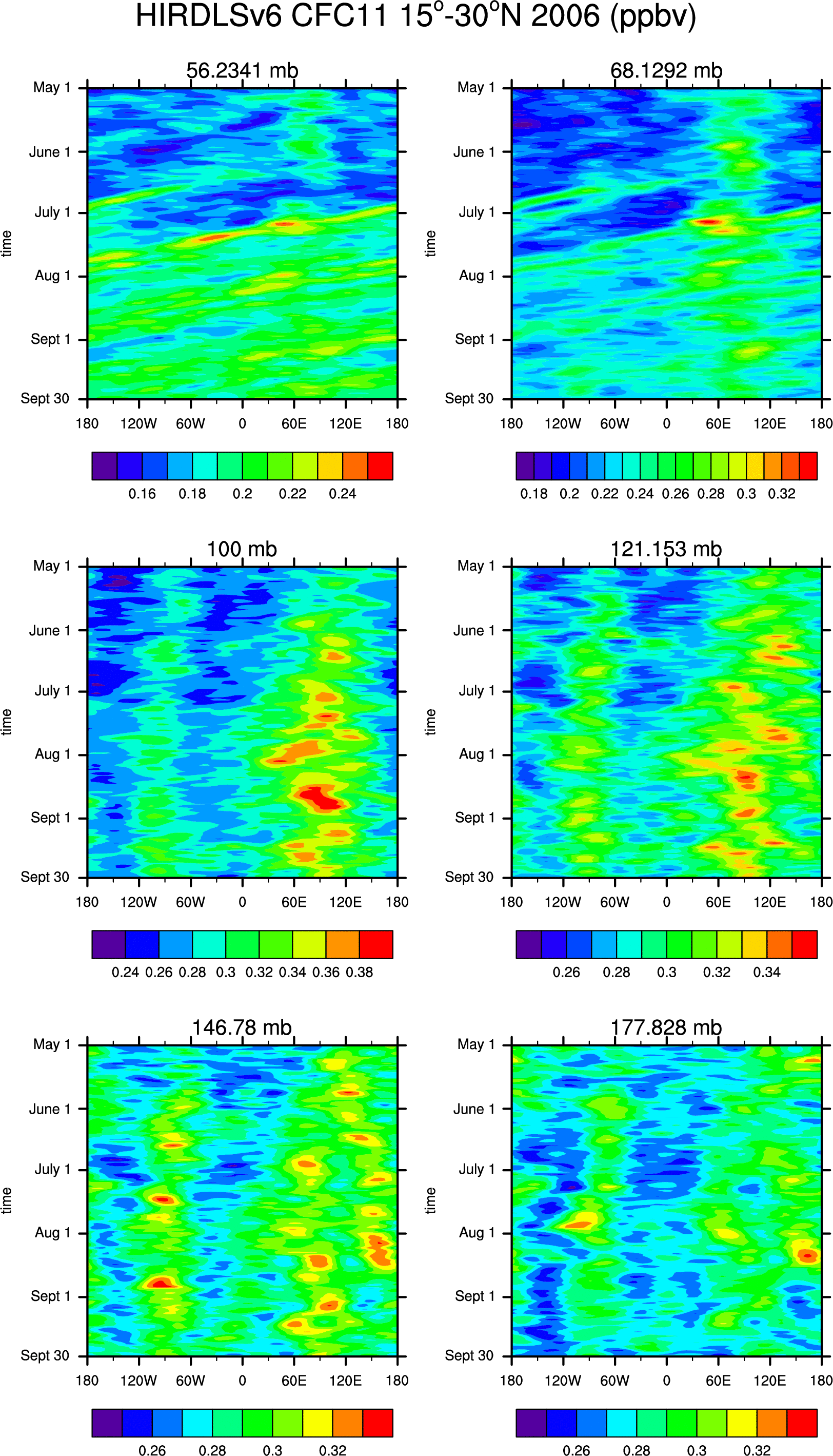
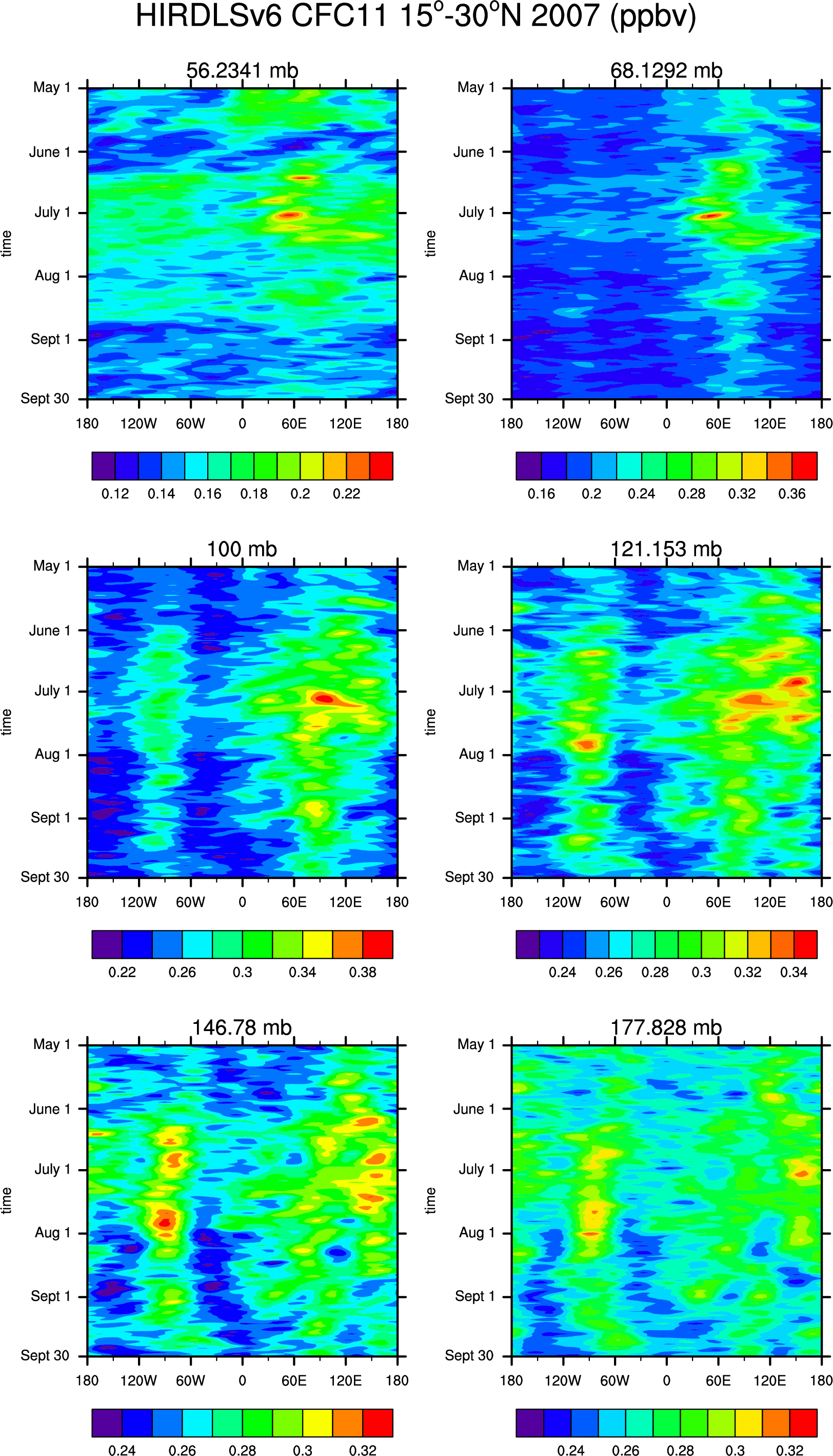
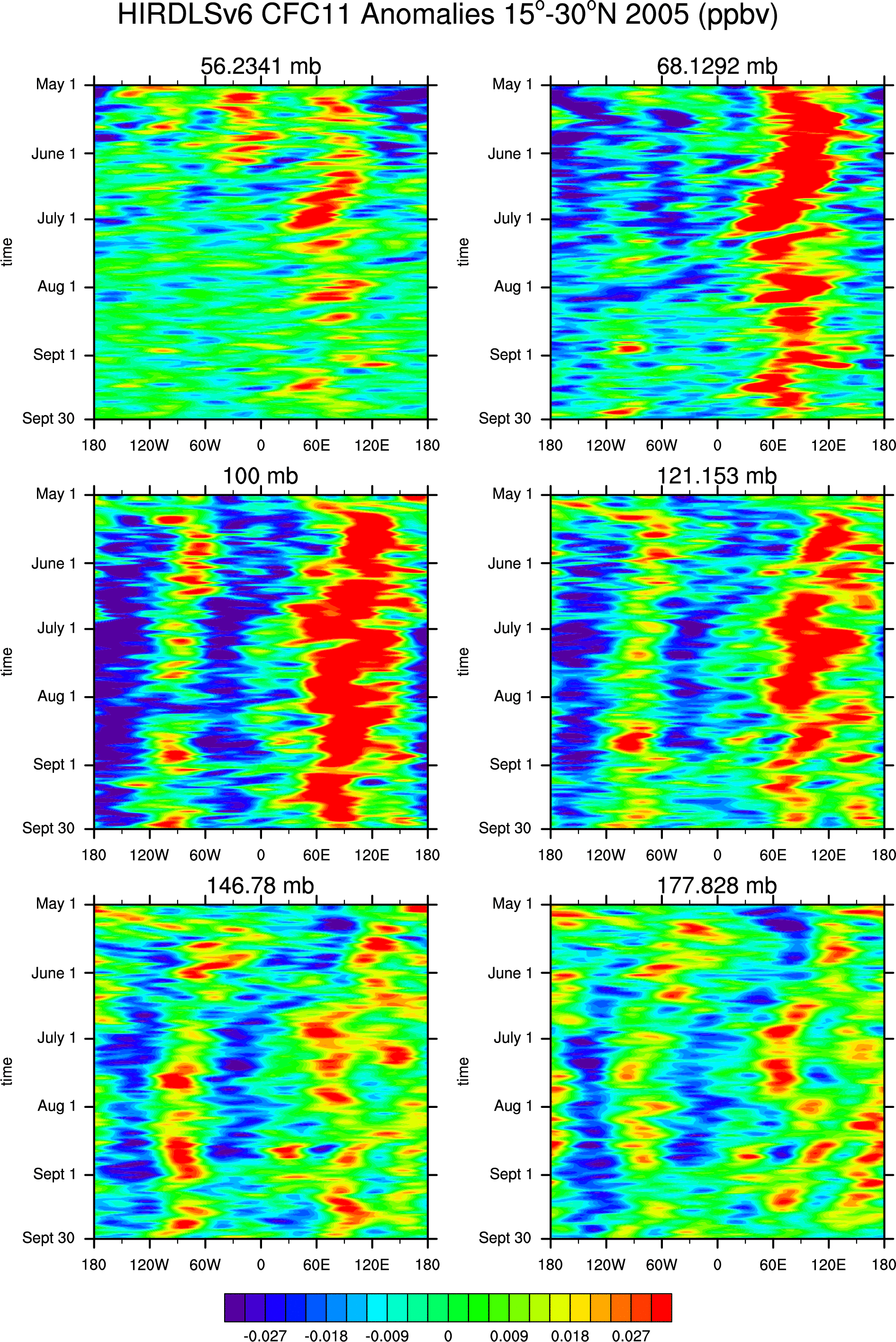
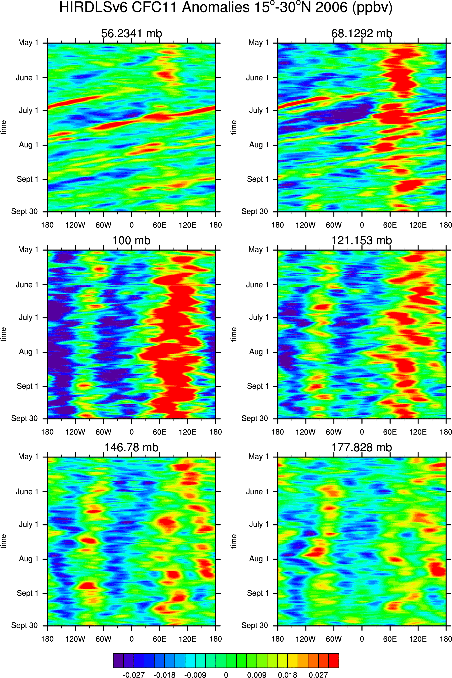
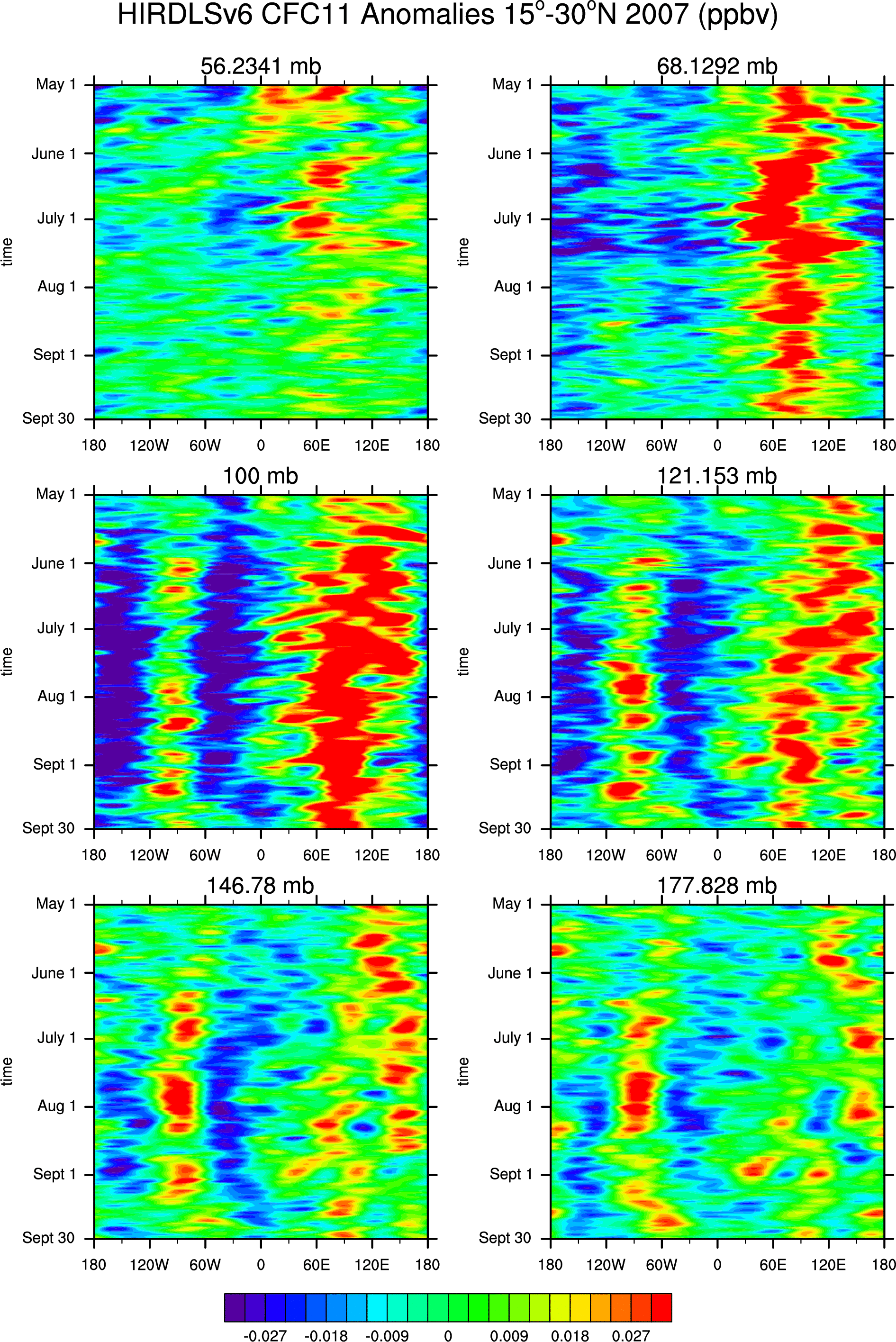
- Hovmoller diagrams of HIRDLS V.6 (15-30N) for May 1 -- September 30:
- GPH: '05, '06, '07, GPH Anomalies: '05, '06, '07
- Temperature:
'05, '06, '07, Temperature Anomalies: '05, '06, '07
- Ozone:
'05, '06, '07, Ozone Anomalies: '05, '06, '07
- CFC11:
'05, '06, '07, CFC11 Anomalies: '05, '06, '07
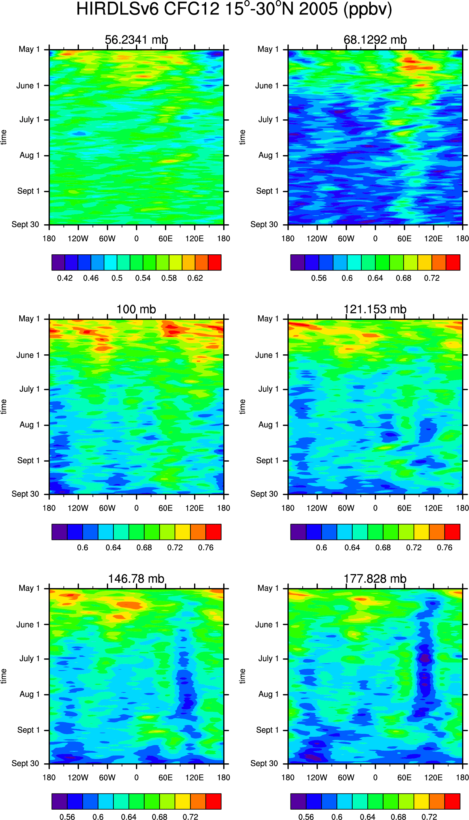
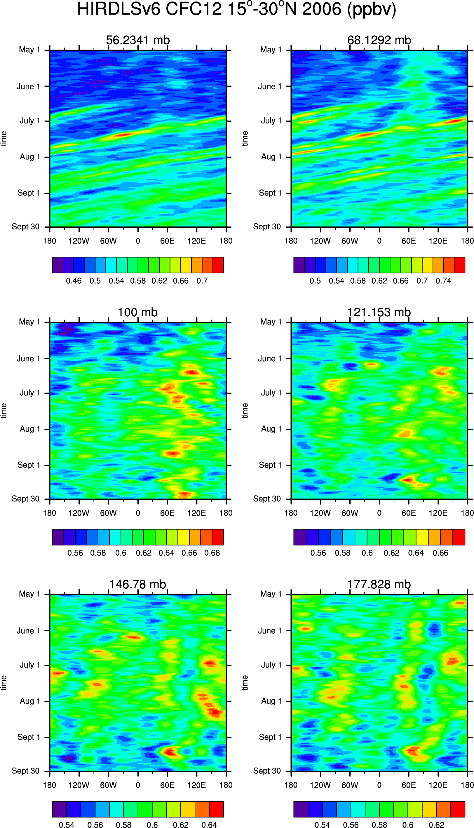
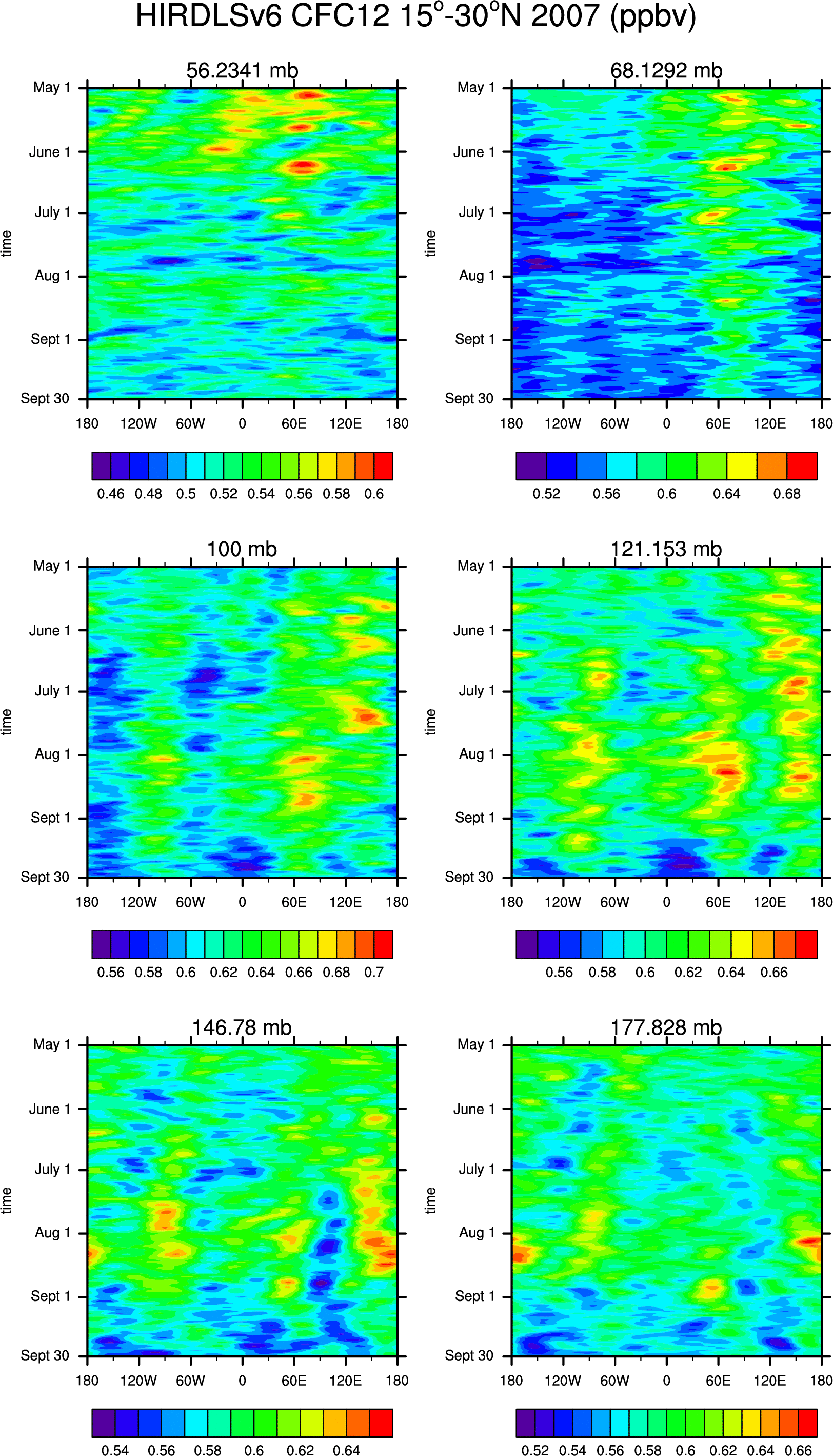
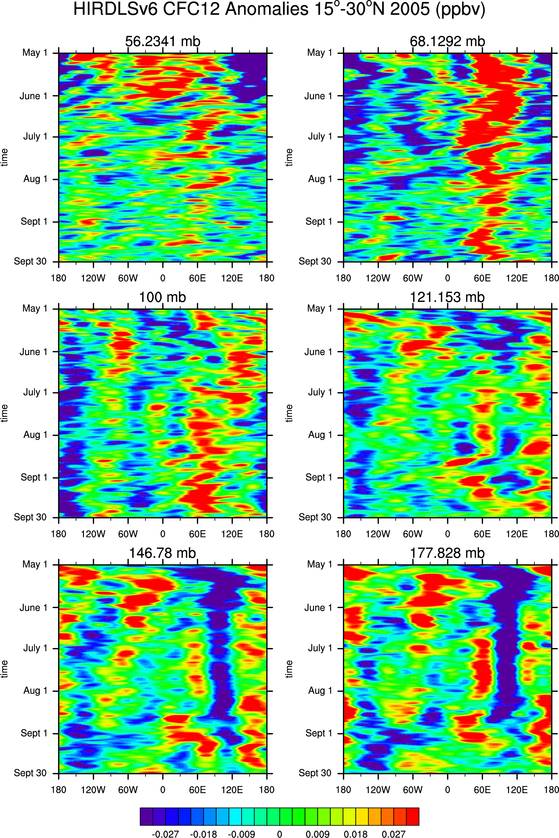
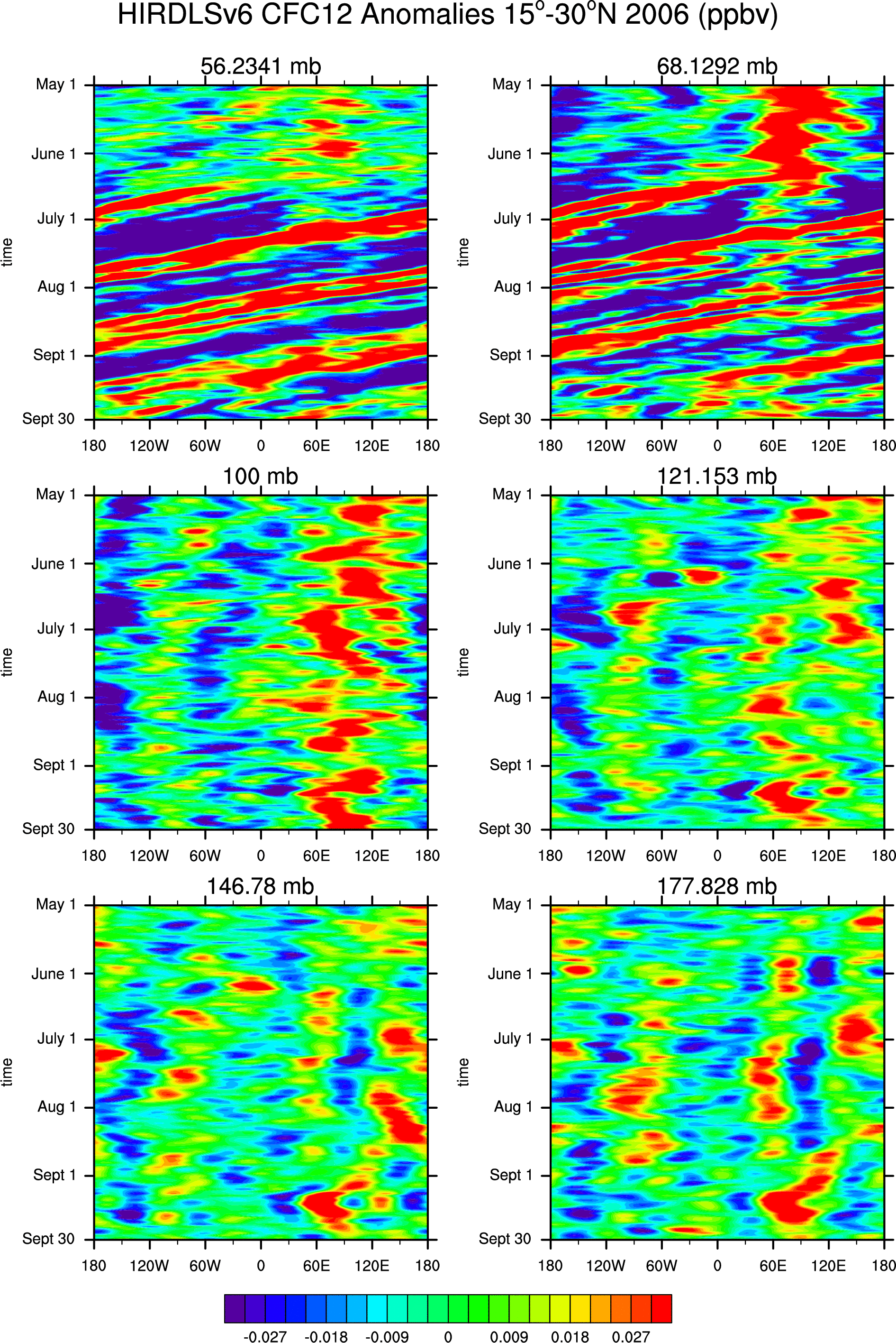
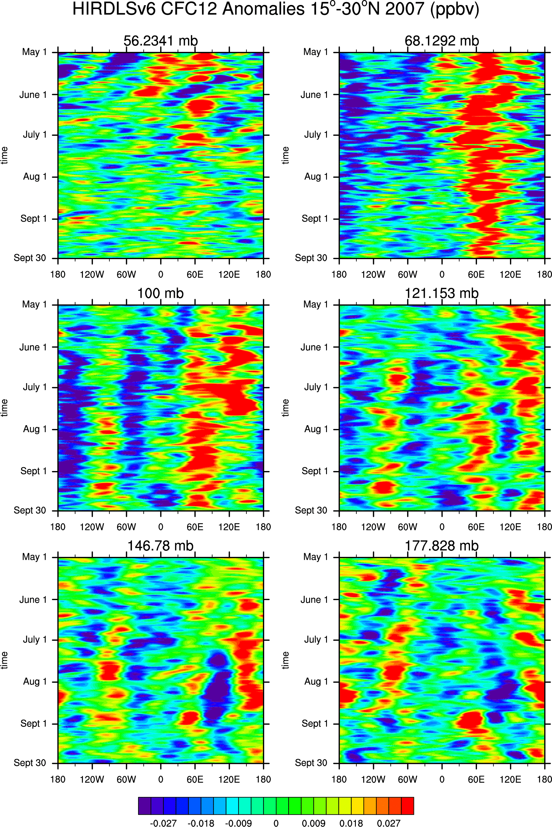
- CFC12:
'05, '06, '07, CFC12 Anomalies: '05, '06, '07
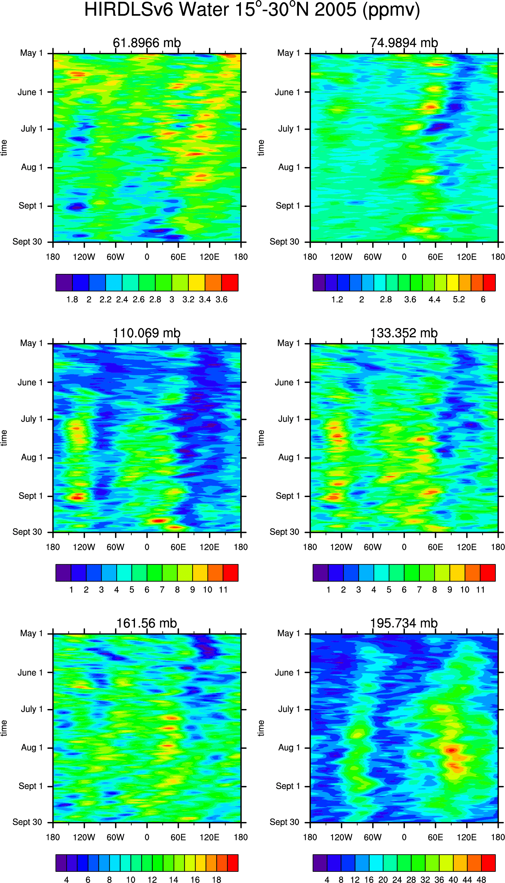
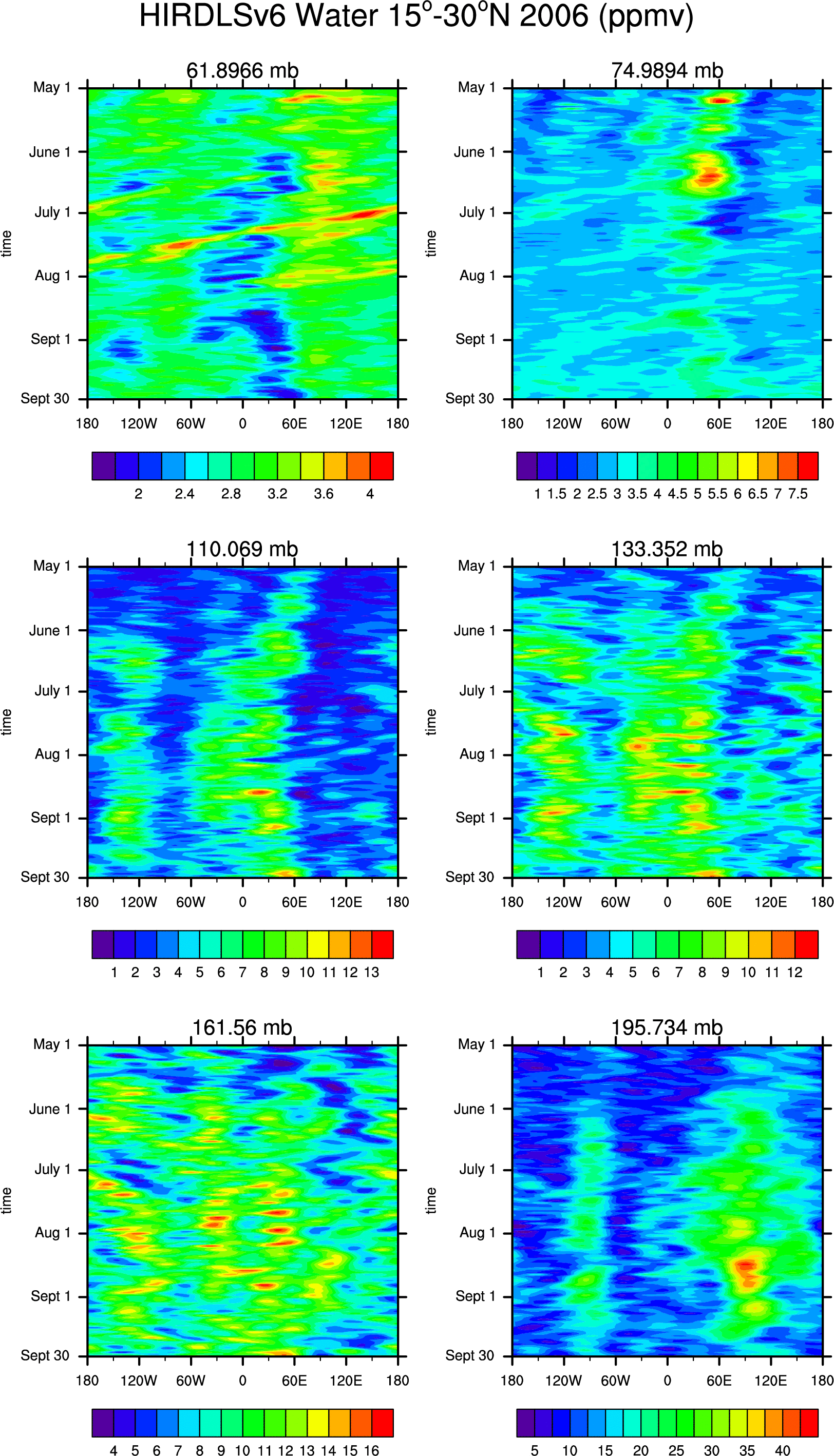
- water:
'05, '06, '07, water anomalies: '05, '06, '07
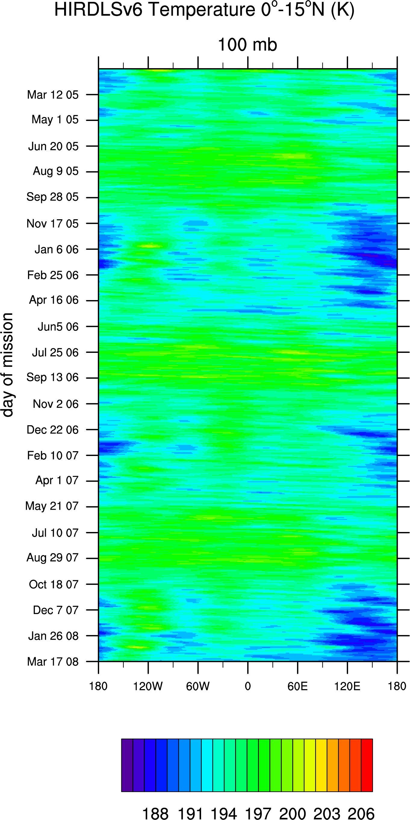
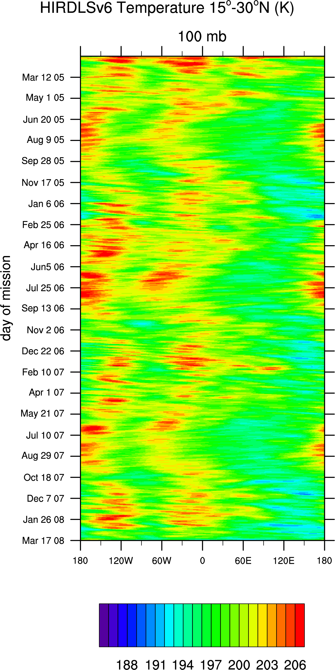
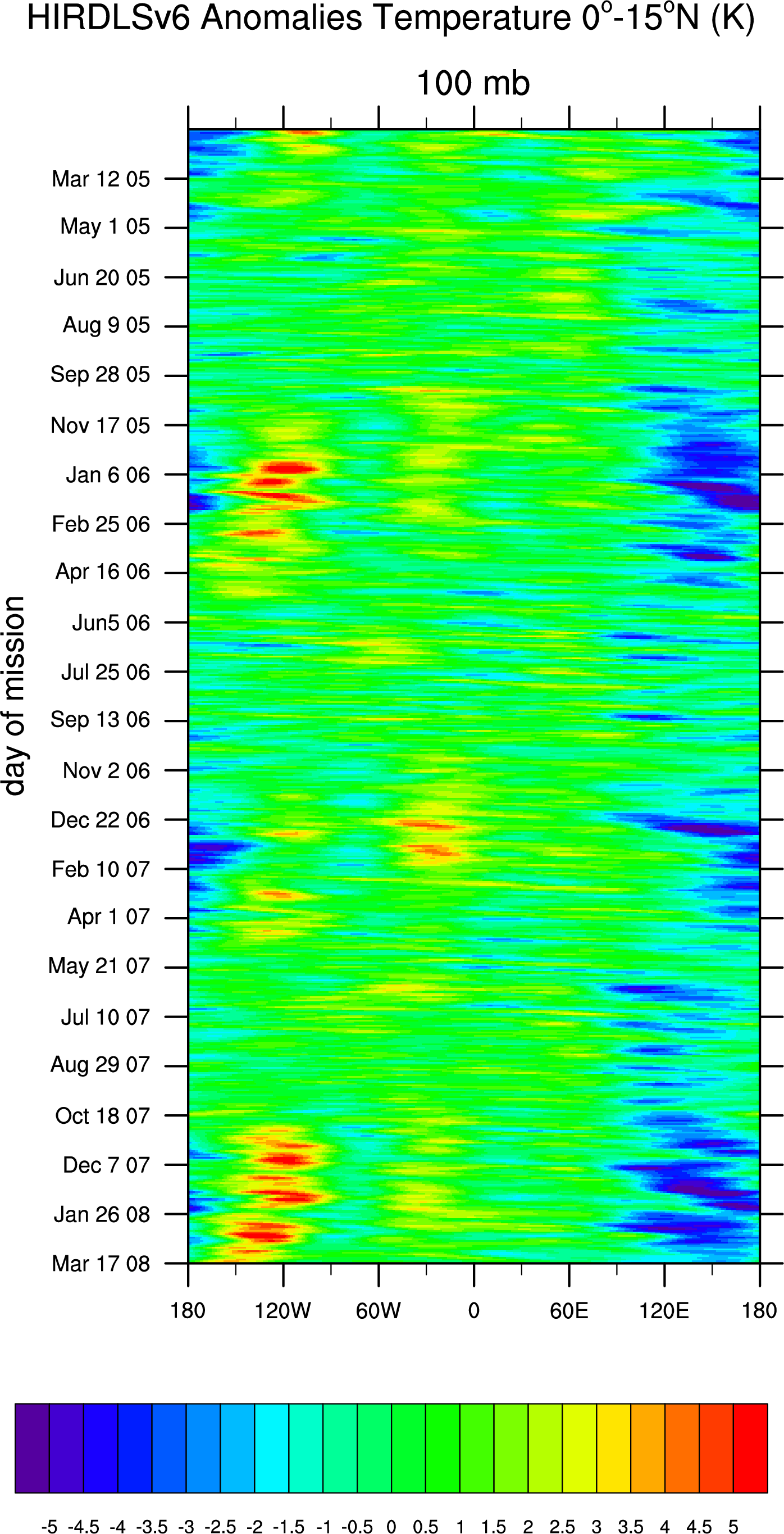
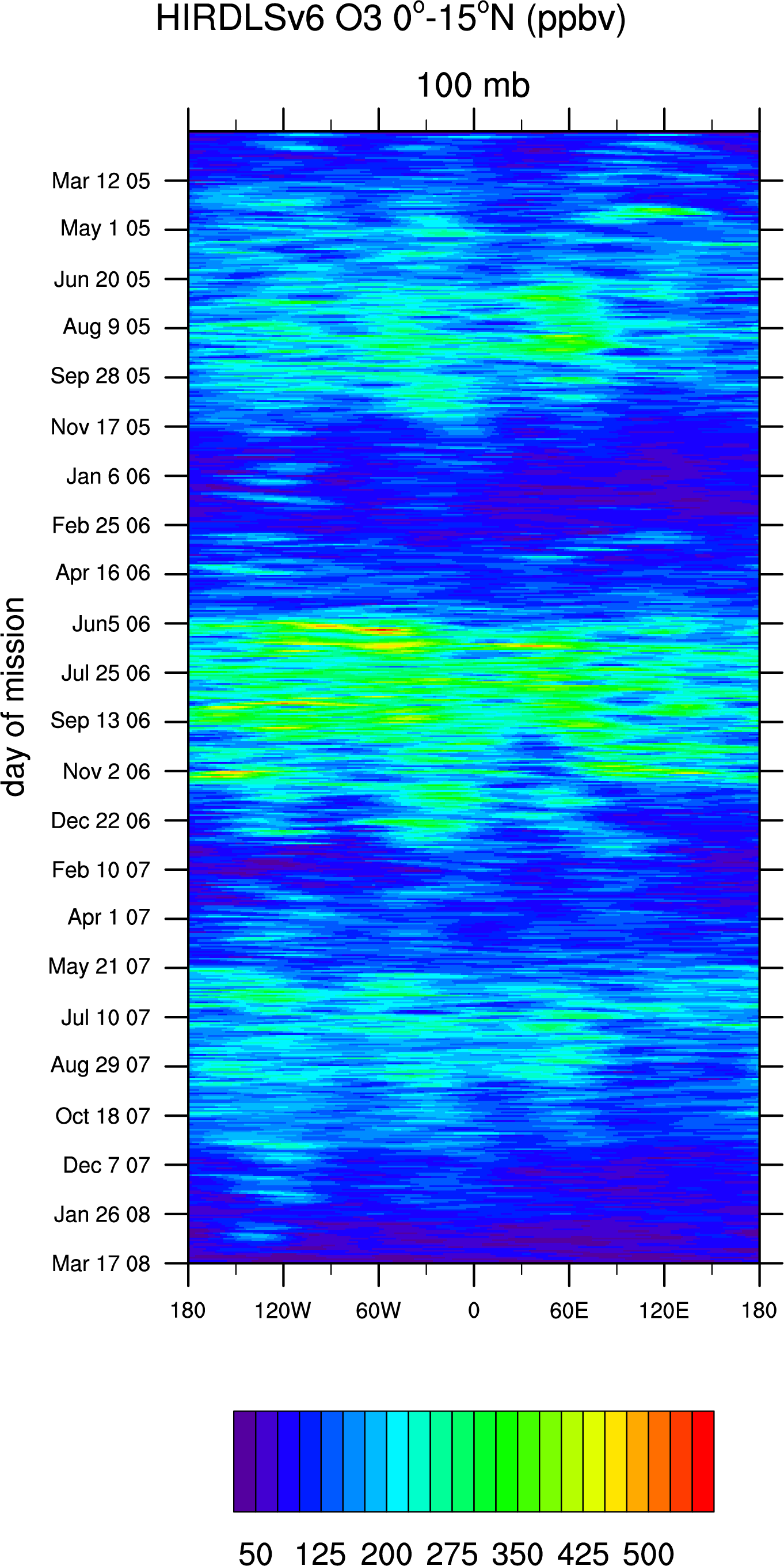
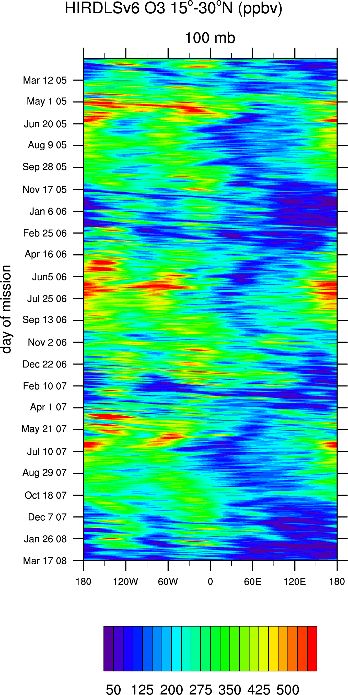
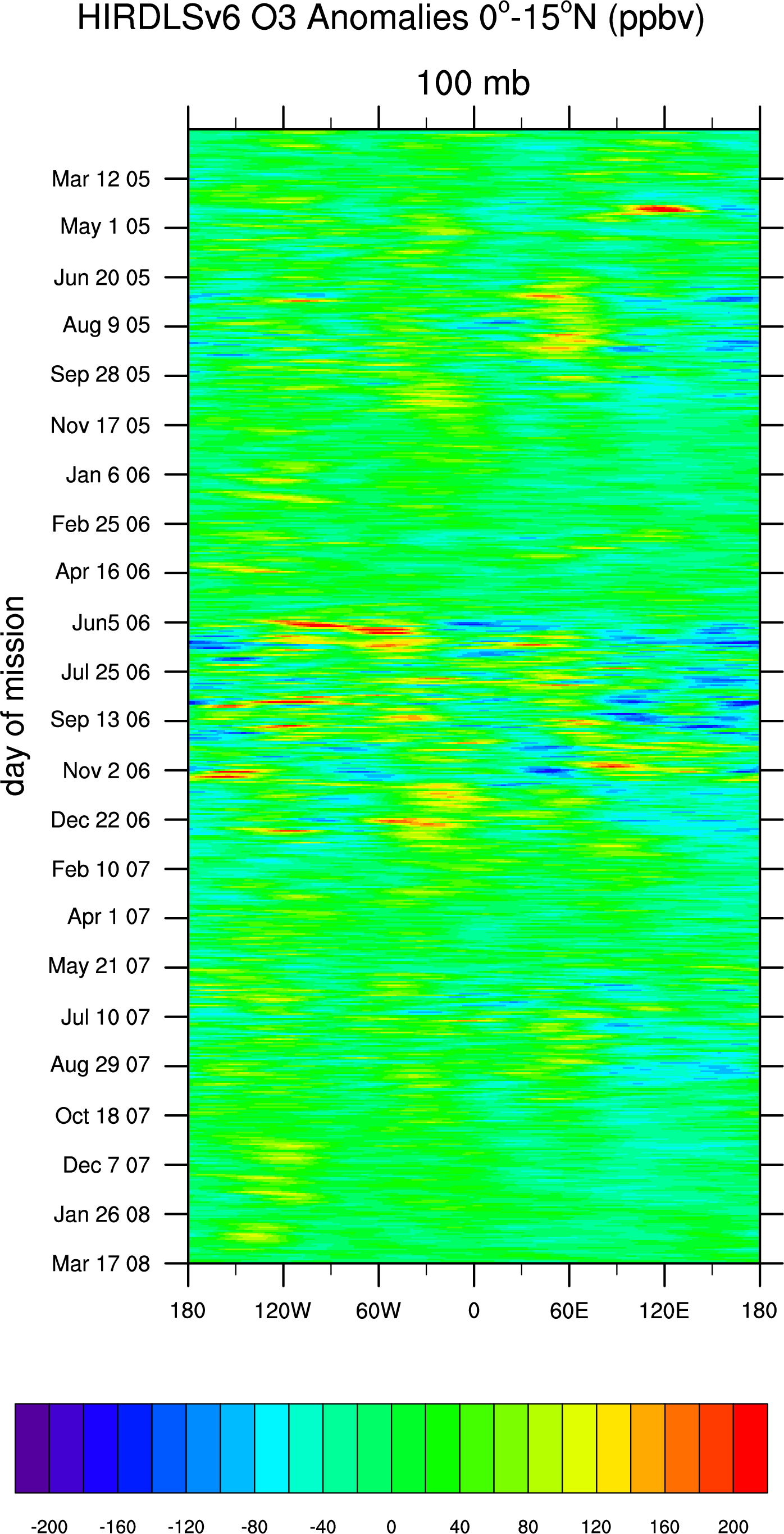
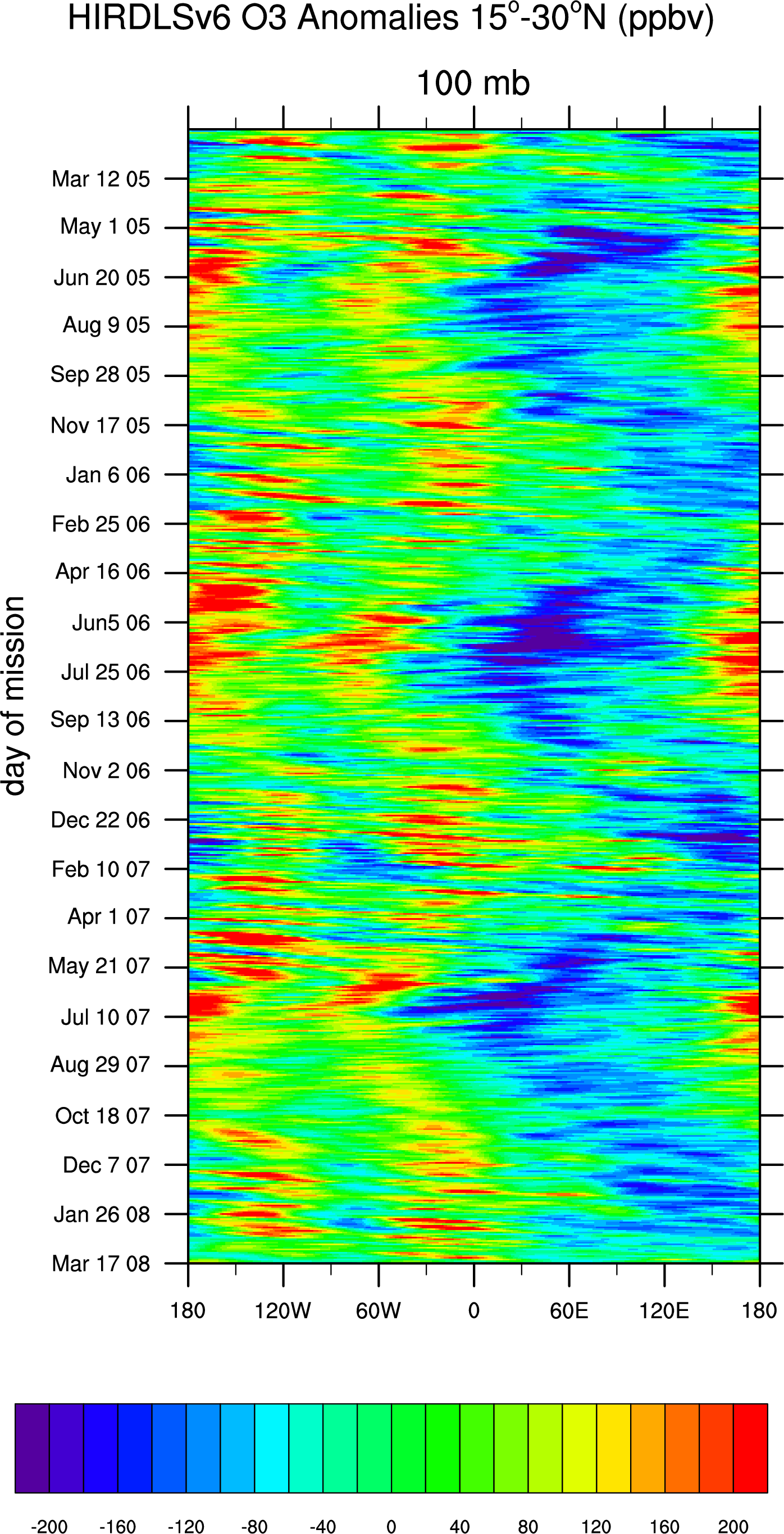
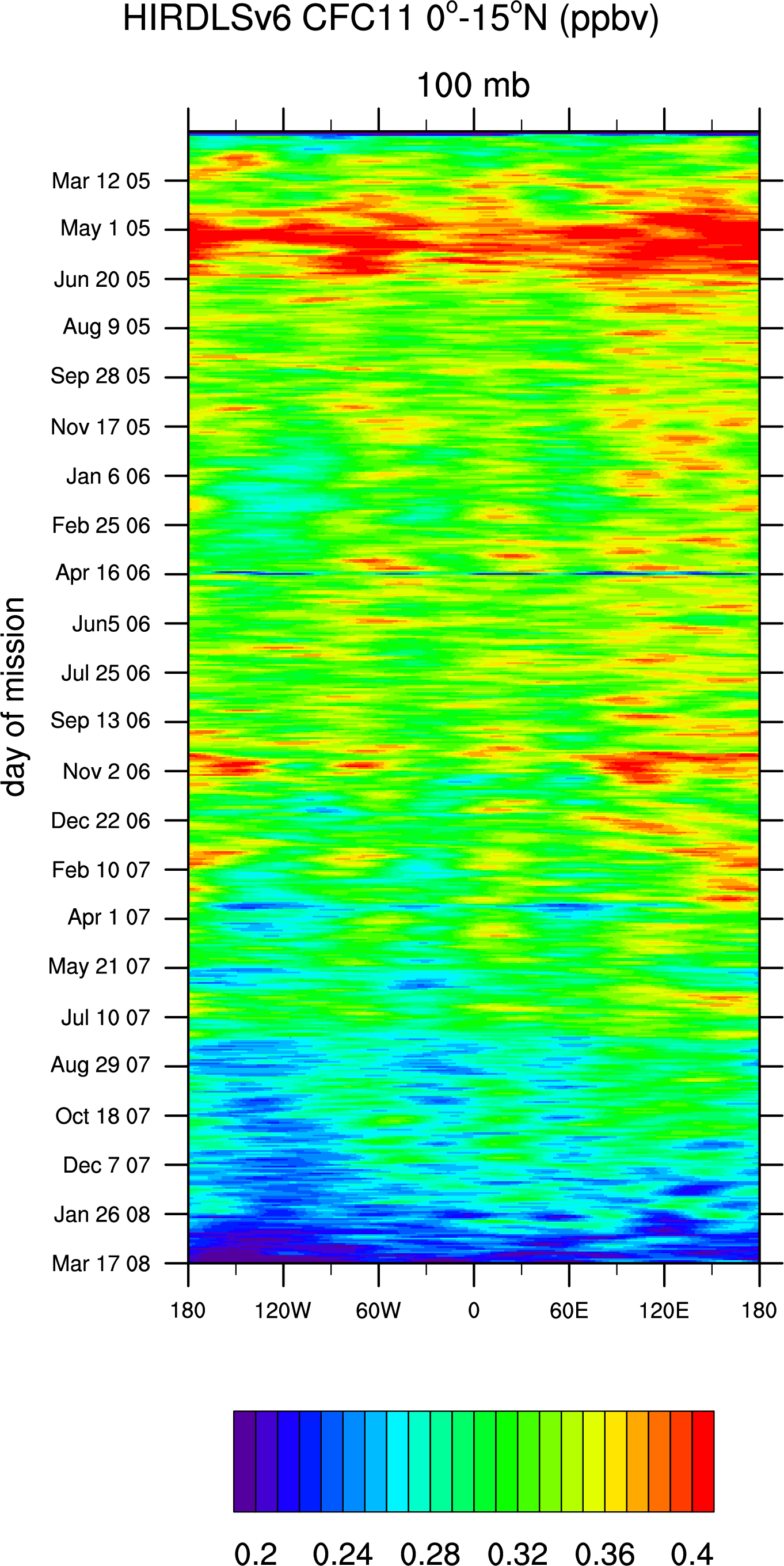
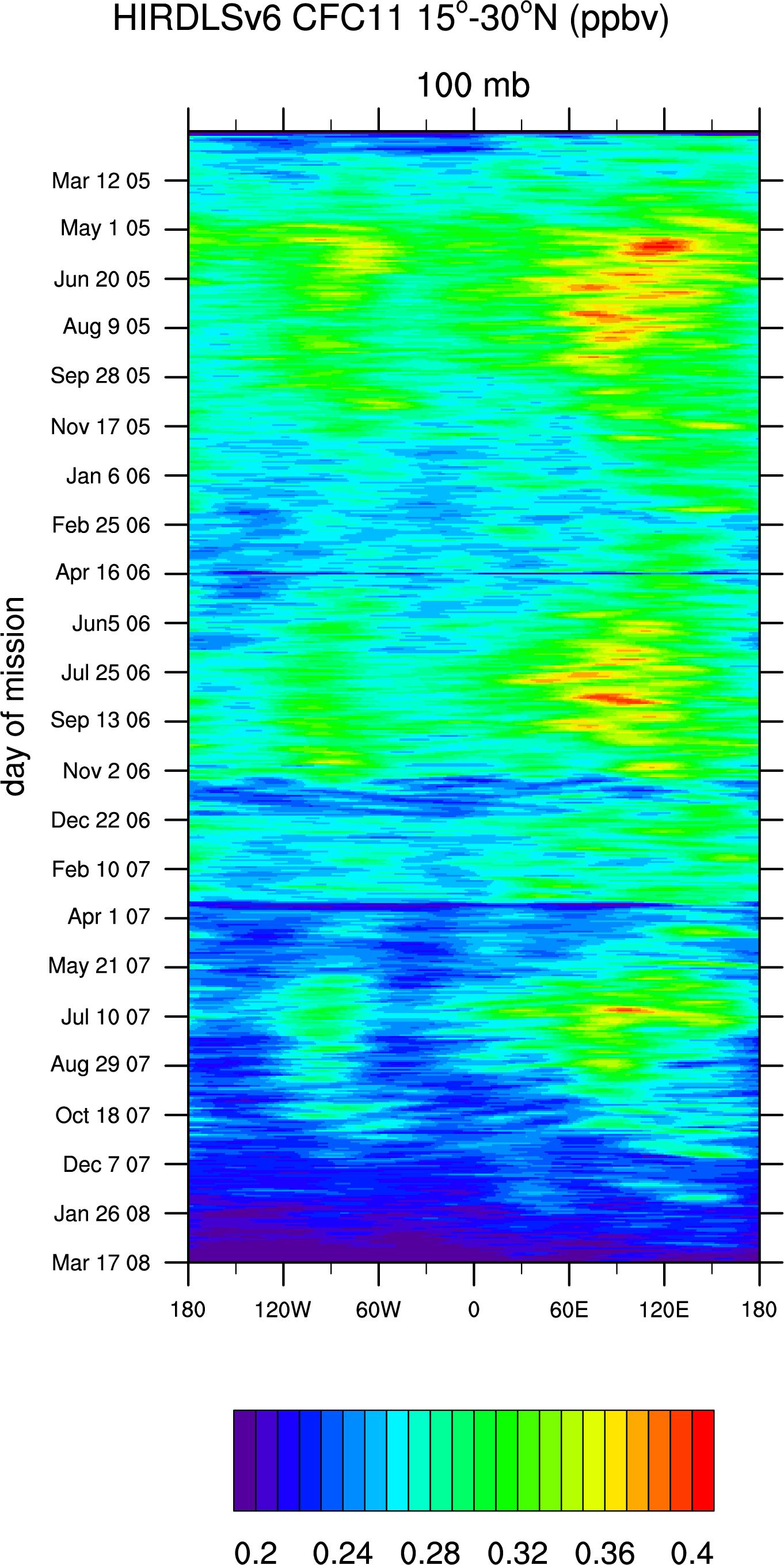
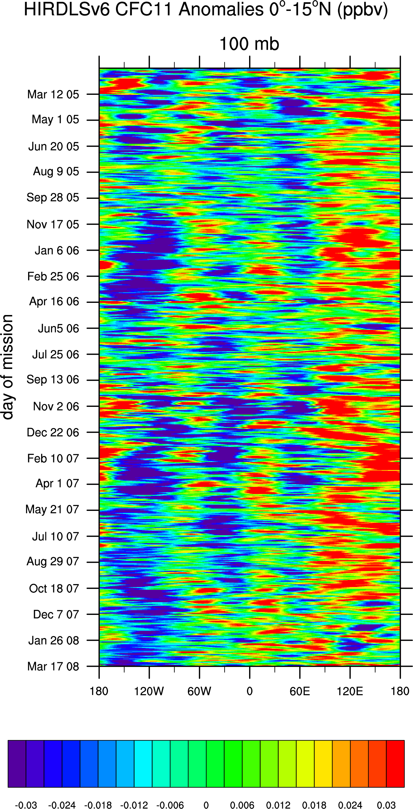
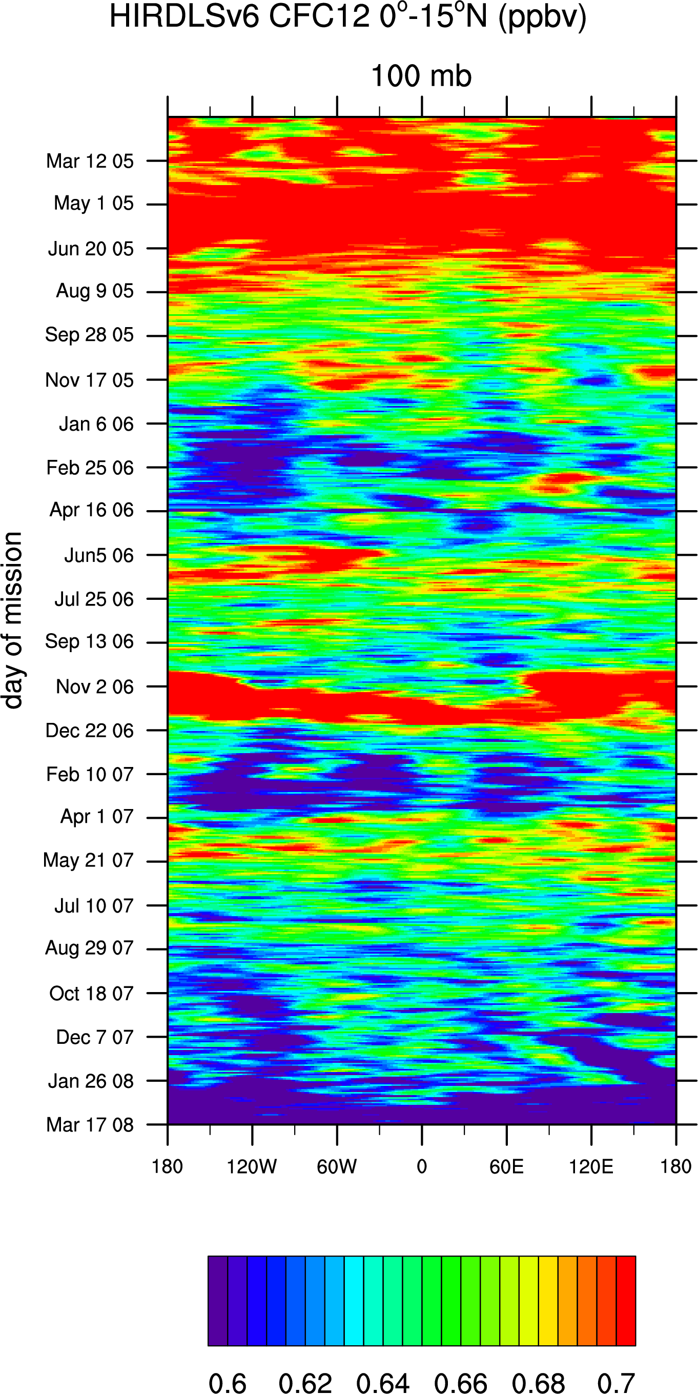
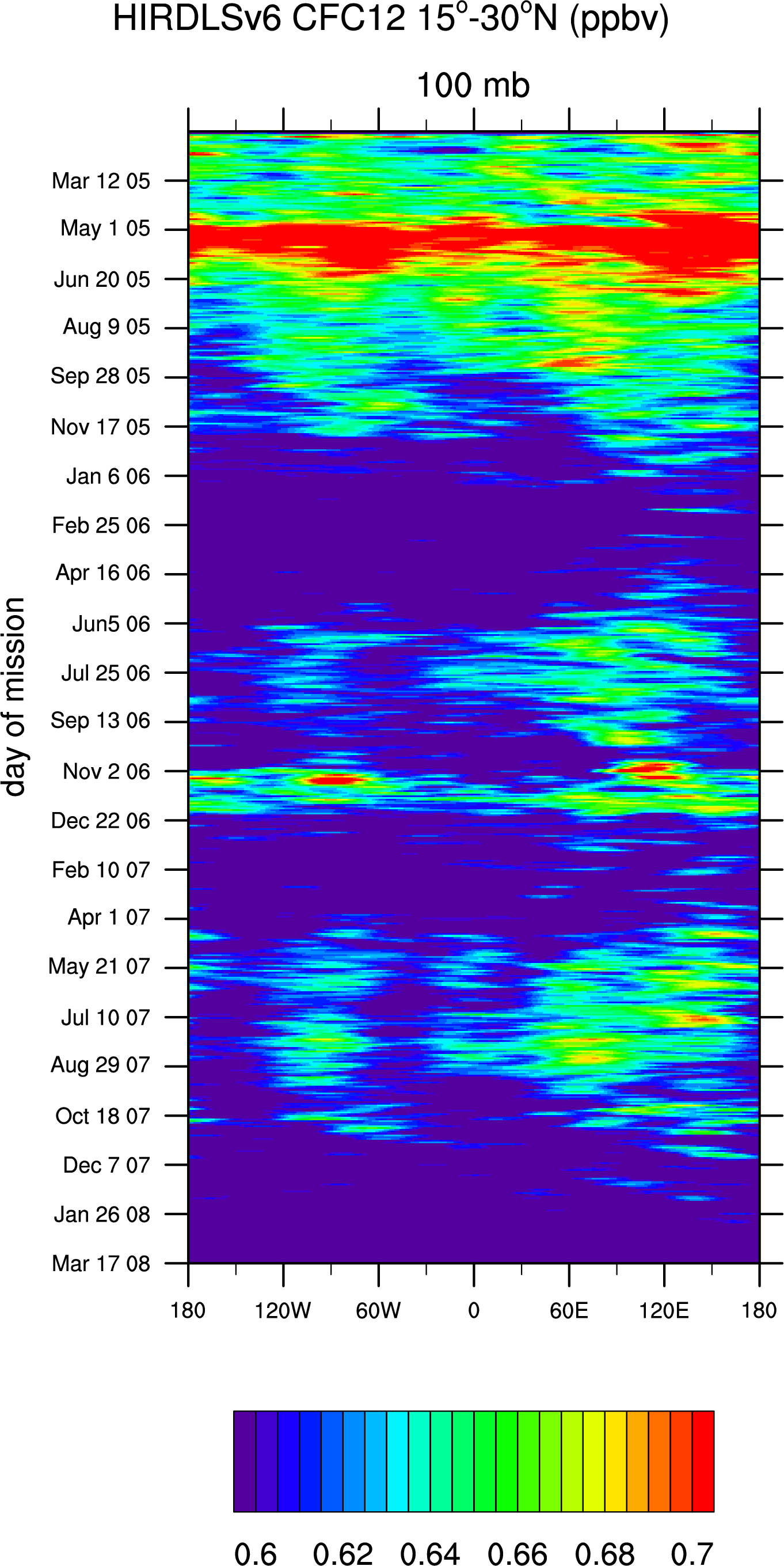
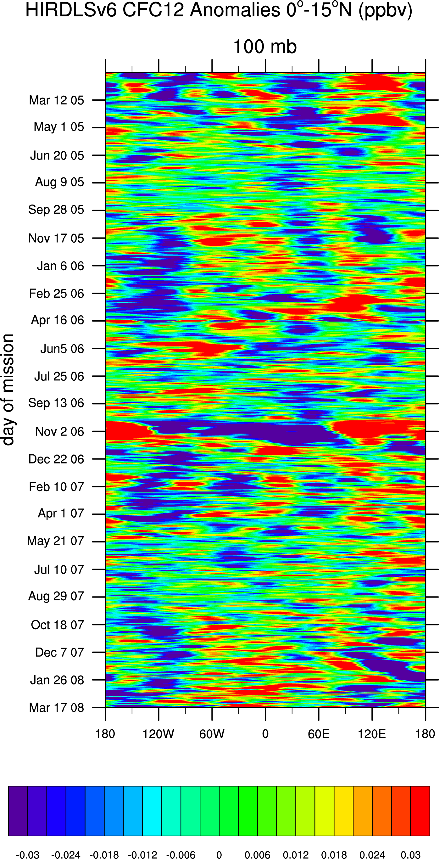
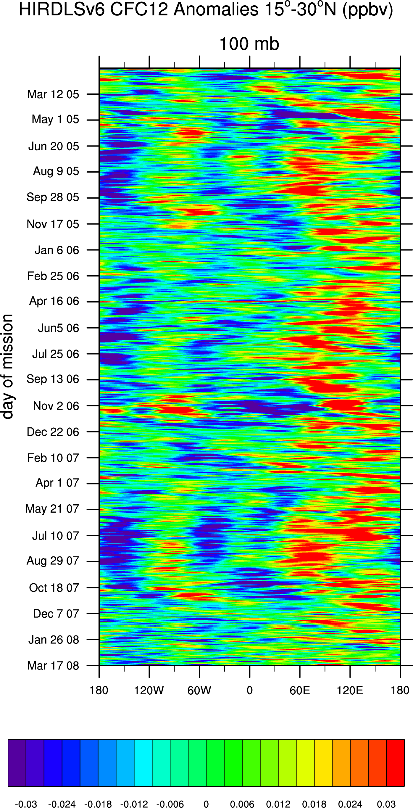
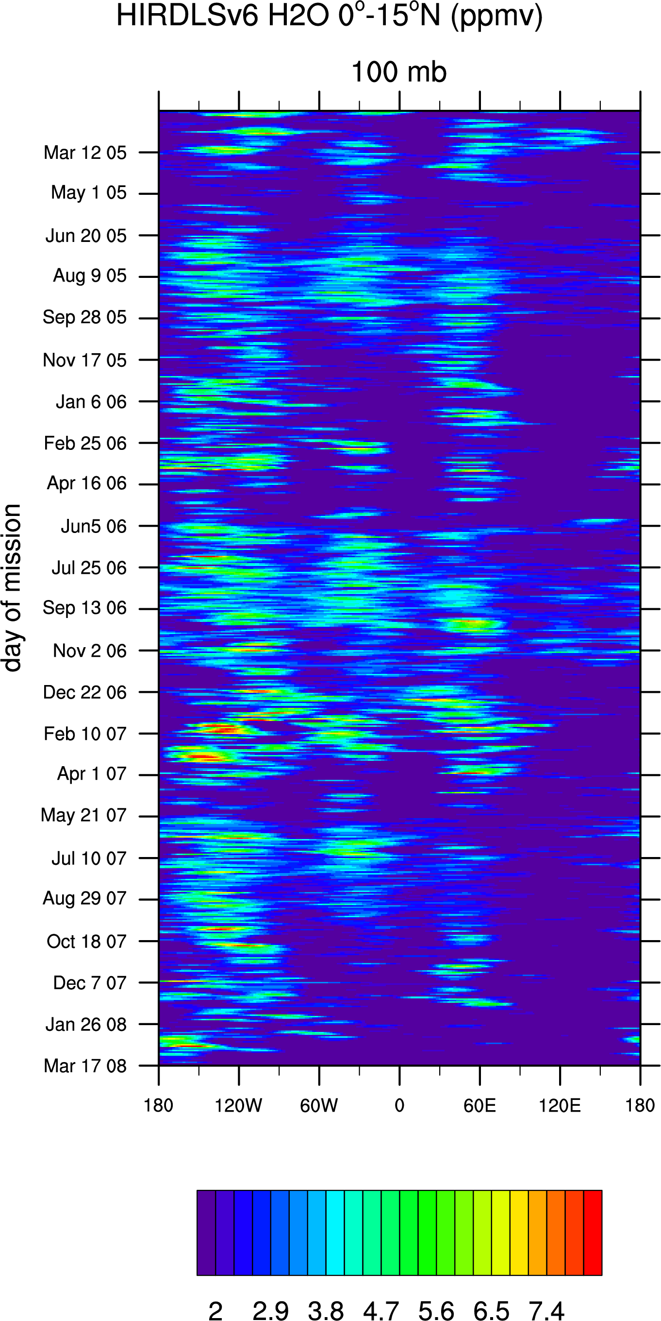
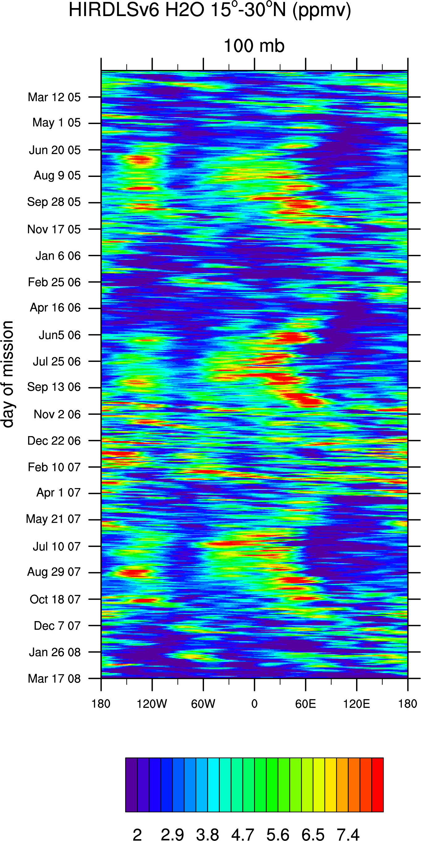
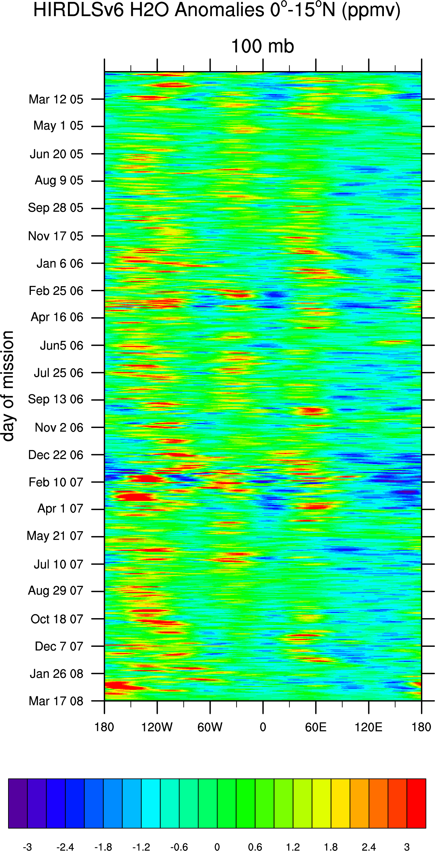
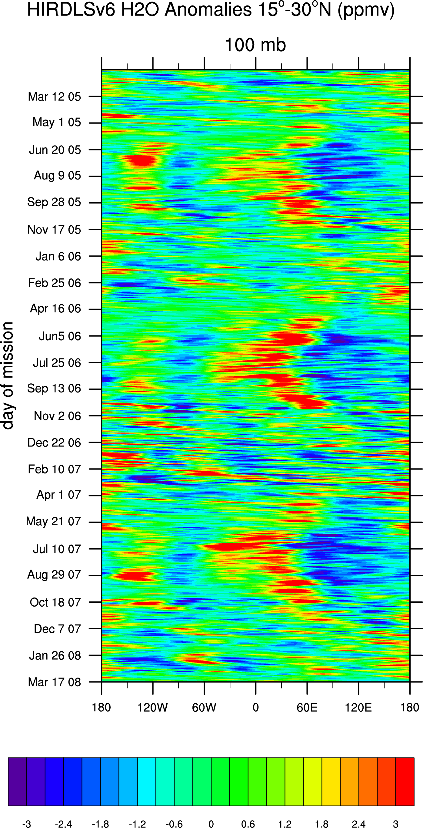
- Hovmoller diagrams of HIRDLS V.6 @100mb for the entire mission:
- Temperature: 0-15 N,
15-
30 N, T Anomalies: 0-15 N,
15-
30 N
- Ozone: 0-15 N,
15-
30 N, Ozone Anomalies: 0-15 N,
15-
30 N
- CFC11: 0-15 N,
15-
30 N, CFC11 Anomalies: 0-15 N,
15-
30 N
- CFC12: 0-15 N,
15-
30 N, CFC12 Anomalies: 0-15 N,
15-
30 N
- water: 0-15 N,
15-
30 N, water Anomalies: 0-15 N,
15-
30 N
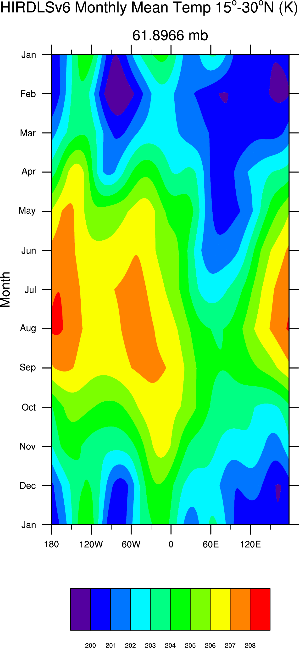
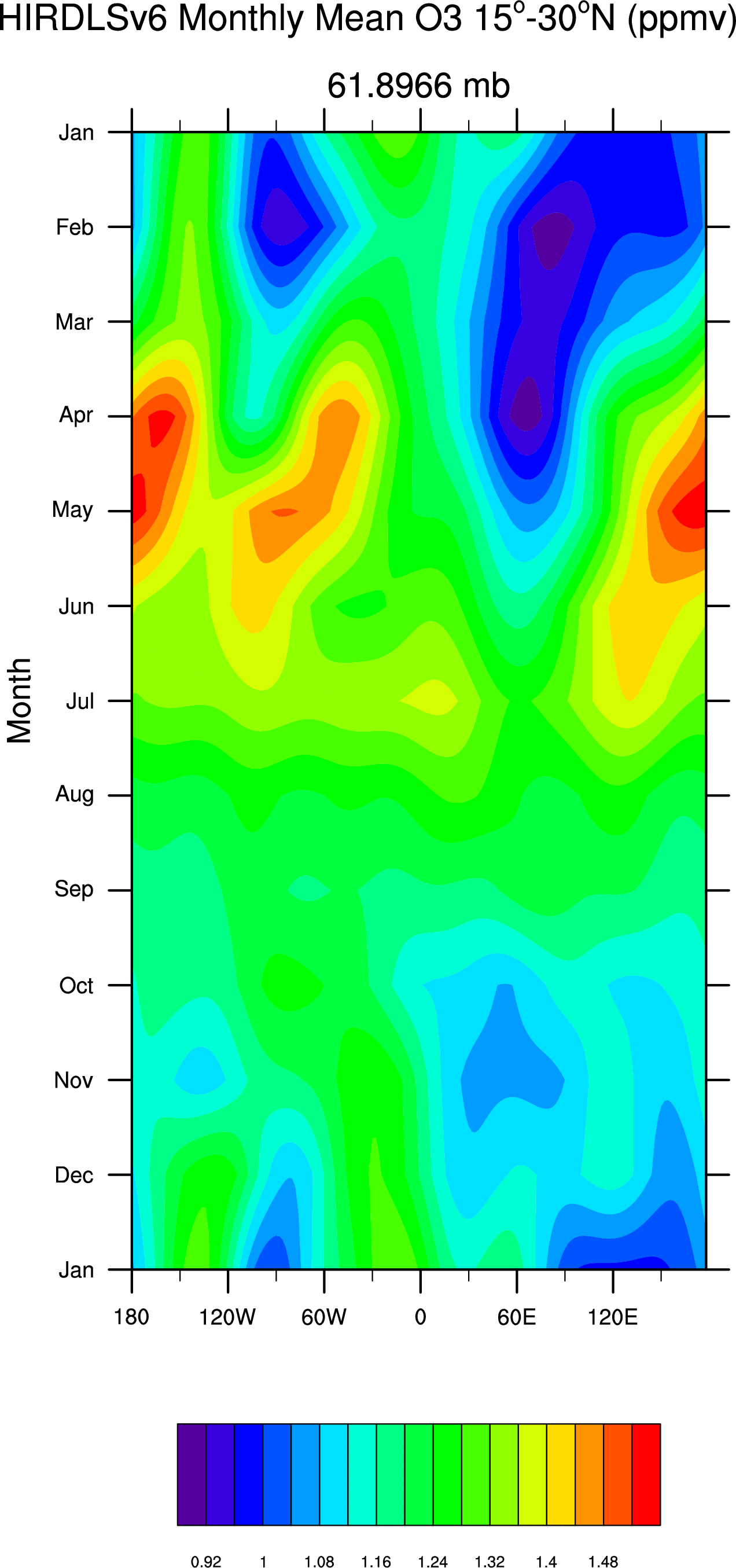
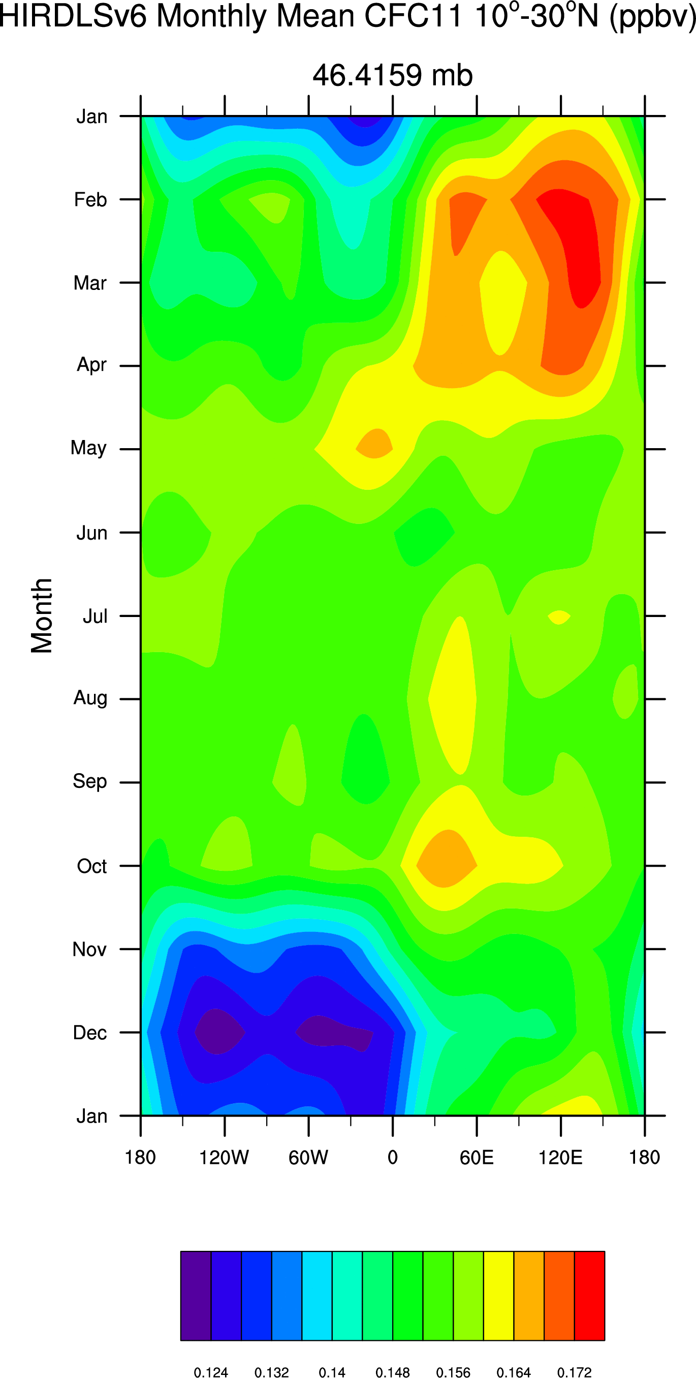
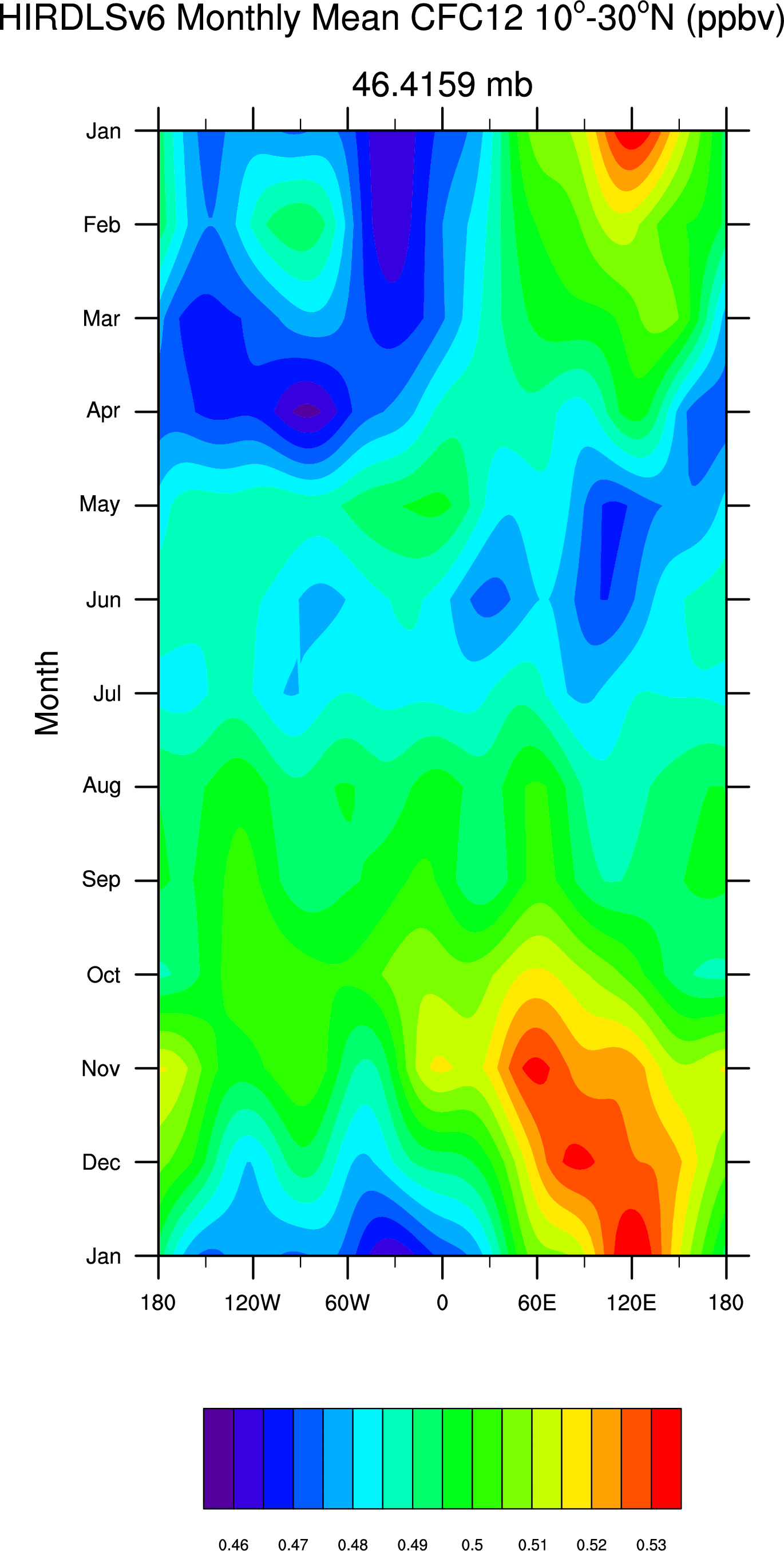
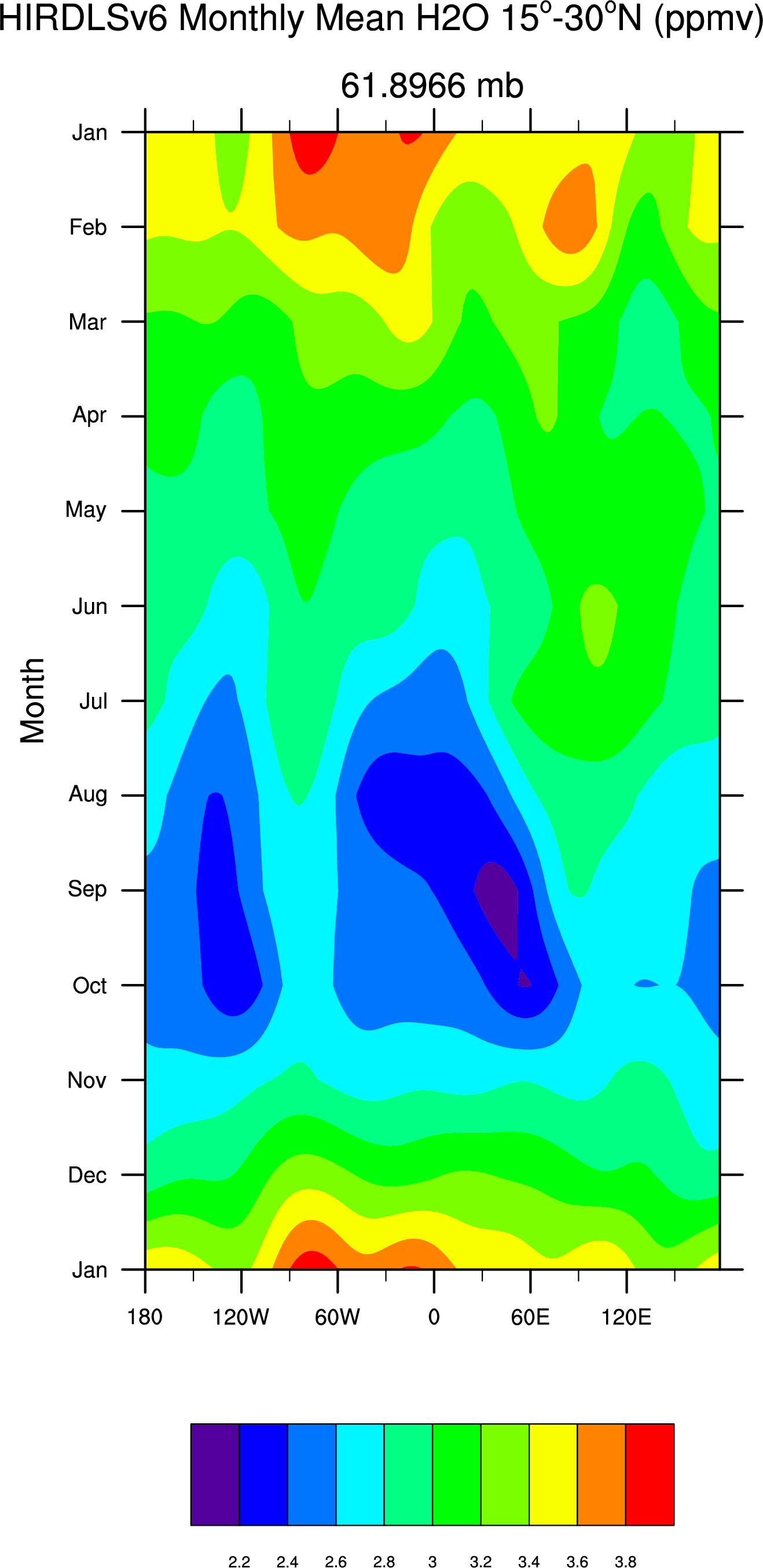
- Hovmoller diagrams of HIRDLS V.6 monthly mean "Climatologies" 10-30N for the entire mission:
- Temperature: 61mb,
100mb,
133mb
- Ozone: 61mb,
100mb,
133mb
- CFC11: 46mb,
75mb,
100mb
- CFC12: 46mb,
75mb,
100mb
- water: 61mb,
100mb,
133mb
- Hovmoller diagrams of HIRDLS V.6 anomalies for different latitude bands.
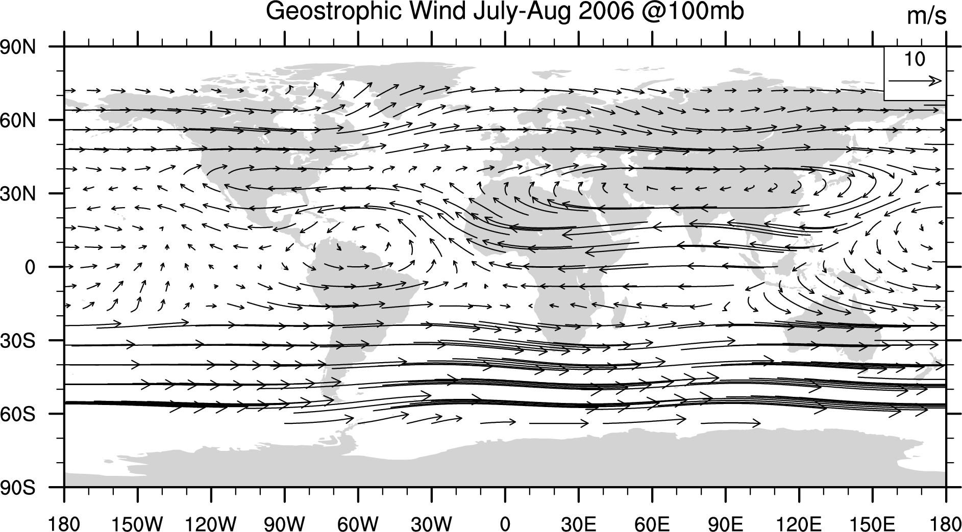
HIRDLS V.6.5 sample vector wind plot for July-Aug 2006: (gif)
Other dates available upon request.
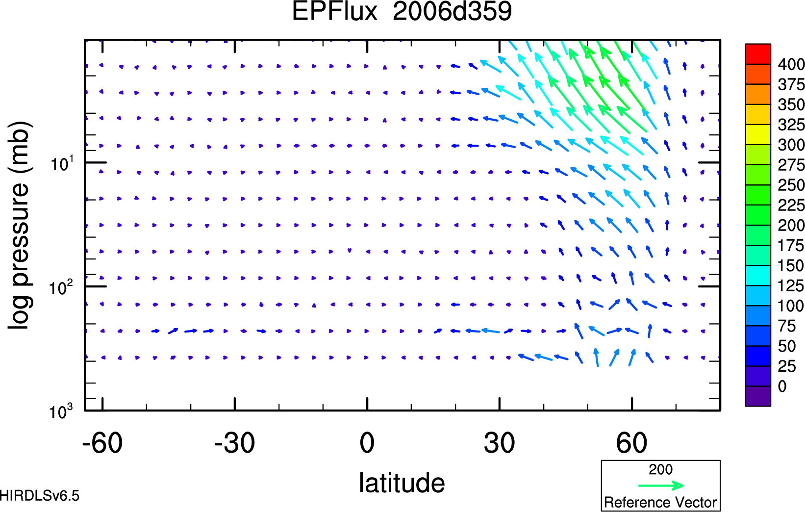
HIRDLS V.6.5 sample EP flux plot: 2006d359 (gif)
Other days available upon request.
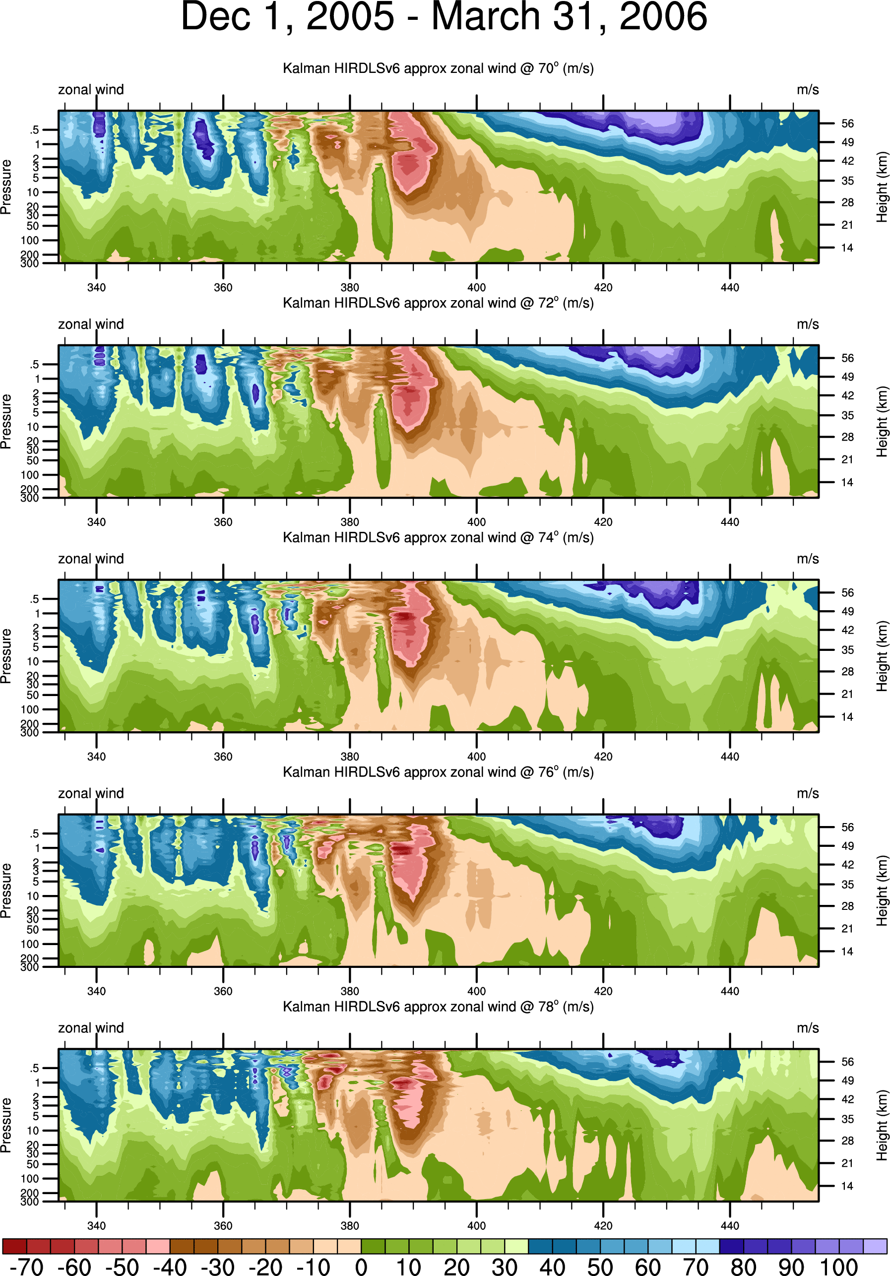
HIRDLS V.6.5 sample zonal wind plot @ high N latitudes: winter 2006 (gif)
Other times, latitudes available upon request.
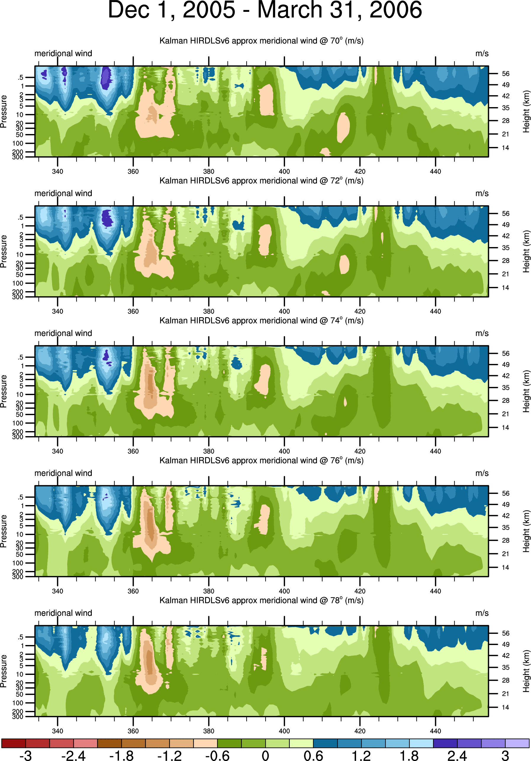
HIRDLS V.6.5 sample meridional wind plot @ high N latitudes: winter 2006 (gif)
Other times, latitudes available upon request.
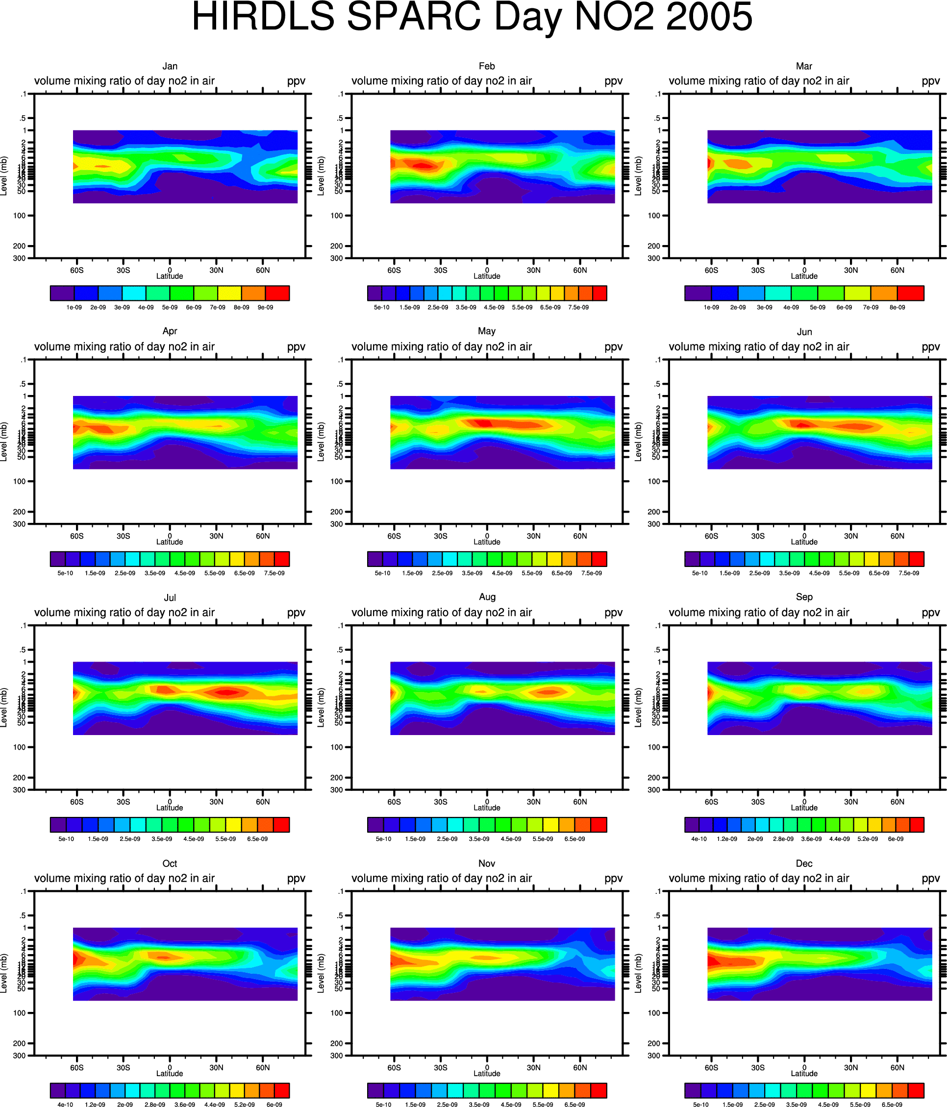
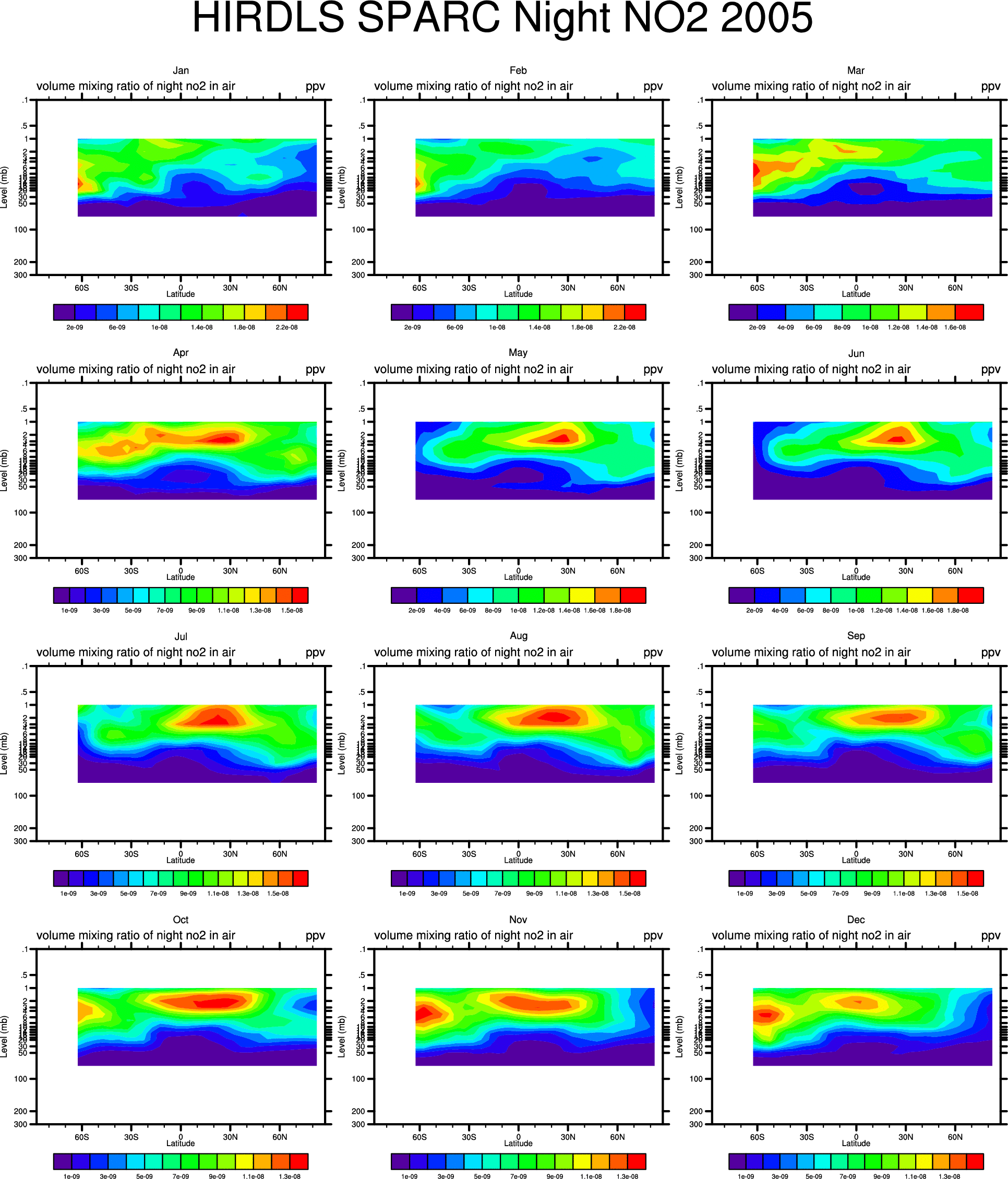
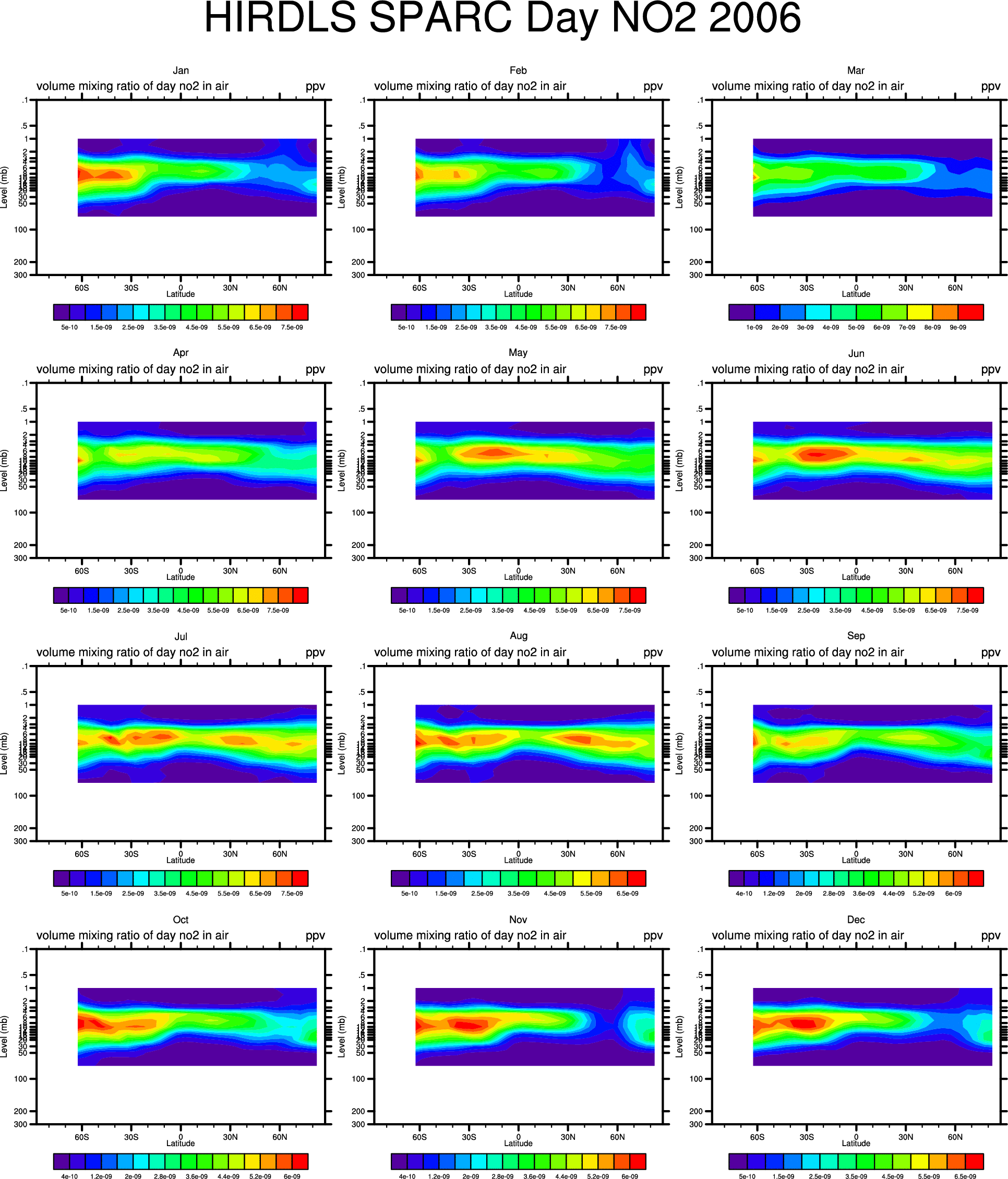
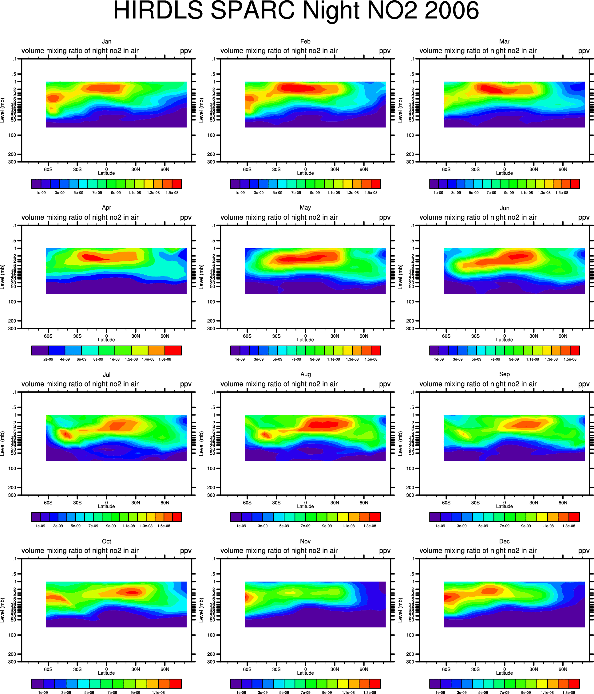
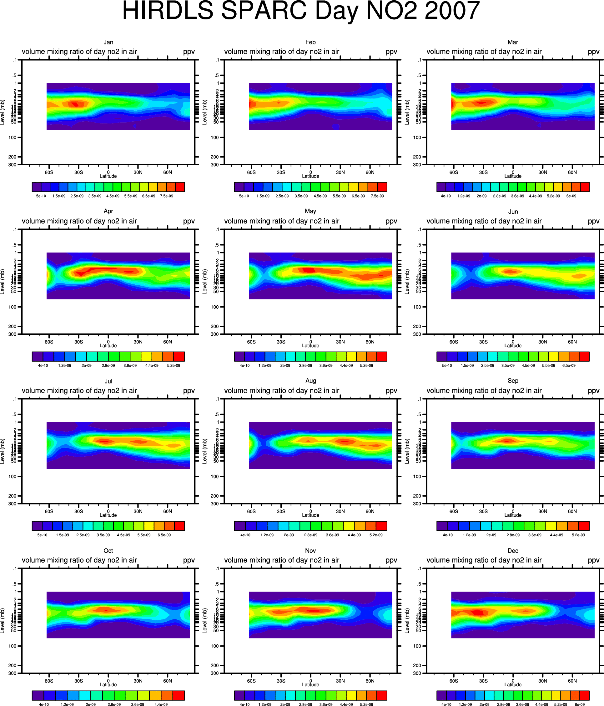
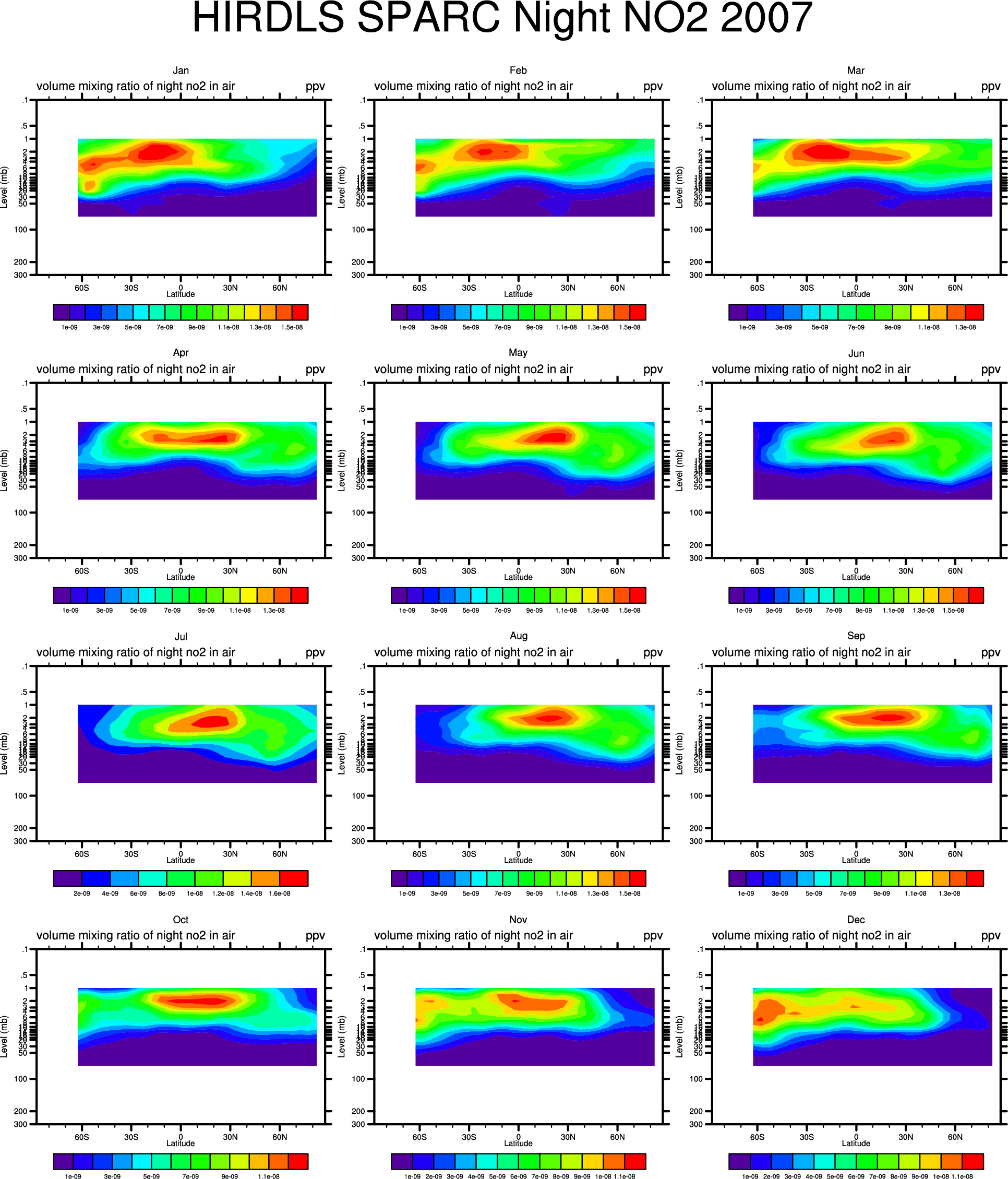
HIRDLS V.6 monthly mean species in SPARC format:
HIRDLS V.6 Temperatures compared with ERA-Interim temperatures:
HIRDLS V.6 Temperatures compared with SABER kinetic temperatures:
HIRDLS V.6 Temperatures compared with MLS temperatures:
Evidence for Solar Proton Events via HIRDLS V.5 NO2?
- Plot of Ion Pair Production Rate for HIRLDS period 2005-2007: gif
Maxima occur at: 2005Jan.17-21, 2005May15, 2005Aug.23-24, 2005Sept.9-12,15, 2006Dec.7-9,13-15
- Northern Hemisphere, Ascending and Descending: Jan 22, 2005, May 15, 2005, Aug 24, 2005, Sep 15, 2005, Dec 15, 2006 (gifs)
- Southern Hemisphere, Ascending and Descending:
Jan 22, 2005,May 15, 2005, Aug 24, 2005, Sep 15, 2005, Dec 15, 2006 (gifs)
Plots for other days of mission also available.
Diffusivities: Kappa plots from HIRDLS V.5 Ozone data.
HIRDLS Version 5: GPH
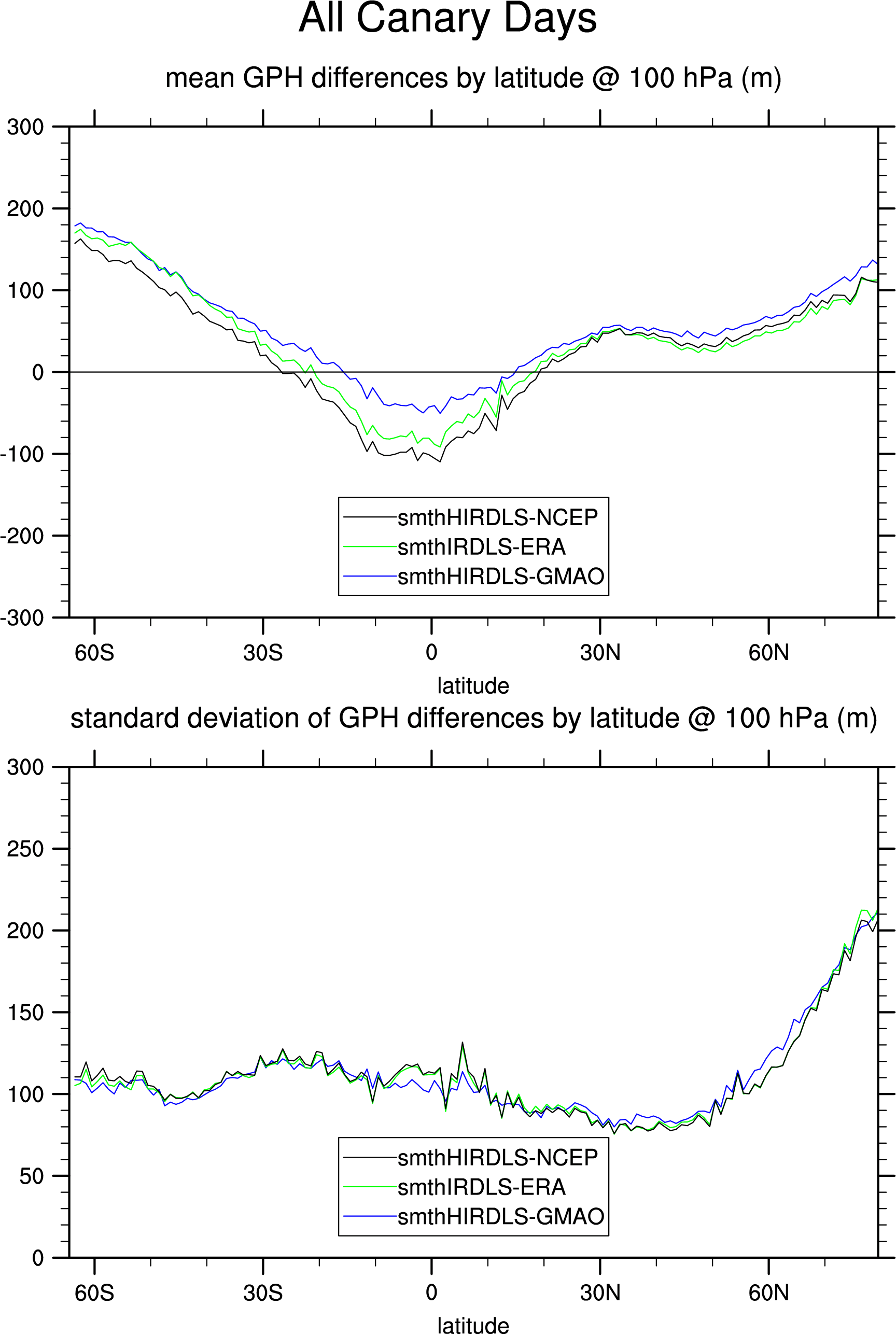
- HIRDLS Version 5 GPH at 10mb(open circle) and 100mb(closed circle), binned by latitude, compared to ERA-Interim, NCEP/NCAR Reanalysis, and GMAO for all canary days in Dec, Jan, Feb: gif
- HIRDLS Version 5 GPH at 10mb and 100mb, binned by latitude, compared to ERA-Interim, NCEP/NCAR Reanalysis, and GMAO for all canary days in Mar, Apr, May: gif
- HIRDLS Version 5 GPH at 10mb and 100mb, binned by latitude, compared to ERA-Interim, NCEP/NCAR Reanalysis, and GMAO for all canary days in Jun, Jul, Aug: gif
- HIRDLS Version 5 GPH at 10mb and 100mb, binned by latitude, compared to ERA-Interim, NCEP/NCAR Reanalysis, and GMAO for all canary days in Sep, Oct, Nov: gif
- HIRDLS Version 5 GPH at 10mb(open circle) and 100mb(closed circle), binned by latitude, compared to ERA-Interim, for all 2005(red), 2006(green), 2007(blue) days in Jan (gif),
Feb (gif)
Mar (gif)
Apr (gif)
May (gif)
Jun (gif)
Jul (gif)
Aug (gif)
Sep (gif)
Oct (gif)
Nov (gif)
Dec (gif)
- HIRDLS Version 5 GPH at 10mb(open circle) and 100mb(closed circle), binned by latitude, compared to ERA-Interim, mean and standard deviation of all 2005, 2006, 2007 days in Jan (gif),
Feb (gif)
Mar (gif)
Apr (gif)
May (gif)
Jun (gif)
Jul (gif)
Aug (gif)
Sep (gif)
Oct (gif)
Nov (gif)
Dec (gif)
HIRDLS (Version 4) Temperature
- Sample OrbitPlot curtain plot for canary day 2006d212: gif,
sample OrbitPlot orbit: gif
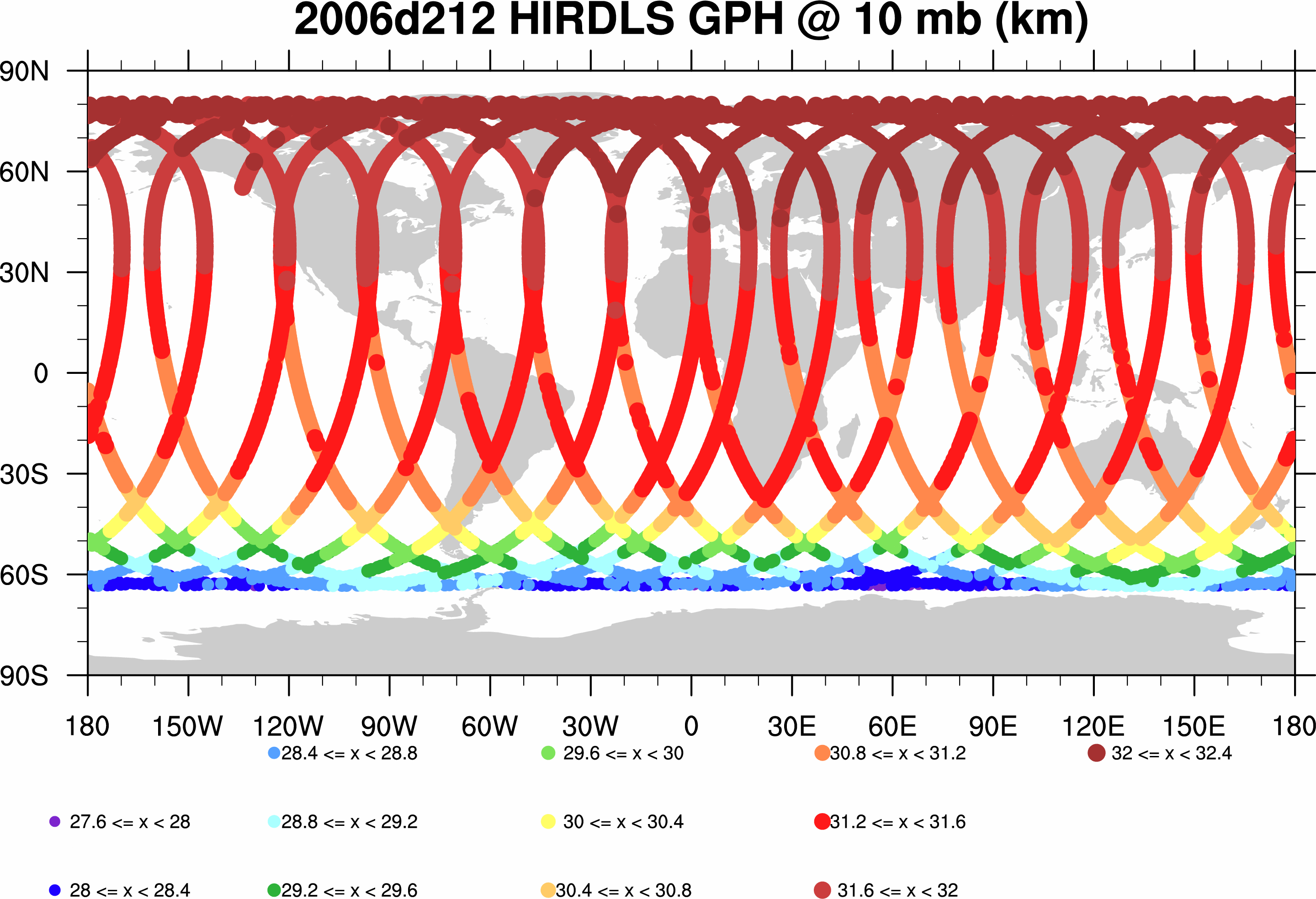
- @ 10mb for canary day 2006d212, orbits plotted on map: gif
- @ 100mb for canary day 2006d212, orbits plotted on map: gif
- For comparison, 4x-daily ERA-Interim Temperature, averaged over day 2006d212
- maps @ 10mb and 100mb: gif
- pressure v. latitude contour plot gif
Test HIRDLS GPH computed via SIPS
- Sample OrbitPlot curtain plot for canary day 2006d212: gif
- Unsmoothed HIRDLS GPH compared to multiple applications of nine-point local smoother: gif
- @ 10mb for canary day 2006d212, orbits plotted on map: gif
- @ 100mb for canary day 2006d212, orbits plotted on map: gif
- For comparison, 4x-daily ERA-Interim Geopotential Height, averaged over day 2006d212
- maps @ 10mb and 100mb: gif
- pressure v. latitude contour plot gif
- Smoothed SIPS HIRDLS GPH --interpolated GMAO, for canary day 2006d212, orbits plotted on map
- Smoothed SIPS HIRDLS GPH compared to interpolated GMAO, ERA-Interim, NCEP for canary day 2006d212, line plots, in half-orbits
- @ 10mb:gif
- Blow-up of half-orbit 28:gif
- Differences @ 10mb:gif
- Blow-up of half-orbit 28:gif
- @100mb:gif
- Blow-up of half-orbit 28:gif
- Differences @ 100mb:gif
- Blow-up of half-orbit 28:gif
- Smoothed SIPS HIRDLS GPH compared to interpolated GMAO, ERA-Interim, NCEP for canary days, mean differences & standard deviations of differences, line plots, binned by latitudes
- All canary days
- Dec,Jan,Feb canary days
- Jun,July,Aug canary days
Zonal Wind
For comparison, 4x-daily ERA-Interim Zonal Wind, averaged over day 2006d212
- maps @ 10mb and 100mb: gif
- pressure v. latitude contour plot gif
preliminary HIRDLS Cloud Top Altitude binned by lat, lon:
August 2007, between 30-degrees south and 30-degrees north:
Line plots:
In all cases, column 1 is mean altitude, column 2 is standard deviation * N, column 3 is N.
- Cloud Flag 1 (Unknown) Northern Hemisphere gif, ps
- Cloud Flag 1 (Unknown) Southern Hemisphere gif, ps
- Cloud Flag 2 (Cirrus) Northern Hemisphere gif, ps
- Cloud Flag 2 (Cirrus) Southern Hemisphere gif, ps
- Cloud Flag 3 (extensive Polar Stratospheric) Northern Hemisphere --insufficient data
- Cloud Flag 3 (extensive Polar Stratospheric) Southern Hemisphere --insufficient data
- Cloud Flag 4 (Opaque) Northern Hemisphere gif, ps
- Cloud Flag 4 (Opaque) Southern Hemisphere gif, ps
Contour plots on cylindrical equidistant maps:
- 45 south to 45 north map(s) for any cloud: gif, ps.
- 30 south to 30 north map(s) for any cloud: gif, ps.
- 45 south to 45 north map(s) for unknown cloud: gif, ps.
- 30 south to 30 north map(s) for unknown cloud: gif, ps.
- 45 south to 45 north map(s) for Cirrus cloud: gif, ps.
- 30 south to 30 north map(s) for Cirrus cloud: gif, ps.
- 30 south to 30 north map(s) for extensive Polar Stratospheric cloud -- insufficient data
- 45 south to 45 north map(s) for Opaque cloud: gif, ps.
- 30 south to 30 north map(s) for Opaque cloud: gif, ps.
HIRDLS GPH computed via SIPS Preliminary studies, testing the algorithm(s):
- Canary day 2005d029 smoothed HIRDLS GPH compared with GMAO GPH @ 10 hPa: gif.
- Canary day 2005d029 smoothed HIRDLS GPH compared with GMAO GPH @ 100hPa: gif
HIRDLS GPH computed (approximate method*) using HIRDLS 30km (descending) or 26km (ascending) starting Altitude, 30N to 60N, for constrained longitudes, i.e. including only -130 < lon < -60, -10 < lon < 60
- preliminary scatter plots of means and standard deviations of differences of integrated HIRDLS-Temp calcs and GMAO GPH (10mb) for Summer 2006 for 30N to 60N for descending half orbits: gif (red markers denote mean per day),
where Summer 2006 is: 2006d200 through 2006d270
- preliminary scatter plots of means and standard deviations of differences of integrated HIRDLS-Temp calcs and GMAO GPH (10mb) for Summer 2006 for 30N to 60N for ascending half orbits: gif (red markers denote mean per day), where dates as above.
- preliminary scatter plots of means and standard deviations of differences of integrated HIRDLS-Temp calcs and GMAO GPH (10mb) for all dates for 30N to 60N for descending half orbits: gif ,
where all dates are: 2005d089, 2005d181, 2005d273, 2005d363, 2006d089, 2006d181, 2006d273, 2006d364, 2007d089, 2007d181, 2007d273, 2007d364.
- preliminary scatter plots of means and standard deviations of differences of integrated HIRDLS-Temp calcs and GMAO GPH (10mb) for all dates for 30N to 60N for ascending half orbits: gif , where all dates are as above.
HIRDLS GPH computed (approximate method*) using HIRDLS 30km (descending) or 26km (ascending) starting Altitude:
(ascending and descending determined via OrbitAscendingFlag)
integrated HIRDLS-Temp calcs compared with GMAO GPHs for 30N to 60N:
- a.)2007d089 4 descending half-orbits GPH @ 10mb for HIRDLS T-int and GMAO GPH (gif)
- b.)2007d089 4 ascending half-orbits GPH @ 10mb, HIRDLS T-int and GMAO GPH (gif)
- c.) differences of curves in plots a.) above, descending half-orbits HIRDLS T-int -- GMAO GPH (gif)
- d.) differences of curves in plots b.) above, ascending half-orbits HIRDLS T-int -- GMAO GPH (gif)
- scatter plots of means and standard deviations of differences of integrated HIRDLS-Temp calcs and GMAO GPH (10mb) for all dates for 30N to 60N for descending half orbits: gif . (data from plots c.) above is included here)
where all dates are: 2005d089, 2005d181, 2005d273, 2005d364, 2006d089, 2006d181, 2006d273, 2006d364, 2007d089, 2007d181, 2007d273, 2007d364.
- scatter plots of means and standard deviations of differences of integrated HIRDLS-Temp calcs and GMAO GPH (10mb) for all dates for 30N to 60N for ascending half orbits: gif . (data from plots d.) above is included here)
HIRDLS GPH computed (approximate method*) using HIRDLS approx 30km starting Altitude:
integrated HIRDLS-Temp calcs compared with GMAO GPHs for 2007d089 for 30N to 60N:
- 1st 4 half-orbits GPH @ 10mb for HIRDLS T-int and GMAO GPH (gif)
- 1st 4 half-orbits GPH @ 10mb, HIRDLS T-int -- GMAO GPH (gif)
- half-orbits 5-8 GPH @ 10mb, HIRDLS T-int -- GMAO GPH (gif)
- half-orbits 9-12 GPH @ 10mb, HIRDLS T-int -- GMAO GPH (gif)
- scatter plots of means and standard deviations of differences of integrated HIRDLS-Temp calcs and GMAO GPH (10mb) for all dates for 30N to 60N: gif .
- scatter plots of differences of integrated HIRDLS-Temp calcs and GMAO GPH (10mb) for all dates for 30N to 60N ascending and descending: gif .
- Line plot differences of HIRDLS All Altitudes (Toolkit) GPH calculation and GMAO GPH, averaged over 30N-60N, for -130 < lon < -60 or -10 < lon < 60 versus GMAO pressure levels:
for dates 2005d089, 2005d181, 2005d273, 2005d363, 2006d089, 2006d181, 2006d273, 2006d364, 2007d089, 2007d181, 2007d273, 2007d364
- Scatter plot differences of HIRDLS All Altitudes (Toolkit) GPH calculation and GMAO GPH for 30N-60N and constrained longitudes:
for dates 2005d089, 2005d181, 2005d273, 2005d363, 2006d089, 2006d181, 2006d273, 2006d364, 2007d089, 2007d181, 2007d273, 2007d364
- Preliminary 2007d089 Contour plots of
Toolkit Altitude GPH--Temperature-Integrated GPH for:
HIRDLS GPH computed (approximate method*) using HIRDLS approx 30km starting Altitude:
integrated HIRDLS-Temp calcs and GMAO GPHs compared with HIRDLS All-Altitude calculations for 2007d089 for 30N to 60N:
- A comparison of "Exact" and "Approximate" GPH calculation utilizing standard atmosphere altitude: gif , as outlined in SW-HIR-1506 Eqn.s (A.9), (A.10).
*Approximate method is: GPH = G*Z(1-Z/a), where Z is Altitude, G is gravity term, and a is Earth's semi-major axis. Follows SW-HIR-1506 "Geodetic - Geopotential Height Conversions" by A. Lambert, NCAR November 2000.
HIRDLS GPH computed (approximate method) using HIRDLS 30km starting Altitude:
integrated HIRDLS-Temp calcs and integrated GMAO-Temp calcs compared with HIRDLS All-Altitude calculations for 2007d089 for 30N to 60N:
HIRDLS GPH computed (approximate method) using HIRDLS 100 mb starting Altitude:
for fourth half-orbit 2007d089, 30N-60N all-altitudes 10mb and 100mb cases compared with integrated HIRDLS-Temperatures and integrated GMAO-Temperatures cases: gif.
HIRDLS GPH computed (exact method) using HIRDLS 30 km starting Altitude:
fourth half-orbit 2007d181 GPH @ 30mb ECMWF, NCEP/NCAR, GMAO, HIRDLS png with additional 300m altitude adjustment
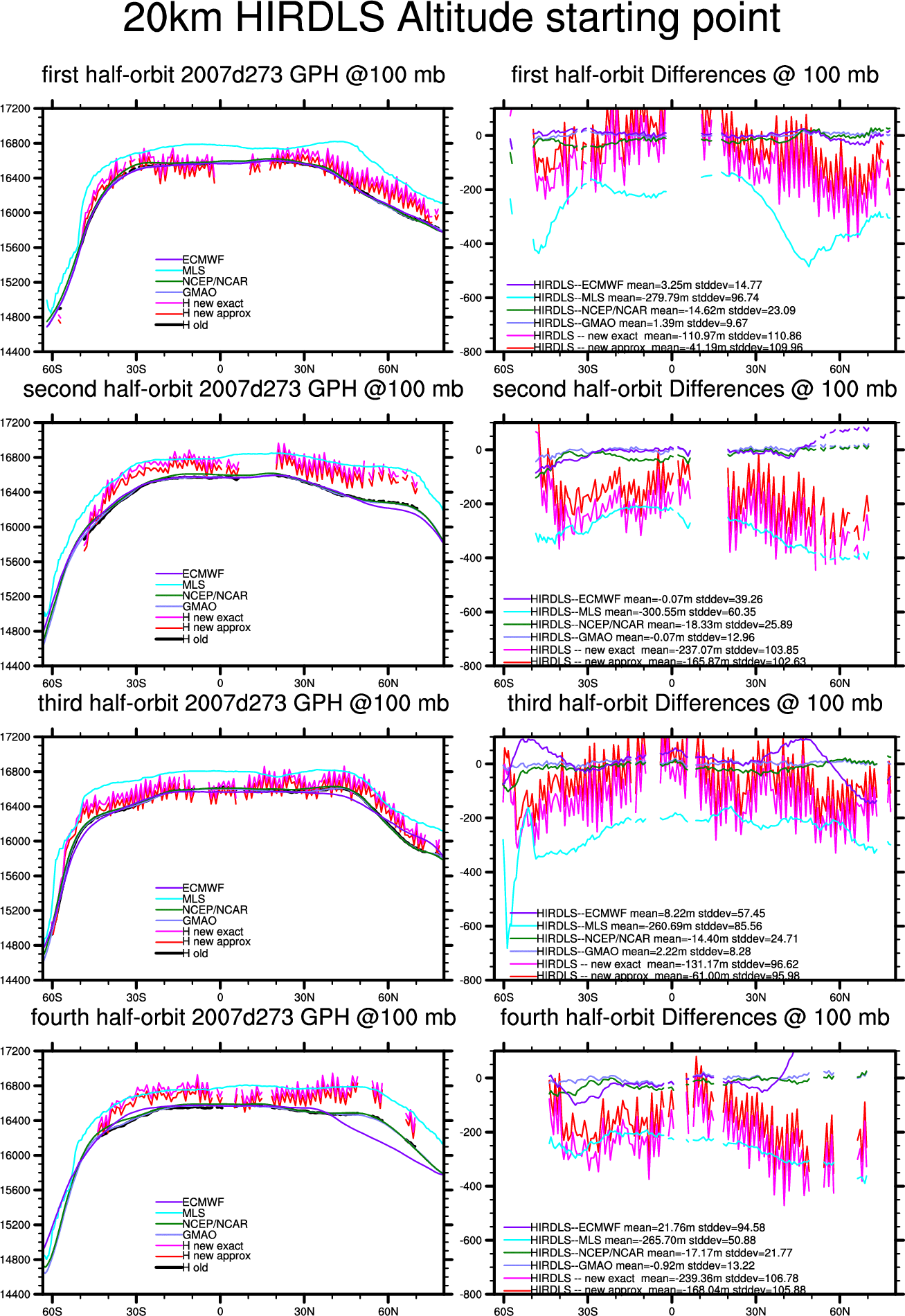
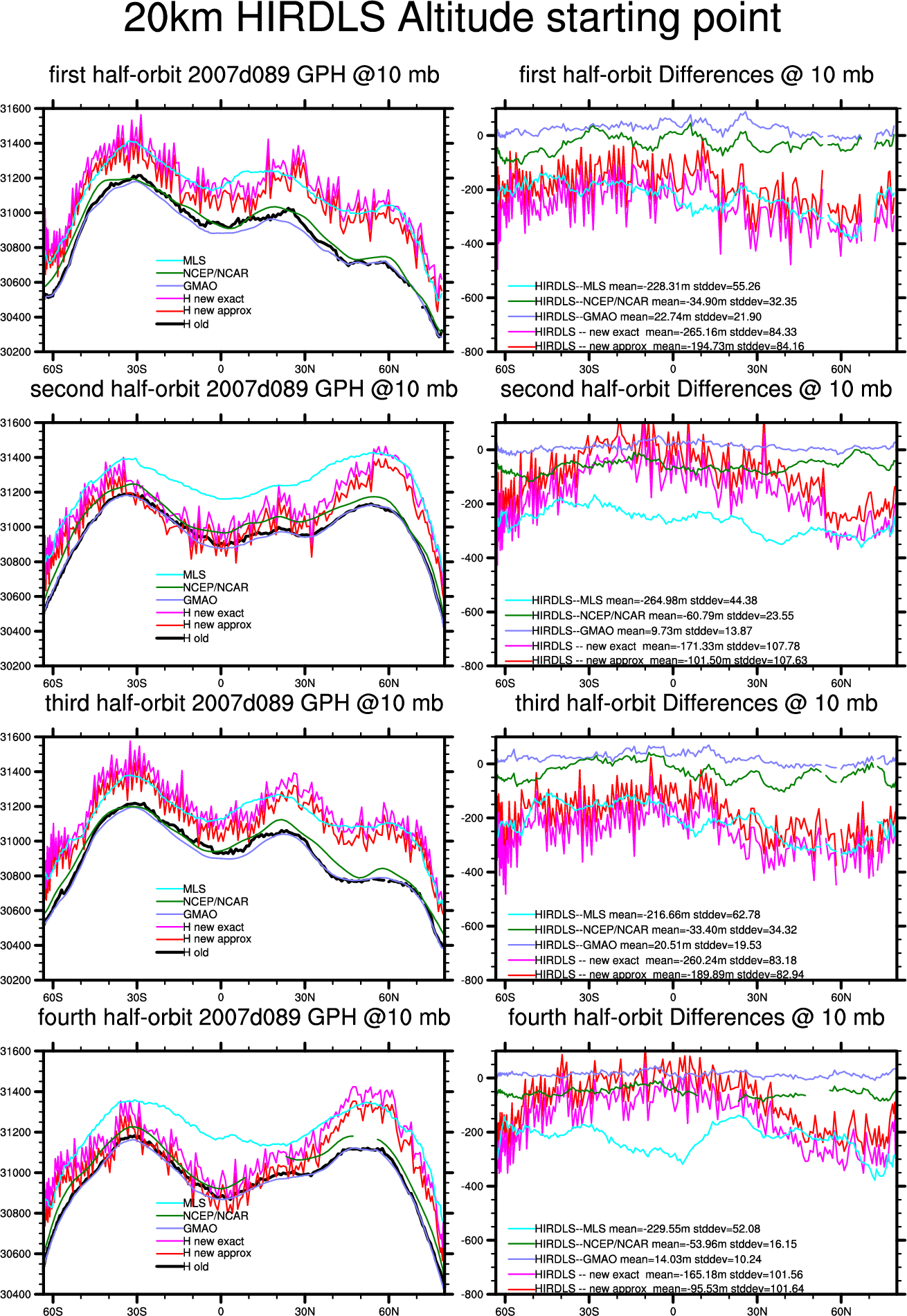
preliminary HIRDLS GPH computed using HIRDLS 20 km starting Altitude:
old method utilizes 50mb GMAO GPH,
new approximate method utilizes formula H = G*Z(1-Z/a),
new exact method utilizes formula
H = G*Z(1-omega*Z/a+Z^2/a^2).
-
first 4 half-orbits, old & new HIRDLS, GMAO, NCEP, MLS and ECWMF (except March) GPHs:
- Mean differences of exact new 2005-2007 HIRDLS GPH methods (20km ref alt) compared with
GMAO GPH for 10mb, 50mb, and 100mb, 30N to 60N half-orbits: gif
- Mean differences of exact new HIRDLS GPH method compared with
GMAO, 30N to 60N half-orbits: (gif plot above)
| March 30,2005 | June 30, 2005 | Sept 30, 2005 | Dec 30, 2005 |
| 100 mb exact | -124.47 m |
-118.49 m |
-194.85 m |
-204.72 m |
|---|
| 50 mb exact | -140.10 m |
-138.21 m |
-201.84 m |
-232.92 m |
|---|
| 10 mb exact | -164.28 m |
-159.6 m |
-203.57 m |
-270.95 m |
|---|
| March 30,2006 | June 30, 2006 | Sept 30, 2006 | Dec 30, 2006 |
| 100 mb exact | -212.07 m |
-180.22 m |
-270.16 m |
-264.75 m |
|---|
| 50 mb exact | -220.84 m |
-192.51 m |
-278.32 m |
-280.64 m |
|---|
| 10 mb exact | -231.73 m |
-210.63 m |
-287.13 m |
-286.99 m |
|---|
| March 30,2007 | June 30, 2007 | Sept 30, 2007 | Dec 30, 2007 |
| 100 mb exact | -208.22 m |
-170.6 m |
-206.67 m |
-202.80 m |
|---|
| 50 mb exact | -216.32 m |
-182.57 m |
-207.56 m |
-209.72 m |
|---|
| 10 mb exact | -221.0 m |
-206.95 m |
-210.17 m |
-219.63 m |
|---|
preliminary HIRDLS GPH computed using HIRDLS Altitude:
for sample day 2006d215:
old method utilizes 50mb GMAO GPH, new approximate method utilizes formula
H = G*Z(1-Z/a), new exact method utilizes formula
H = G*Z(1-omega*Z/a+Z^2/a^2).
- comparison of old method and approximate new method gif, ps
- comparison of old method and exact new method gif, ps
- comparison of old method and new methods, first 4 half-orbits: gif, ps, pdf.
for sample day 2007d181:
- comparison of HIRDLS-old-method, HIRDLS-new-methods,
NCEP, MLS, and ECMWF GPH @ 100mb, first 4 half-orbits: gif, ps.
- comparison of HIRDLS-old-method, HIRDLS-new-methods,
NCEP, MLS, and ECMWF GPH @ 10mb, first 4 half-orbits: gif, ps.
Mean differences of approximate and exact new HIRDLS GPH methods compared with GMAO GPH for 10mb, 50mb, and 100mb, 30N to 60N half-orbits: gif
| March 30,2007 | June 30, 2007 | Sept 30, 2007 | Dec 30, 2007 |
| 100 mb exact | -208.22 m |
-170.6 m |
-206.67 m |
-202.80 m |
|---|
| 100 mb approx | -138.2 m |
-97.83 m |
-135.24 m |
-133.76 m |
|---|
| 50 mb exact | -216.32 m |
-182.57 m |
-207.56 m |
-209.72 m |
|---|
| 50 mb approx | -146.33 m |
-109.8 m |
-136.17 m |
-140.81 m |
|---|
| 10 mb exact | -221.0 m |
-206.95 m |
-210.17 m |
-219.63 m |
|---|
| 10 mb approx | -151.0 m |
-134.18 m |
-138.79 m |
-150.74 m |
|---|
Lesley L. Smith Home Page
To the Atmospheric Chemistry Home Page